Category:Political maps of Hocking County, Ohio as of the 2000 United States Census
Jump to navigation
Jump to search
Media in category "Political maps of Hocking County, Ohio as of the 2000 United States Census"
The following 18 files are in this category, out of 18 total.
-
 Map of Hocking County Ohio Highlighting Benton Township.png 668 × 454; 17 KB
-
 Map of Hocking County Ohio Highlighting Buchtel Village.png 668 × 454; 17 KB
-
 Map of Hocking County Ohio Highlighting Falls Township.png 668 × 454; 17 KB
-
 Map of Hocking County Ohio Highlighting Good Hope Township.png 668 × 454; 17 KB
-
 Map of Hocking County Ohio Highlighting Green Township.png 668 × 454; 17 KB
-
 Map of Hocking County Ohio Highlighting Laurel Township.png 668 × 454; 17 KB
-
 Map of Hocking County Ohio Highlighting Laurelville Village.png 668 × 454; 17 KB
-
 Map of Hocking County Ohio Highlighting Logan City.png 668 × 454; 17 KB
-
 Map of Hocking County Ohio Highlighting Marion Township.png 668 × 454; 17 KB
-
 Map of Hocking County Ohio Highlighting Murray City Village.png 668 × 454; 17 KB
-
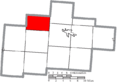
 Map of Hocking County Ohio Highlighting Perry Township.png 668 × 454; 17 KB
-
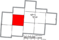
 Map of Hocking County Ohio Highlighting Salt Creek Township.png 668 × 454; 17 KB
-
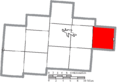
 Map of Hocking County Ohio Highlighting Starr Township.png 668 × 454; 17 KB
-
 Map of Hocking County Ohio Highlighting Ward Township.png 668 × 454; 17 KB
-
 Map of Hocking County Ohio Highlighting Washington Township.png 668 × 454; 17 KB
-
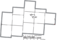
 Map of Hocking County Ohio With Municipal and Township Labels.PNG 668 × 454; 32 KB
-
 Map of Hocking County, Ohio No Text, Municipalities Distinct.png 668 × 454; 17 KB
-
 Map of Hocking County, Ohio No Text.png 668 × 454; 17 KB


