Category:Population density maps of New Zealand
Jump to navigation
Jump to search
Media in category "Population density maps of New Zealand"
The following 10 files are in this category, out of 10 total.
-
-
 BayOfPlentyRegionPopulationDensity.png 1,236 × 1,135; 118 KB
-
 CanterburyRegionPopulationDensity.png 2,236 × 2,176; 255 KB
-
 Cities in Oceania.png 1,344 × 743; 38 KB
-
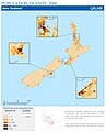
 New Zealand Population Density, 2000 (5457017237).jpg 2,507 × 3,265; 598 KB
-
 New Zealand Population Density, 2000 (6172445050) (cropped).jpg 2,324 × 2,874; 561 KB
-
 New Zealand Population Density, 2000 (6172445050).jpg 2,324 × 3,161; 666 KB
-
 NewZealandPopulationDensity.png 4,369 × 6,360; 1.46 MB
-
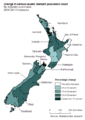
 Population density of New Zealand regions.png 3,249 × 2,655; 303 KB
-
 TaranakiRegionPopulationDensity.png 665 × 792; 66 KB


.jpg)
_(cropped).jpg)
.jpg)


