Category:Portington, East Riding of Yorkshire
Jump to navigation
Jump to search
English: Portington is a hamlet in the East Riding of Yorkshire, England. It is situated approximately 5 miles (8 km) north east of Goole and lies 0.5 miles (0.8 km) east of the A614 road.
village in East Riding of Yorkshire, United Kingdom  | |||||
| Upload media | |||||
| Instance of | |||||
|---|---|---|---|---|---|
| Location | Eastrington, East Riding of Yorkshire, Yorkshire and the Humber, England | ||||
 | |||||
Media in category "Portington, East Riding of Yorkshire"
The following 23 files are in this category, out of 23 total.
-
 A Footpath To Burland Hall - geograph.org.uk - 215088.jpg 640 × 480; 104 KB
-
 Bringing in the Corn - geograph.org.uk - 203292.jpg 640 × 480; 113 KB
-
 Chapel Conversion - geograph.org.uk - 215095.jpg 640 × 480; 105 KB
-
 Developments And Conversions - geograph.org.uk - 215091.jpg 640 × 480; 101 KB
-
 Fields to NW of A614 Portington Junction - geograph.org.uk - 234396.jpg 640 × 426; 104 KB
-
 Grove Farm - geograph.org.uk - 1247239.jpg 640 × 480; 34 KB
-
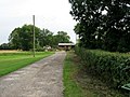
 Manor Farm, Portington - geograph.org.uk - 215098.jpg 640 × 480; 104 KB
-
 New Carr Lane - geograph.org.uk - 217713.jpg 640 × 480; 95 KB
-
 Portington Hall - geograph.org.uk - 94370.jpg 640 × 422; 78 KB
-
 Portington Hall.jpg 640 × 480; 105 KB
-
 Public footpath to Portington Grange - geograph.org.uk - 1364903.jpg 640 × 480; 45 KB
-
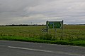 Road Junction Near Portington - geograph.org.uk - 234178.jpg 640 × 426; 101 KB
-
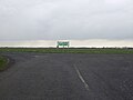
 Sign at A614 Portington Junction - geograph.org.uk - 234400.jpg 426 × 640; 108 KB
-
 Sleights Lane - geograph.org.uk - 217712.jpg 640 × 480; 99 KB
-
 The A614 Junction - geograph.org.uk - 1247266.jpg 640 × 480; 30 KB
-
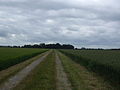
 The Lane to Portington - geograph.org.uk - 203286.jpg 640 × 480; 109 KB
-
 The Lane to the A614 - geograph.org.uk - 203295.jpg 640 × 480; 100 KB
-
 The Road Across Portington Common - geograph.org.uk - 215067.jpg 640 × 480; 100 KB
-
 This Is Just A Trailer - geograph.org.uk - 203290.jpg 640 × 480; 106 KB
-
 Track to Milkingstile Lane - geograph.org.uk - 1247254.jpg 640 × 480; 54 KB
-
 Track to the Flats - geograph.org.uk - 1248484.jpg 640 × 480; 38 KB
-
 Tudor House - geograph.org.uk - 1248487.jpg 640 × 346; 26 KB
-
 Two Right Angled Bends In Succession - geograph.org.uk - 215065.jpg 640 × 480; 112 KB


