Category:Potomac River watershed
Jump to navigation
Jump to search
drainage basin of the Potomac River | |||||
| Upload media | |||||
| Instance of | |||||
|---|---|---|---|---|---|
| Part of | |||||
| Named after | |||||
| Location |
| ||||
| Located in or next to body of water | |||||
| Has part(s) |
| ||||
| Drainage basin | |||||
| |||||
English: The Potomac River Drainage Basin (watershed) of the eastern United States.
- With a drainage basin of around 14,700 square miles (38,000 km²).
Subcategories
This category has the following 28 subcategories, out of 28 total.
A
B
- Lake Bernard Frank (8 F)
C
- Crabbs Branch (10 F)
D
L
- Lake Artemesia (12 F)
M
- Maps of the Potomac River (27 F)
- McMillan Reservoir (56 F)
- Mount Storm Lake (16 F)
- Muddy Branch (5 F)
N
- Needwood Dam (8 F)
P
- Patowmack Canal (53 F)
R
S
T
- Tenmile Creek (Maryland) (4 F)
W
Media in category "Potomac River watershed"
The following 23 files are in this category, out of 23 total.
-

-
 A pier leading to Little Seneca Lake Maryland (14868584688).jpg 3,008 × 1,960; 588 KB
-
 Anacostia River Watershed Map.png 2,550 × 3,300; 3.15 MB
-
 Barcroft-Dam-Fairfax-County-Virginia-22-Oct-2017.jpg 4,608 × 3,456; 5.65 MB
-
 Big-Run-Monongahela-National-Forest-8-Oct-2017.jpg 4,608 × 3,456; 5.68 MB
-
 Big-Run-Monongahela-National-Forest-beaver-dam-8-Oct-2017.jpg 4,608 × 3,456; 6.06 MB
-
 Cameron-Run-Holmes-Backlick-Confluence-Arlington-Virginia.jpg 4,608 × 3,456; 6.35 MB
-
 Report on the water and land resources in the Potomac River basin (IA CAT80737679).pdf 1,166 × 1,643, 144 pages; 9.81 MB
-
 Glen Echo Park (6783152988).jpg 4,000 × 3,000; 4.73 MB
-
 Glen Echo Park (6783162228).jpg 4,000 × 3,000; 5.13 MB
-
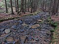
 Glen-echo-stream.jpg 2,152 × 1,426; 1.97 MB
-
 Interstate Commission on the Potomac River Basin members map.svg 959 × 593; 32 KB
-
 Little Seneca Lake 2008.jpg 2,048 × 1,536; 315 KB
-
 Little Seneca Lake MD.jpg 1,659 × 1,244; 429 KB
-

-
 Major sub-basins and cities of the Potomac River basin.jpg 760 × 728; 145 KB
-
 Map of Potomac River Watershed in West Virginia Virginia Pennsylvania Maryland.jpg 2,087 × 2,441; 908 KB
-
 Popes creek.jpg 1,331 × 1,732; 722 KB
-
 Popes creek2.jpg 800 × 508; 97 KB
-
 Potomac Dams CoE 2-45.jpg 1,250 × 919; 131 KB
-
 PR sub-basins with tributary names.jpg 760 × 728; 158 KB
-
 SandyBranchTravilah.jpg 4,032 × 3,024; 4.45 MB
-


.jpg)


.jpg)
.jpg)


