Category:Public transport maps of Manchester
Jump to navigation
Jump to search
Media in category "Public transport maps of Manchester"
The following 17 files are in this category, out of 17 total.
-
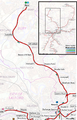
 Altrincham Line Map.png 976 × 1,146; 1.23 MB
-
 Bury Line Map.png 816 × 1,272; 1.06 MB
-
 East Manchester Line.png 1,300 × 529; 820 KB
-
 Ecclesline.png 1,198 × 491; 696 KB
-
 Manchester Metrolink - Schemaplan.png 3,550 × 874; 323 KB
-
 Manchester Metrolink map in Urdu.jpg 3,643 × 1,123; 729 KB
-
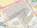
 Manchester Piccadilly plan.png 1,000 × 568; 791 KB
-
 Manchester Victoria plan.png 1,000 × 756; 634 KB
-
 Map of Manchester Metrolink.png 1,986 × 2,736; 4.1 MB
-
 Metrolink Airport Line Map.png 696 × 1,300; 921 KB
-
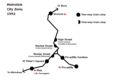 Metrolink Central Zone 1992.png 1,028 × 716; 53 KB
-
 Metrolink Central Zone 2013.png 1,028 × 716; 55 KB
-
 Metrolink Central Zone 2017.png 1,028 × 716; 64 KB
-
 Oldham & Rochdale Line Map.png 1,184 × 1,472; 1.62 MB
-
 Picc-vic-map.png 1,501 × 1,275; 1.19 MB
-
 South Manchester Line.png 581 × 777; 462 KB
-
 Trafford Park Line.png 2,924 × 1,435; 3.37 MB


