Category:Public transport maps of New Jersey Transit
Jump to navigation
Jump to search
NJTransit public transport maps
- for PATH maps see Category:Port Authority Trans-Hudson maps
Media in category "Public transport maps of New Jersey Transit"
The following 23 files are in this category, out of 23 total.
-
 20030701 60 Newark City Subway map (5962598440).jpg 1,920 × 2,560; 1.47 MB
-
 Atlantic City Line.svg 1,800 × 1,800; 310 KB
-
 Current north Hudson County railroads.png 852 × 1,041; 89 KB
-
 HBLR diagram.svg 646 × 1,123; 608 KB
-
 HBLR-Map-02112006.png 4,781 × 1,296; 189 KB
-
 HBLR-Map.png 681 × 1,381; 72 KB
-
 HBLR.MOS.legend.2001.png 774 × 594; 224 KB
-
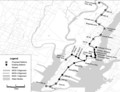
 Hoboken HBLR Alignments.png 1,306 × 1,434; 1.79 MB
-
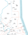
 MainBergenCoLineNJTMap.png 1,592 × 1,792; 225 KB
-
 NCS-Map.png 656 × 1,184; 81 KB
-
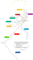
 NERL.png 1,475 × 2,053; 137 KB
-
 Newark buses.svg 4,452 × 4,560; 1.24 MB
-
 Newark Light Rail.svg 316 × 551; 422 KB
-
 Newark Penn Station.png 197 × 492; 6 KB
-
 NJT rail Moodna Viaduct.png 2,174 × 1,958; 548 KB
-
 NJT rail.png 2,176 × 3,968; 689 KB
-
 NJT railmap infobox.svg 2,720 × 4,960; 768 KB
-
 NJT railmap.svg 2,720 × 4,960; 292 KB
-
 NJTransitRailOperations wConnectingServices notToScale.svg 1,728 × 2,592; 2.14 MB
-
 NLR Map.png 1,311 × 2,295; 210 KB
-
 Pascack Valley Line route and stations.svg 420 × 900; 32 KB
-
 PascackValleyLineNJTMap.png 1,411 × 1,801; 346 KB
-
 River LINE map.svg 984 × 676; 36 KB
.jpg)


