Category:Purton, Wiltshire
Jump to navigation
Jump to search
village in Wiltshire, United Kingdom  | |||||
| Upload media | |||||
| Instance of | |||||
|---|---|---|---|---|---|
| Location | Wiltshire, South West England, England | ||||
| Different from | |||||
| official website | |||||
 | |||||
English: Purton is a large village in north Wiltshire with a current population of about 4,000. The civil parish of Purton also contains the village of Purton Stoke, and the hamlets of Bentham, Hayes Knoll, Restrop and Widham.
Subcategories
This category has the following 6 subcategories, out of 6 total.
Media in category "Purton, Wiltshire"
The following 200 files are in this category, out of 370 total.
(previous page) (next page)-
 A seldom-used stile - geograph.org.uk - 5393681.jpg 5,202 × 3,465; 4.9 MB
-
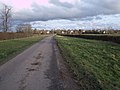
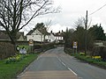 Approach to Purton - geograph.org.uk - 1802470.jpg 640 × 480; 84 KB
-
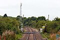
 Approaching Collins Lane Crossing - geograph.org.uk - 1557699.jpg 640 × 418; 85 KB
-
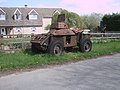 Armoured vehicle, Queen Street, Braydon - geograph.org.uk - 3938481.jpg 4,000 × 3,000; 2.83 MB
-
 B4553 towards Peatmoor - geograph.org.uk - 6320224.jpg 800 × 600; 123 KB
-
 B4553 towards Swindon - geograph.org.uk - 6319885.jpg 800 × 600; 107 KB
-
 B4553 towards Swindon - geograph.org.uk - 6320205.jpg 800 × 600; 97 KB
-
 B4553, The Pry - geograph.org.uk - 6320193.jpg 800 × 600; 130 KB
-
 B4696 to Ashton Keynes - geograph.org.uk - 1238258.jpg 640 × 480; 160 KB
-
 Bagbury Green Farm - geograph.org.uk - 876875.jpg 640 × 351; 66 KB
-
 Barns at Manor Farm, Purton - geograph.org.uk - 5394926.jpg 5,202 × 3,465; 4.02 MB
-
 Battlelake Plantation - geograph.org.uk - 1234104.jpg 640 × 480; 258 KB
-
 Battlelake wood - geograph.org.uk - 358068.jpg 640 × 480; 130 KB
-
 Battlelake wood - geograph.org.uk - 358070.jpg 640 × 480; 143 KB
-
 Battlelake wood - geograph.org.uk - 358074.jpg 640 × 480; 155 KB
-
 Bentham House - geograph.org.uk - 324665.jpg 640 × 481; 83 KB
-
 Bentham House, Bentham Lane, Purton Stoke - geograph.org.uk - 3890787.jpg 4,000 × 3,000; 2.91 MB
-
 Best-one supermarket, Purton - geograph.org.uk - 5394895.jpg 5,202 × 3,465; 3.67 MB
-
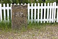
 Boundary stone - geograph.org.uk - 438586.jpg 640 × 480; 140 KB
-
 Boundary stone and bridleway, Purton - geograph.org.uk - 2665490.jpg 800 × 600; 219 KB
-
 Boundary stones, Purton - geograph.org.uk - 2665504.jpg 800 × 600; 221 KB
-
 Braydon Methodist Church - geograph.org.uk - 3938486.jpg 4,000 × 3,000; 2.83 MB
-
 Bremhill, Swindon to Stroud railway - geograph.org.uk - 266499.jpg 640 × 480; 135 KB
-

-
 Bridge reconstruction, Tadpole Lane - geograph.org.uk - 3275512.jpg 4,000 × 3,000; 2.84 MB
-
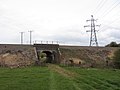 Bridge under the Swindon - Gloucester line - geograph.org.uk - 2899280.jpg 4,000 × 3,000; 2.69 MB
-

-
 Bridleway entrance, Collins Lane, Purton - geograph.org.uk - 797599.jpg 640 × 480; 222 KB
-
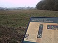 Brockhurst Meadow Nature Reserve, near Purton - geograph.org.uk - 3777223.jpg 2,848 × 2,136; 1.35 MB
-
 Buttercup meadow and threatening skies - geograph.org.uk - 5393677.jpg 5,202 × 3,465; 3.81 MB
-
 Cars and vans, Swindon and Cricklade Railway, Blunsdon - geograph.org.uk - 2553196.jpg 1,440 × 1,080; 686 KB
-
 Charolais cattle, Fox Mill Farm, Purton - geograph.org.uk - 3275531.jpg 4,000 × 3,000; 2.85 MB
-

-
 Classic cars, Swindon and Cricklade Railway, Blunsdon - geograph.org.uk - 2552424.jpg 1,440 × 1,080; 716 KB
-
 College Farm House, Purton - geograph.org.uk - 5323951.jpg 640 × 480; 133 KB
-
 College Farm, High Street, Purton - geograph.org.uk - 2832495.jpg 2,848 × 2,136; 1.36 MB
-
 Collins Lane, Purton - geograph.org.uk - 797597.jpg 640 × 480; 163 KB
-
 Common Farm, near Purton - geograph.org.uk - 3939054.jpg 4,000 × 3,000; 2.87 MB
-
 Country lane near Greenacres Farm - geograph.org.uk - 4057519.jpg 4,000 × 3,000; 5.2 MB
-
 Cowleaze - geograph.org.uk - 6320211.jpg 800 × 600; 89 KB
-
 Cows in the road - geograph.org.uk - 4113142.jpg 640 × 480; 148 KB
-
 Cricklade Road arrives at Purton - geograph.org.uk - 5393702.jpg 5,202 × 3,465; 3.63 MB
-
 Cricklade Road, Purton - geograph.org.uk - 5393721.jpg 5,202 × 3,465; 3.25 MB
-
 Defence fuel storage depot - geograph.org.uk - 2899288.jpg 4,000 × 3,000; 2.58 MB
-
 Defence fuel storage depot - geograph.org.uk - 4699089.jpg 800 × 348; 42 KB
-
 Development work at Blunsdon station - geograph.org.uk - 5392549.jpg 5,202 × 3,465; 4.01 MB
-
 Direct path to Purton from Downs Farm - geograph.org.uk - 5393666.jpg 5,202 × 3,465; 4.46 MB
-
 Disused RAF Blakehill Farm airfield - geograph.org.uk - 3860923.jpg 4,000 × 3,000; 2.93 MB
-
 Disused railway carriage, Purton - geograph.org.uk - 2832587.jpg 2,848 × 2,136; 1.37 MB
-
 Downs Farm House - geograph.org.uk - 5393664.jpg 5,202 × 3,465; 3.64 MB
-
-
 Farm buildings, The Pry - geograph.org.uk - 6319890.jpg 800 × 520; 77 KB
-
 Farm track (bridleway), The Pry - geograph.org.uk - 6320199.jpg 800 × 600; 165 KB
-

-
 Farm, Hoggs Lane, Purton - geograph.org.uk - 2831847.jpg 2,848 × 2,136; 1.33 MB
-
 Farmland east of Diana Lodge - geograph.org.uk - 4699081.jpg 800 × 413; 52 KB
-
 Farmland east of Upper Dudgemore farm - geograph.org.uk - 3386564.jpg 1,024 × 768; 129 KB
-
 Farmland near Lower Pavenhill, Purton - geograph.org.uk - 1234076.jpg 640 × 480; 154 KB
-
 Farmland near Manor Hill Farm, Purton - geograph.org.uk - 892925.jpg 640 × 480; 101 KB
-

-
 Farmland south of Collins Lane, Purton - geograph.org.uk - 797596.jpg 640 × 480; 132 KB
-

-
 Field boundary, north of Cross Lanes Farm - geograph.org.uk - 4007871.jpg 1,024 × 615; 102 KB
-
 Field full of buttercups, south of Hayes Knoll - geograph.org.uk - 4007837.jpg 1,024 × 768; 130 KB
-
 Field gate on the east side of Brown's Crossing - geograph.org.uk - 3386582.jpg 1,024 × 768; 195 KB
-

-
 Fields east of Widham - geograph.org.uk - 4699076.jpg 800 × 181; 17 KB
-
 Folly Down Farm - geograph.org.uk - 5393670.jpg 5,202 × 3,465; 4.01 MB
-
 Footbridge of the River Ray near Mouldon Hill - geograph.org.uk - 2899272.jpg 4,000 × 3,000; 3.74 MB
-
 Footpath near No Parish Farm - geograph.org.uk - 5323822.jpg 640 × 480; 198 KB
-
 Footpath towards Blunsdon from Cricklade Road - geograph.org.uk - 5393709.jpg 5,202 × 3,465; 4.23 MB
-
 Ford, Swindon and Cricklade Railway, Blunsdon - geograph.org.uk - 2553219.jpg 1,440 × 1,080; 705 KB
-
 Former chapel, Hoggs Lane, Purton - geograph.org.uk - 5323836.jpg 640 × 490; 126 KB
-
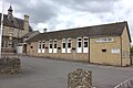
 Former school, Cricklade Road - geograph.org.uk - 5323972.jpg 640 × 428; 98 KB
-
 Fowler 0-4-0 diesel locomotive, Swindon ^ Cricklade Railway - geograph.org.uk - 5745034.jpg 4,000 × 3,000; 4.72 MB
-
-
 Frog, dog and alligator - geograph.org.uk - 5393730.jpg 4,354 × 2,956; 3.76 MB
-
 Ghost Train pub, Purton - geograph.org.uk - 5393715.jpg 5,202 × 3,465; 3.61 MB
-
 Gloucester to Swindon railway, Purton - geograph.org.uk - 1204462.jpg 640 × 480; 178 KB
-
 Going east past Moonsleaze Farm - geograph.org.uk - 3520957.jpg 640 × 480; 164 KB
-
 Grassland - geograph.org.uk - 438583.jpg 640 × 480; 110 KB
-
 Grassland near the River Ray - geograph.org.uk - 3956320.jpg 4,000 × 3,000; 2.85 MB
-
 Grassland, Bremhill Bridge - geograph.org.uk - 6320208.jpg 800 × 600; 91 KB
-
 Grazing off the B4553 - geograph.org.uk - 6319883.jpg 800 × 600; 91 KB
-
 Green Hill - geograph.org.uk - 1220013.jpg 640 × 480; 160 KB
-
-
 High Street, Purton - geograph.org.uk - 5394889.jpg 5,202 × 3,465; 3.41 MB
-
 Hoggs Lane, Purton - geograph.org.uk - 2831862.jpg 2,848 × 2,136; 1.34 MB
-
 Home Guard memorial, River Ray, Blunsdon - geograph.org.uk - 465672.jpg 480 × 640; 137 KB
-
 House on the B4553, The Pry - geograph.org.uk - 6320202.jpg 800 × 532; 84 KB
-
 House, Hoggs Lane, Purton - geograph.org.uk - 2831894.jpg 2,848 × 2,136; 1.61 MB
-
 Household recycling centre, Mopes Lane, Purton - geograph.org.uk - 3937671.jpg 4,000 × 3,000; 4.19 MB
-
 Jumble sale, Purton Silver Threads Hall - geograph.org.uk - 4796135.jpg 4,000 × 3,000; 4.79 MB
-
 Jumble sale, Purton Silver Threads Hall - geograph.org.uk - 4796136.jpg 4,000 × 3,000; 5.01 MB
-

-
 Lane, Braydon Manor - geograph.org.uk - 4057513.jpg 4,000 × 3,000; 5.72 MB
-

-
-
 Lineside cabin, Swindon to Gloucester railway, Purton - geograph.org.uk - 1735103.jpg 1,600 × 1,200; 597 KB
-
 Lineside electricity box, Purton - geograph.org.uk - 1204473.jpg 479 × 640; 204 KB
-

-
 Lower Pavenhill, near Purton - geograph.org.uk - 914289.jpg 640 × 480; 100 KB
-
 Maize crop, The Pry - geograph.org.uk - 6320194.jpg 800 × 600; 111 KB
-
 Malthouse Farm, Purton - geograph.org.uk - 2831832.jpg 2,848 × 2,136; 1.34 MB
-
 Manor House, Purton - geograph.org.uk - 2832529.jpg 2,848 × 2,136; 1.37 MB
-
 Manure transport in Purton, Wiltshire, England..jpg 640 × 480; 183 KB
-
 Maple Sale Copse - geograph.org.uk - 5323826.jpg 640 × 480; 142 KB
-
 Maple Sale Copse, near Purton - geograph.org.uk - 1234405.jpg 640 × 480; 251 KB
-
 Mares and foals in a field near Lower Pavenhill Farm, Purton - geograph.org.uk - 3946253.jpg 4,000 × 3,000; 2.83 MB
-
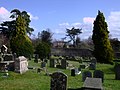
 Medieval cross, Saint Mary's Churchyard, Purton - geograph.org.uk - 2832554.jpg 2,848 × 2,136; 1.33 MB
-
 Millennium stone, Purton - geograph.org.uk - 2665456.jpg 800 × 600; 211 KB
-
 Mini-roundabout and shops, Purton - geograph.org.uk - 2830947.jpg 2,848 × 2,136; 1.33 MB
-
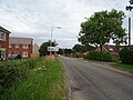
 Minor road east of Queen Street - geograph.org.uk - 1219647.jpg 640 × 480; 157 KB
-
 Minor road to Purton - geograph.org.uk - 1234129.jpg 640 × 480; 168 KB
-
 Moredon Aqueduct - geograph.org.uk - 2899304.jpg 4,000 × 3,000; 3.8 MB
-

-
 Morning sunlight on frosty field - geograph.org.uk - 3338093.jpg 640 × 482; 83 KB
-
 Motorcyclists, The Fox - geograph.org.uk - 797535.jpg 640 × 480; 136 KB
-
 Muddy bridleway near Stoke Common Farm, Purton Stoke - geograph.org.uk - 3860997.jpg 4,000 × 3,000; 2.82 MB
-
 National Cycle Route 45 towards Swindon - geograph.org.uk - 6319881.jpg 800 × 600; 145 KB
-
 New housing off the B4553 - geograph.org.uk - 6320222.jpg 800 × 600; 125 KB
-
 New housing, Cowleaze - geograph.org.uk - 6320209.jpg 800 × 492; 86 KB
-
 New housing, Peatmoor - geograph.org.uk - 6320227.jpg 800 × 600; 107 KB
-
 New school on Akers Way - geograph.org.uk - 309340.jpg 612 × 442; 108 KB
-
 Newth's Lane - geograph.org.uk - 5323978.jpg 640 × 480; 144 KB
-
 North Wilts Canal, Hayes Knoll - geograph.org.uk - 4788413.jpg 4,000 × 3,000; 4.68 MB
-
 Not Mud Lane, Restrop, near Purton - geograph.org.uk - 893020.jpg 640 × 480; 106 KB
-
 Old and new roads, Widham Bridge - geograph.org.uk - 5323961.jpg 640 × 480; 124 KB
-
 Old farm buildings in Purton - geograph.org.uk - 5394885.jpg 5,202 × 3,465; 3.41 MB
-
 Old Milestone (geograph 6114745).jpg 1,007 × 1,757; 217 KB
-
 Old Pike House, Station Road, Purton - geograph.org.uk - 415963.jpg 640 × 480; 80 KB
-
-
 Old railway van near Purton - geograph.org.uk - 5394923.jpg 5,202 × 3,465; 5.52 MB
-
 Old Toll House by Station Road, Purton (geograph 6115168).jpg 640 × 409; 112 KB
-
 On the ramparts of Ringsbury Camp, near Dogridge, Purton - geograph.org.uk - 3776034.jpg 2,848 × 2,136; 1.41 MB
-

-
 Parish church (11) (geograph 6354543).jpg 4,320 × 3,240; 4.11 MB
-
 Parish church (13) (geograph 6354545).jpg 4,320 × 3,240; 4.32 MB
-
 Parish church (14) (geograph 6354546).jpg 3,240 × 4,320; 4.08 MB
-
 Pasture and cattle, The Fox - geograph.org.uk - 797533.jpg 640 × 480; 155 KB
-
 Path from B4553 towards Downs Farm - geograph.org.uk - 5393659.jpg 5,202 × 3,465; 3.56 MB
-
 Path from the church to The Hyde, Purton - geograph.org.uk - 5394907.jpg 5,202 × 3,465; 5.55 MB
-
 Path to Bruton through the buttercups - geograph.org.uk - 5393673.jpg 5,202 × 3,465; 5.53 MB
-
 Path towards Packhorse Lane - geograph.org.uk - 5393684.jpg 5,202 × 3,465; 3.91 MB
-
 Path towards Purton - geograph.org.uk - 5393690.jpg 4,332 × 2,551; 1.85 MB
-

-

-

-
 Pry Farm - geograph.org.uk - 6319893.jpg 800 × 490; 65 KB
-
 Public footpath, Collins Lane, Purton - geograph.org.uk - 3275523.jpg 4,000 × 3,000; 2.83 MB
-
 Purton buildings (3) (geograph 6355752).jpg 4,134 × 3,101; 2.71 MB
-
 Purton buildings (8) (geograph 6355769).jpg 4,211 × 3,159; 2.58 MB
-
 Purton buildings (9) (geograph 6356819).jpg 3,240 × 4,320; 4.07 MB
-
 Purton Club - geograph.org.uk - 5394863.jpg 5,202 × 3,465; 2.65 MB
-
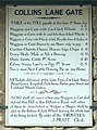
 Purton Collins Lane Crossing - geograph.org.uk - 1557702.jpg 640 × 425; 66 KB
-
 Purton engraving.png 571 × 403; 440 KB
-
 Purton features (4) (geograph 6356820).jpg 3,240 × 4,320; 3.82 MB
-
 Purton features (5) (geograph 6356821).jpg 4,320 × 3,240; 3.08 MB
-
 Purton House, seen from Saint Mary's churchyard - geograph.org.uk - 2832576.jpg 2,848 × 2,136; 1.35 MB
-
 Purton houses (10) (geograph 6356823).jpg 4,320 × 3,240; 3.29 MB
-
 Purton houses (11) (geograph 6356825).jpg 4,320 × 3,240; 3.43 MB
-
 Purton houses (3) (geograph 6353626).jpg 4,177 × 3,133; 4.34 MB
-
 Purton houses (4) (geograph 6353702).jpg 3,743 × 2,807; 2.99 MB
-
 Purton houses (7) (geograph 6355758).jpg 3,927 × 2,945; 2.45 MB
-
 Purton houses (8) (geograph 6356818).jpg 4,320 × 3,240; 3.64 MB
-
 Purton houses (9) (geograph 6356822).jpg 4,320 × 3,240; 3.13 MB
-
 Purton housess (geograph 6353624).jpg 4,213 × 3,159; 3.59 MB
-
 Purton library - geograph.org.uk - 5394892.jpg 4,950 × 3,241; 2.86 MB
-
 Purton Manor House - geograph.org.uk - 5411645.jpg 3,678 × 2,456; 4.96 MB
-

-
 Purton Milestone - geograph.org.uk - 5185261.jpg 800 × 600; 111 KB
-
 Purton Parish marker stone - geograph.org.uk - 5392534.jpg 5,202 × 3,465; 4.56 MB
-
 Purton Stoke from Stoke Common Lane - geograph.org.uk - 3860908.jpg 4,000 × 3,000; 2.85 MB
-
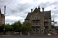
 Purton University, High Street, Purton - geograph.org.uk - 2831940.jpg 2,797 × 2,053; 1.77 MB
-
 Purton Village Hall - geograph.org.uk - 5394866.jpg 5,202 × 3,465; 3.83 MB
-
 Purton Workingmen's Club, Station Road - geograph.org.uk - 2830913.jpg 2,848 × 2,136; 1.37 MB
-
 Purton, House bordering St. Mary's Churchyard - geograph.org.uk - 5411636.jpg 3,678 × 2,455; 6.17 MB
-
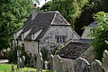
 Purton, St. Mary's Church - geograph.org.uk - 5411633.jpg 3,650 × 2,363; 3.89 MB
-
 Purton, St. Mary's Church - geograph.org.uk - 5411649.jpg 5,060 × 3,240; 7.35 MB
-
 Purton, St. Mary's Church, Benchmark - geograph.org.uk - 5476888.jpg 3,678 × 2,456; 7.01 MB
-
-
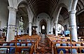 Purton, St. Mary's Church, c13th nave - geograph.org.uk - 5476944.jpg 5,281 × 3,426; 7.26 MB
-

-

-

-
 Purton, St. Mary's Church, c19th oak pulpit with tester - geograph.org.uk - 5476902.jpg 2,884 × 4,505; 4.76 MB
-

-
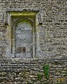
 Purton, St. Mary's Church, Capital detail 1 - geograph.org.uk - 5476958.jpg 4,313 × 2,858; 5.75 MB
-
 Purton, St. Mary's Church, Capital detail 2 - geograph.org.uk - 5476964.jpg 5,438 × 3,554; 6.26 MB
-
 Purton, St. Mary's Church, Capital detail 3 - geograph.org.uk - 5476972.jpg 5,234 × 3,182; 7.25 MB
-
 Purton, St. Mary's Church, Capital detail 4 - geograph.org.uk - 5476978.jpg 4,798 × 3,460; 7.56 MB
-

-
-
-

-
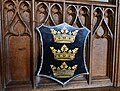
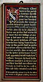 Purton, St. Mary's Church, Francis Gleed benefaction board - geograph.org.uk - 5477003.jpg 2,386 × 4,539; 5.74 MB
-
-
-

-


,_The_Pry_-_geograph.org.uk_-_6320199.jpg)
_off_National_Cycle_Route_45_-_geograph.org.uk_-_6319880.jpg)


_-_geograph.org.uk_-_3611576.jpg)
_-_geograph.org.uk_-_3611601.jpg)


.jpg)


.jpg)


_(geograph_6354543).jpg)
_(geograph_6354545).jpg)
_(geograph_6354546).jpg)


_(geograph_6355752).jpg)
_(geograph_6355769).jpg)
_(geograph_6356819).jpg)


_(geograph_6356820).jpg)
_(geograph_6356821).jpg)

_(geograph_6356823).jpg)
_(geograph_6356825).jpg)
_(geograph_6353626).jpg)
_(geograph_6353702).jpg)
_(geograph_6355758).jpg)
_(geograph_6356818).jpg)
_(geograph_6356822).jpg)
.jpg)


