Category:Quercus gambelii range maps
Jump to navigation
Jump to search
Media in category "Quercus gambelii range maps"
The following 2 files are in this category, out of 2 total.
-
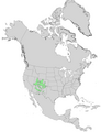 Quercus gambelii range map 0.png 4,812 × 6,253; 485 KB
-
 Quercus gambelii range map 1.png 3,331 × 3,330; 138 KB


Categories:
- Quercus gambelii
- Quercus distribution maps
- Flora distribution maps of Mexico
- Flora distribution maps of the United States
- Flora distribution maps of North America
- Arizona flora distribution maps
- Colorado flora distribution maps
- New Mexico flora distribution maps
- Utah flora distribution maps
- Arizona transition zone/Mogollon Rim flora distribution maps