Category:RAF Kingsnorth (WWII)
Jump to navigation
Jump to search
| Object location | | View all coordinates using: OpenStreetMap |
|---|
WWII allied airfield  | |||||
| Upload media | |||||
| Instance of | |||||
|---|---|---|---|---|---|
| Location | England | ||||
| Operator | |||||
| Inception |
| ||||
| Dissolved, abolished or demolished date |
| ||||
 | |||||
Media in category "RAF Kingsnorth (WWII)"
The following 2 files are in this category, out of 2 total.
-
 36fg-p47-uk-1944.jpg 600 × 370; 56 KB
-
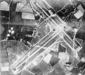 Kingsnorth-12may44.jpg 600 × 531; 85 KB
