Category:Rail transport in County Antrim
Jump to navigation
Jump to search
Subcategories
This category has the following 11 subcategories, out of 11 total.
Media in category "Rail transport in County Antrim"
The following 82 files are in this category, out of 82 total.
-
 186 approaching Killoge Bridge - geograph.org.uk - 344279.jpg 640 × 426; 122 KB
-
 712 Bla' Hole - geograph.org.uk - 312335.jpg 640 × 433; 53 KB
-
 A diesel train passes - geograph.org.uk - 353654.jpg 640 × 426; 129 KB
-
 A Lonely Engine - geograph.org.uk - 364913.jpg 640 × 426; 116 KB
-
 A Passing Steam train - geograph.org.uk - 353454.jpg 640 × 426; 124 KB
-
 A passing train - geograph.org.uk - 380552.jpg 640 × 426; 99 KB
-

-
 Approaching train - geograph.org.uk - 345502.jpg 640 × 426; 154 KB
-
 Ballast train at Magheramorne - geograph.org.uk - 1034076.jpg 640 × 403; 111 KB
-
 Ballycastle1906.jpg 300 × 183; 40 KB
-
 Ballyclare Junction - geograph.org.uk - 345540.jpg 640 × 414; 130 KB
-
 Ballyclare Junction - geograph.org.uk - 345542.jpg 640 × 426; 120 KB
-
 Ballymartin level crossing - geograph.org.uk - 309273.jpg 640 × 426; 134 KB
-
 Broken-down train at Ballyrobert - geograph.org.uk - 1021197.jpg 640 × 384; 79 KB
-
 Carrickfergus - geograph-4412081-by-Albert-Bridge.jpg 640 × 363; 95 KB
-
 Clipperstown - geograph-2714744-by-Albert-Bridge.jpg 640 × 382; 116 KB
-

-
 Diesel locomotive at Kingsbog Junction (geograph 2420248).jpg 640 × 480; 78 KB
-
 Dismantled railway - geograph.org.uk - 852646.jpg 640 × 360; 104 KB
-
 Dismantled railway(2) - geograph.org.uk - 852651.jpg 640 × 360; 63 KB
-
 Disused railway near Glenavy (1) - geograph.org.uk - 2591437.jpg 640 × 408; 125 KB
-
 Disused railway, Ballinderry (1) - geograph.org.uk - 2584003.jpg 640 × 391; 128 KB
-
 Disused railway, Ballinderry (2) - geograph.org.uk - 2584042.jpg 640 × 425; 139 KB
-
 Disused railway, Ballinderry (3) - geograph.org.uk - 2584070.jpg 640 × 391; 123 KB
-

-

-
-

-

-

-

-
 Drumsough level crossing near Antrim - geograph.org.uk - 347141.jpg 640 × 426; 148 KB
-
 Dunluce Castle & Giant's Causeway Tram.jpg 1,284 × 981; 160 KB
-
 Enterprise Express passing Moyrusk Road - geograph.org.uk - 342489.jpg 640 × 426; 120 KB
-

-

-
-
 Giant's Causeway station - geograph.org.uk - 545954.jpg 640 × 480; 88 KB
-
 Giant's Causeway tram, Causeway Hotel.jpg 580 × 431; 69 KB
-
 Lisburn Station Sign.jpg 4,032 × 3,024; 6.85 MB
-
 Macfin Level Crossing - geograph.org.uk - 344304.jpg 640 × 426; 92 KB
-
 Moss Road Bridge - geograph.org.uk - 569019.jpg 640 × 480; 101 KB
-
 Old bridge, Portrush harbour - geograph.org.uk - 306689.jpg 640 × 428; 69 KB
-

-
 Old railway, Carnlough - geograph.org.uk - 690740.jpg 640 × 444; 105 KB
-

-
 Portrush Train station in 2019.jpg 1,212 × 778; 203 KB
-
 Railway Embankment - geograph.org.uk - 340435.jpg 640 × 426; 95 KB
-
 Railway embankment - geograph.org.uk - 852622.jpg 640 × 360; 71 KB
-
 Railway Line - geograph.org.uk - 343534.jpg 640 × 428; 73 KB
-
 Railway Line - geograph.org.uk - 76295.jpg 640 × 480; 162 KB
-
 Railway near Glynn - geograph.org.uk - 365489.jpg 640 × 426; 138 KB
-
 Railway near Whitehead (2) - geograph.org.uk - 786791.jpg 581 × 389; 79 KB
-
 Railway near Whitehead - geograph.org.uk - 1110148.jpg 640 × 426; 112 KB
-
 Railway near Whitehead - geograph.org.uk - 1757594.jpg 640 × 406; 111 KB
-
 Railway near Whitehead - geograph.org.uk - 786762.jpg 640 × 419; 101 KB
-
 Railway near Whitehead and Cloghan - geograph.org.uk - 1758128.jpg 640 × 414; 83 KB
-
 Railway sign near Whitehead (1) - geograph.org.uk - 786665.jpg 640 × 432; 92 KB
-
 Railway sign near Whitehead (2) - geograph.org.uk - 786685.jpg 640 × 449; 130 KB
-

-
 Railway track near Ballynadrentagh - geograph.org.uk - 759078.jpg 479 × 640; 129 KB
-
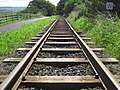
 Railway Tracks - geograph.org.uk - 345358.jpg 640 × 426; 121 KB
-
 Railway Warning Sign - geograph.org.uk - 344207.jpg 640 × 423; 67 KB
-
 Railway, Larne - geograph.org.uk - 650592.jpg 640 × 432; 98 KB
-

-
 Road and rail routes to Coleraine - geograph.org.uk - 721310.jpg 640 × 480; 128 KB
-

-

-
 The Bushmills tramway to Portballintrae - geograph.org.uk - 1087748.jpg 600 × 450; 166 KB
-
 The Third Line, Lisburn - geograph.org.uk - 1612356.jpg 640 × 352; 85 KB
-
 Thornhill Rd, Dunmurry - geograph.org.uk - 361083.jpg 640 × 426; 140 KB
-
-
 Under repair - geograph.org.uk - 1303571.jpg 640 × 480; 95 KB
-
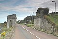
 Waterfoot White Arch 896.JPG 3,008 × 2,000; 770 KB
-
 Waterfoot White Arch 913.JPG 3,000 × 2,000; 697 KB
-
 Waterfoot White Arch 916.JPG 3,000 × 1,800; 551 KB
-

-
 Wire Cages - geograph.org.uk - 312340.jpg 640 × 426; 147 KB
-
 Deceptive Tracks - geograph.org.uk - 568980.jpg 640 × 480; 160 KB
-
 Narrow Gauge to Ballymena - geograph.org.uk - 568995.jpg 640 × 480; 111 KB
-
 Sawmill Road Bridge - geograph.org.uk - 568998.jpg 640 × 480; 130 KB
-
 Single Track towards Antrim - geograph.org.uk - 504081.jpg 640 × 480; 145 KB


.jpg)

_-_geograph.org.uk_-_852651.jpg)
_-_geograph.org.uk_-_2591437.jpg)
_-_geograph.org.uk_-_2584003.jpg)
_-_geograph.org.uk_-_2584042.jpg)
_-_geograph.org.uk_-_2584070.jpg)
_-_geograph.org.uk_-_2583866.jpg)
_-_geograph.org.uk_-_2583964.jpg)
_-_geograph.org.uk_-_2590525.jpg)
_-_geograph.org.uk_-_2590538.jpg)
_-_geograph.org.uk_-_2590559.jpg)
_-_geograph.org.uk_-_2590605.jpg)
_-_geograph.org.uk_-_2590619.jpg)


_-_geograph.org.uk_-_2046987.jpg)
_-_geograph.org.uk_-_2047012.jpg)


_-_geograph.org.uk_-_786791.jpg)


_-_geograph.org.uk_-_786665.jpg)
_-_geograph.org.uk_-_786685.jpg)


