Category:Rail transport maps of Côte-d'Or
Jump to navigation
Jump to search
Media in category "Rail transport maps of Côte-d'Or"
The following 6 files are in this category, out of 6 total.
-
 Gare Dijon Ville schema voies.svg 1,881 × 368; 93 KB
-
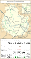 Railway map of France - 21 - 1900 - fr - small.svg 564 × 1,074; 7.28 MB
-
 Railway map of France - 21 - 1930 - fr - small.svg 564 × 1,074; 7.45 MB
-
 Railway map of France - 21 - 1950 - fr - small.svg 564 × 1,074; 7.36 MB
-
 Railway map of France - 21 - 1980 - fr - small.svg 564 × 1,074; 7.34 MB
-
 Railway map of France - 21 - 2020 - fr - small.svg 564 × 1,074; 7.16 MB


