Category:Railway lines in Hampshire
Jump to navigation
Jump to search
Subcategories
This category has the following 14 subcategories, out of 14 total.
A
E
- Eastleigh Lakeside Steam Railway (57 F)
H
- Hythe Pier Railway (31 F)
L
N
- National Motor Museum Monorail (28 F)
P
R
S
W
Media in category "Railway lines in Hampshire"
The following 54 files are in this category, out of 54 total.
-
 Andover - Railwayline - geograph.org.uk - 564887.jpg 640 × 480; 127 KB
-
 Basingstoke to Reading - geograph.org.uk - 664784.jpg 640 × 485; 86 KB
-
 Brokenford Lane footbridge - geograph.org.uk - 1769848.jpg 640 × 480; 97 KB
-
 Burton, boundary - geograph.org.uk - 1124924.jpg 640 × 480; 109 KB
-
 Docks branch line - geograph.org.uk - 1994546.jpg 1,280 × 960; 483 KB
-
 Durnstown, railway - geograph.org.uk - 1506201.jpg 640 × 480; 108 KB
-
 East of Totton - geograph.org.uk - 838398.jpg 640 × 480; 244 KB
-
 Fast track to London - geograph.org.uk - 979463.jpg 640 × 480; 95 KB
-
 Fawley branch line at Veal's Lane - geograph.org.uk - 3130426.jpg 3,648 × 2,736; 3.23 MB
-
 Fork in line east of Havant Station - geograph.org.uk - 635561.jpg 640 × 480; 67 KB
-
 Full speed ahead - geograph.org.uk - 1519744.jpg 480 × 640; 115 KB
-
 Full speed ahead - geograph.org.uk - 1521181.jpg 640 × 480; 100 KB
-
 Heading away from London - geograph.org.uk - 979457.jpg 640 × 480; 94 KB
-
 Heading towards Winchester - geograph.org.uk - 1801896.jpg 640 × 480; 93 KB
-
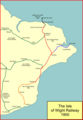 IoWR1900.png 1,052 × 1,523; 86 KB
-
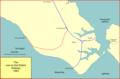 Lee-solent-rly.png 1,513 × 995; 67 KB
-
 Level Crossing at Southampton - geograph.org.uk - 1743129.jpg 3,872 × 2,592; 2.03 MB
-

-

-

-

-

-

-
 Main line to London - geograph.org.uk - 1730179.jpg 800 × 600; 171 KB
-
 Meyrick park.jpg 1,171 × 732; 108 KB
-
 No obstacles ahead - geograph.org.uk - 1519181.jpg 640 × 480; 94 KB
-

-
 On railway bridge looking north-west - geograph.org.uk - 609356.jpg 640 × 480; 92 KB
-
 Parallel lines - geograph.org.uk - 1530483.jpg 640 × 480; 75 KB
-

-
 Railway at Fleet - geograph.org.uk - 170810.jpg 640 × 516; 408 KB
-
 Railway Line - geograph.org.uk - 156943.jpg 640 × 480; 85 KB
-

-
 Railway line to Redbridge - geograph.org.uk - 1143960.jpg 640 × 480; 86 KB
-
 Railway line to Southampton, St Cross - geograph.org.uk - 449926.jpg 640 × 427; 91 KB
-

-
 Railway track and Gresley Road - geograph.org.uk - 1240924.jpg 640 × 480; 283 KB
-
 Railway, Hook - geograph.org.uk - 956232.jpg 640 × 480; 139 KB
-

-

-
 Monxton - Railway Line - geograph.org.uk - 657672.jpg 640 × 512; 131 KB
-
 Railway at Overton - geograph.org.uk - 173434.jpg 640 × 480; 140 KB
-
 Railway Line - geograph.org.uk - 118493.jpg 640 × 480; 69 KB
-

-
 Railway Line near Crampmoor - geograph.org.uk - 17810.jpg 640 × 480; 102 KB
-
 Railway line out of Botley - geograph.org.uk - 31747.jpg 449 × 640; 156 KB
-
 Railway Line to Dunbridge Station - geograph.org.uk - 422777.jpg 640 × 480; 109 KB
-
 Railway Line, Winchester - geograph.org.uk - 27808.jpg 640 × 480; 130 KB
-
 Railway near Ludgershall - geograph.org.uk - 479997.jpg 640 × 480; 184 KB
-
 Railway near Newnham - geograph.org.uk - 106001.jpg 640 × 480; 137 KB
-
 Railway, Lower Wyke - geograph.org.uk - 425124.jpg 640 × 480; 169 KB
-
 Railway, Monxton - geograph.org.uk - 484696.jpg 480 × 640; 185 KB
-
 Romsey to Salisbury railway - geograph.org.uk - 184678.jpg 640 × 480; 342 KB
-
 Romsey-Southampton railway - geograph.org.uk - 344650.jpg 640 × 480; 124 KB


