Category:Rampton and Woodbeck
Jump to navigation
Jump to search
English: Rampton and Woodbeck is a civil parish in the Bassetlaw district, in the county of Nottinghamshire, England.
civil parish in Bassetlaw, Nottinghamshire, England | |||||
| Upload media | |||||
| Instance of | |||||
|---|---|---|---|---|---|
| Location | Bassetlaw, Nottinghamshire, East Midlands, England | ||||
 | |||||
Subcategories
This category has the following 3 subcategories, out of 3 total.
Media in category "Rampton and Woodbeck"
The following 121 files are in this category, out of 121 total.
-
 A bend in the River Trent - geograph.org.uk - 5474089.jpg 800 × 600; 118 KB
-
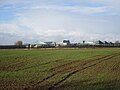
 A walk around Cottam power stations (10) - geograph.org.uk - 5474085.jpg 800 × 600; 155 KB
-
 A walk around Cottam power stations (11) - geograph.org.uk - 5474087.jpg 800 × 600; 181 KB
-
 A walk around Cottam power stations (12) - geograph.org.uk - 5474092.jpg 800 × 650; 146 KB
-
 A walk around Cottam power stations (13) - geograph.org.uk - 5474097.jpg 800 × 600; 115 KB
-
 A walk around Cottam power stations (14) - geograph.org.uk - 5474099.jpg 800 × 600; 115 KB
-
 A walk around Cottam power stations (15) - geograph.org.uk - 5474103.jpg 800 × 600; 111 KB
-
 A walk around Cottam power stations (16) - geograph.org.uk - 5474233.jpg 600 × 800; 107 KB
-
 A walk around Cottam power stations (17) - geograph.org.uk - 5474236.jpg 800 × 600; 170 KB
-
 A walk around Cottam power stations (8) - geograph.org.uk - 5473842.jpg 800 × 600; 118 KB
-

-
 After the harvest - geograph.org.uk - 209487.jpg 640 × 427; 45 KB
-
 All Saints Church - geograph.org.uk - 4241934.jpg 800 × 600; 176 KB
-
 All Saints' Church in Rampton - geograph.org.uk - 4949763.jpg 800 × 749; 228 KB
-
 All Saints' church, Rampton - geograph.org.uk - 4714754.jpg 4,569 × 2,982; 5.04 MB
-
 Another footbridge over another drain - geograph.org.uk - 3040579.jpg 1,024 × 768; 356 KB
-
 Arch under Torksey Viaduct - geograph.org.uk - 5372918.jpg 800 × 588; 135 KB
-
 Barn and stable building at Ravens Farm - geograph.org.uk - 4154987.jpg 1,280 × 960; 345 KB
-
 Bench mark, All Saints' Church, Rampton - geograph.org.uk - 4154758.jpg 960 × 1,280; 423 KB
-
 Buildings next to the Trent - geograph.org.uk - 3158912.jpg 640 × 427; 177 KB
-
 Church of All Saints, Rampton - geograph.org.uk - 4154873.jpg 935 × 1,280; 229 KB
-
 Church of All Saints, Rampton - geograph.org.uk - 4154888.jpg 1,280 × 850; 307 KB
-
 Church of All Saints, Rampton - geograph.org.uk - 4154926.jpg 1,280 × 860; 247 KB
-
 Church of All Saints, Rampton - geograph.org.uk - 4154929.jpg 1,280 × 956; 384 KB
-
 Church of All Saints, Rampton - geograph.org.uk - 4154972.jpg 960 × 1,280; 433 KB
-
 Churchyard, All Saints, Rampton - geograph.org.uk - 4154895.jpg 1,280 × 946; 384 KB
-
 Cleveland Farmhouse, Main Street - geograph.org.uk - 4154997.jpg 1,280 × 872; 192 KB
-
 Contrast in barns, Old Manor Farm, Rampton - geograph.org.uk - 4154978.jpg 1,280 × 831; 289 KB
-

-
 Cottam Development Centre Power Station - geograph.org.uk - 4949743.jpg 800 × 655; 163 KB
-
 Cottam Power Station - geograph.org.uk - 4866584.jpg 1,024 × 682; 138 KB
-
 Cottam Power Station - geograph.org.uk - 5195627.jpg 3,776 × 2,399; 3.52 MB
-
 Cottam Power Station - geograph.org.uk - 5558859.jpg 1,280 × 960; 238 KB
-
 Cottam Power Station and field with bales - geograph.org.uk - 4285475.jpg 1,024 × 768; 170 KB
-
 Cottam power station seen from Wranglands Lane - geograph.org.uk - 4285302.jpg 1,024 × 768; 205 KB
-
 Cottham power station - geograph.org.uk - 4227540.jpg 4,896 × 3,672; 6.69 MB
-
 Crop field off Laneham Street - geograph.org.uk - 3512228.jpg 640 × 480; 82 KB
-
 Danger sunken island keep left - geograph.org.uk - 3160492.jpg 640 × 454; 178 KB
-
 Datestone, Rampton Methodist Chapel - geograph.org.uk - 4154995.jpg 1,280 × 960; 249 KB
-
 Derelict farm buildings (2) - geograph.org.uk - 3040611.jpg 1,024 × 768; 165 KB
-
 Derelict farm buildings - geograph.org.uk - 3040608.jpg 1,024 × 768; 249 KB
-
 Difficult path - geograph.org.uk - 3040002.jpg 1,024 × 768; 193 KB
-
 Distant smoke and steam - geograph.org.uk - 5993709.jpg 640 × 480; 43 KB
-
 Drain off Laneham Street - geograph.org.uk - 3512232.jpg 640 × 480; 126 KB
-
 East End Farm on Torksey Street - geograph.org.uk - 4949753.jpg 800 × 527; 106 KB
-

-
 Entering Rampton - geograph.org.uk - 4241932.jpg 800 × 600; 166 KB
-
 Entrance to the Fossdyke, near Torksey Lock - geograph.org.uk - 3163785.jpg 4,000 × 3,000; 4.86 MB
-
 Farmland near Stokeham - geograph.org.uk - 2688817.jpg 640 × 480; 83 KB
-
 Farmland south of Treswell - geograph.org.uk - 2688803.jpg 640 × 480; 56 KB
-
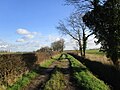
 Footpath to Brecks Lane - geograph.org.uk - 3040649.jpg 1,024 × 768; 186 KB
-
 Footpath to Cottam - geograph.org.uk - 531662.jpg 427 × 640; 116 KB
-
 Footpath towards Cottam Power Station - geograph.org.uk - 4714952.jpg 4,615 × 3,110; 7.06 MB
-
 Former Methodist Chapel, Rampton - geograph.org.uk - 4154993.jpg 960 × 1,280; 314 KB
-
 Gateway to Rampton Hospital - geograph.org.uk - 5474253.jpg 800 × 600; 101 KB
-
 Green tunnel - geograph.org.uk - 3040582.jpg 1,024 × 768; 349 KB
-
 Hawthorn tunnel - geograph.org.uk - 531664.jpg 640 × 427; 129 KB
-
 Hiding behind the trees - geograph.org.uk - 5555855.jpg 1,280 × 960; 214 KB
-

-
 Isolated tree - geograph.org.uk - 3040596.jpg 1,024 × 782; 200 KB
-

-
 Km 71 and Cottam Power Station - geograph.org.uk - 2576119.jpg 1,024 × 768; 181 KB
-
 Laneham Street - geograph.org.uk - 3512230.jpg 640 × 480; 66 KB
-
 Laneham Street in Rampton - geograph.org.uk - 4949865.jpg 800 × 538; 150 KB
-

-
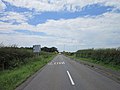
 Looking west along Retford Road - geograph.org.uk - 3049789.jpg 800 × 600; 88 KB
-
 Minor road towards Stokeham - geograph.org.uk - 2688805.jpg 640 × 480; 56 KB
-
 Minor road towards Stokeham - geograph.org.uk - 2688814.jpg 640 × 480; 47 KB
-
 O on the Beaufort Scale - geograph.org.uk - 1856544.jpg 426 × 640; 60 KB
-
 Oil seed rape near Cottam Power Station - geograph.org.uk - 4949737.jpg 800 × 585; 156 KB
-
 On Trent Valley Way, SE of Cottam Power Stn - geograph.org.uk - 6334590.jpg 5,184 × 2,920; 5.24 MB
-
 On Trent Valley Way, SE of Torksey Ferry Rd - geograph.org.uk - 6334593.jpg 5,184 × 2,920; 5.67 MB
-
 Ordnance Survey Cut Mark - geograph.org.uk - 4967985.jpg 640 × 570; 129 KB
-
 Part of Rampton Hospital - geograph.org.uk - 4314108.jpg 1,024 × 768; 170 KB
-
 Plenty of Dust - geograph.org.uk - 1498212.jpg 640 × 372; 52 KB
-
 Quay next to the River Trent - geograph.org.uk - 4949477.jpg 800 × 539; 107 KB
-
 Rampton Road - geograph.org.uk - 3853193.jpg 1,024 × 674; 88 KB
-
 Remains of a bench mark, Laneham Street - geograph.org.uk - 4155805.jpg 1,280 × 960; 408 KB
-
 Retford Road towards Laneham Lane - geograph.org.uk - 3048696.jpg 800 × 600; 97 KB
-
 River Trent - geograph.org.uk - 4814597.jpg 1,024 × 683; 126 KB
-
 River Trent - geograph.org.uk - 4814603.jpg 1,024 × 698; 194 KB
-
 River Trent - geograph.org.uk - 4870401.jpg 1,024 × 683; 140 KB
-
 Road near Cottam Power Station - geograph.org.uk - 4949460.jpg 800 × 574; 102 KB
-
 Road to the north of Stokeham - geograph.org.uk - 5555851.jpg 1,280 × 960; 244 KB
-
 Ruins of Torksey Castle as seen from Trent Valley Way - geograph.org.uk - 6334595.jpg 5,184 × 2,920; 4.68 MB
-
 Salins Lane - geograph.org.uk - 3498699.jpg 640 × 427; 105 KB
-
 Small island in the River Trent - geograph.org.uk - 4949444.jpg 800 × 499; 75 KB
-
 Small spinney - geograph.org.uk - 4285490.jpg 1,024 × 768; 128 KB
-

-
 Standing wheat in late September - geograph.org.uk - 5555858.jpg 1,280 × 960; 455 KB
-
 Stokeham seen from Wranglands Lane - geograph.org.uk - 4285348.jpg 1,024 × 768; 341 KB
-
 Stubble field with bales - geograph.org.uk - 4285469.jpg 1,024 × 768; 143 KB
-
 Sunken island - geograph.org.uk - 3160494.jpg 640 × 392; 160 KB
-
 Sunken island - geograph.org.uk - 3160498.jpg 640 × 427; 163 KB
-
 The Granary, Rampton - geograph.org.uk - 4241941.jpg 800 × 600; 100 KB
-
-
 The River Trent - geograph.org.uk - 5474094.jpg 800 × 600; 88 KB
-
 The Trent Valley Way - geograph.org.uk - 3163759.jpg 4,000 × 3,000; 1.85 MB
-
 The Trent Valley Way passing Cottam power station - geograph.org.uk - 3163747.jpg 4,000 × 3,000; 4.63 MB
-
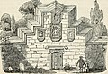
 Torksey Castle - geograph.org.uk - 5474080.jpg 800 × 600; 112 KB
-
 Torksey Ferry Road - geograph.org.uk - 3041603.jpg 1,024 × 768; 185 KB
-
 Torksey Ferry Road - geograph.org.uk - 4949630.jpg 800 × 541; 154 KB
-
 Torksey Ferry Road, Rampton - geograph.org.uk - 4223852.jpg 4,000 × 2,248; 4.95 MB
-
 Torksey Lock on the Fossdyke - geograph.org.uk - 5435751.jpg 4,032 × 3,024; 3.77 MB
-
 Torksey Railway Viaduct over R Trent - walkway - geograph.org.uk - 6335258.jpg 5,184 × 2,920; 4.85 MB
-
 Torksey Street in Rampton - geograph.org.uk - 4949834.jpg 800 × 536; 136 KB
-
 Torksey Viaduct - geograph.org.uk - 5195622.jpg 4,825 × 3,196; 7.45 MB
-
 Torksey Viaduct - geograph.org.uk - 5372917.jpg 800 × 443; 101 KB
-
 Torksey Viaduct - geograph.org.uk - 5473831.jpg 800 × 600; 105 KB
-
 Torksey Viaduct - geograph.org.uk - 5473847.jpg 800 × 600; 104 KB
-
 Torksey Viaduct - geograph.org.uk - 5473850.jpg 800 × 600; 101 KB
-
 Torksey Viaduct bridge - geograph.org.uk - 3397442.jpg 3,648 × 2,736; 4.08 MB
-
 Vicar's Lane - geograph.org.uk - 3040015.jpg 1,024 × 768; 229 KB
-
 View to Rampton Secure Hospital from Dolegate Road - geograph.org.uk - 6299319.jpg 5,126 × 3,755; 4.56 MB
-
 View towards Torksey Castle - geograph.org.uk - 4949607.jpg 800 × 549; 107 KB
-
 Willow plantation off Torksey Ferry Road - geograph.org.uk - 3040590.jpg 1,024 × 768; 153 KB
-
 Working on the Sabbeth - geograph.org.uk - 1498198.jpg 640 × 427; 77 KB
-
 Wranglands Lane - geograph.org.uk - 4284340.jpg 1,024 × 768; 252 KB
-
 Wranglands Lane - geograph.org.uk - 4285333.jpg 1,024 × 768; 297 KB
-
 Wranglands Lane - geograph.org.uk - 4285352.jpg 1,024 × 768; 267 KB
-
 Wranglands Lane and Cottam power station - geograph.org.uk - 4285343.jpg 1,024 × 768; 285 KB

_-_geograph.org.uk_-_5474085.jpg)
_-_geograph.org.uk_-_5474087.jpg)
_-_geograph.org.uk_-_5474092.jpg)
_-_geograph.org.uk_-_5474097.jpg)
_-_geograph.org.uk_-_5474099.jpg)
_-_geograph.org.uk_-_5474103.jpg)
_-_geograph.org.uk_-_5474233.jpg)
_-_geograph.org.uk_-_5474236.jpg)
_-_geograph.org.uk_-_5473842.jpg)
_-_geograph.org.uk_-_5473852.jpg)


_-_geograph.org.uk_-_3040611.jpg)


_-_geograph.org.uk_-_3165159.jpg)


_(14802256613).jpg)


