Category:Rapenburg 31, Leiden
Jump to navigation
Jump to search
| Object location | | View all coordinates using: OpenStreetMap |
|---|
 | |||||
| Upload media | |||||
| Instance of |
| ||||
|---|---|---|---|---|---|
| Location | Leiden, South Holland, Netherlands | ||||
| Occupant | |||||
| Heritage designation |
| ||||
 | |||||
|
This is a category about rijksmonument number 25482
|
| Address |
|
Media in category "Rapenburg 31, Leiden"
The following 9 files are in this category, out of 9 total.
-
 BoerhaaveRapenburg.JPG 2,816 × 2,112; 3.14 MB
-
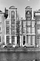 Gevels - Leiden - 20137188 - RCE.jpg 802 × 1,200; 210 KB
-
 Kantoor DUWO voorheen SLS Leiden.jpg 5,184 × 3,456; 7.41 MB
-
 Klmhuisje-nr19-1.jpg 797 × 1,461; 218 KB
-
 Leiden - Rapenburg 31.jpg 2,736 × 3,648; 3.56 MB
-
 Overzicht van de voorgevels - Leiden - 20382198 - RCE.jpg 1,200 × 1,198; 317 KB
-
 Overzicht voorgevel - Leiden - 20364022 - RCE.jpg 1,200 × 932; 273 KB
-
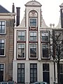
 Voorgevels - Leiden - 20137181 - RCE.jpg 955 × 1,200; 261 KB
-
 Voorgevels - Leiden - 20137189 - RCE.jpg 889 × 1,200; 208 KB


