Category:Rathaus Schwanenstadt
Jump to navigation
Jump to search
| Object location | | View all coordinates using: OpenStreetMap |
|---|
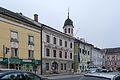
building in Schwanenstadt, Austria  | |||||
| Upload media | |||||
| Instance of | |||||
|---|---|---|---|---|---|
| Location | Schwanenstadt, Vöcklabruck District, Upper Austria, Austria | ||||
| Street address |
| ||||
| Heritage designation | |||||
 | |||||
Deutsch: Rathaus Schwanenstadt
Media in category "Rathaus Schwanenstadt"
The following 3 files are in this category, out of 3 total.
-
 Rathaus Stadtplatz 54.jpg 750 × 1,000; 95 KB
-
 Schwanenstadt Rathaus.jpg 5,500 × 3,667; 4.86 MB
-


