Category:Reformed High School, Szentendre
Jump to navigation
Jump to search
| Object location | | View all coordinates using: OpenStreetMap |
|---|
 | |||||
| Upload media | |||||
| Instance of |
| ||||
|---|---|---|---|---|---|
| Location | Szentendre, Szentendre District, Pest County, Hungary | ||||
| Street address |
| ||||
| Inception |
| ||||
| official website | |||||
 | |||||
Media in category "Reformed High School, Szentendre"
This category contains only the following file.
-
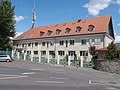 Reformed High School. - Szentendre, Áprily Lajos Sq 3-5.JPG 4,608 × 3,456; 3.34 MB