Category:Refuge Alfred Wills
Jump to navigation
Jump to search
| Object location | | View all coordinates using: OpenStreetMap |
|---|
building  | |||||
| Upload media | |||||
| Instance of | |||||
|---|---|---|---|---|---|
| Named after | |||||
| Location |
| ||||
| Street address |
| ||||
| Owned by | |||||
| Inception |
| ||||
| Mountain range | |||||
| Elevation above sea level |
| ||||
| Different from | |||||
| official website | |||||
 | |||||
Media in category "Refuge Alfred Wills"
The following 16 files are in this category, out of 16 total.
-
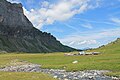
 Lac d'Anterne, 5 June 2010.jpg 3,872 × 2,592; 7.05 MB
-
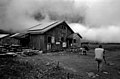
 Refuge Alfred Wills-août 2016-1.jpg 4,272 × 2,848; 3.26 MB
-
 Refuge Alfred Wills-août 2016-10.jpg 4,272 × 2,848; 2.64 MB
-
 Refuge Alfred Wills-août 2016-11.jpg 2,848 × 4,272; 1.94 MB
-
 Refuge Alfred Wills-août 2016-12.jpg 4,272 × 2,848; 2.48 MB
-
 Refuge Alfred Wills-août 2016-2.jpg 4,272 × 2,848; 4.36 MB
-
 Refuge Alfred Wills-août 2016-3.jpg 4,272 × 2,848; 3.1 MB
-
 Refuge Alfred Wills-août 2016-4.jpg 4,272 × 2,848; 3.11 MB
-
 Refuge Alfred Wills-août 2016-5.jpg 4,272 × 2,848; 3.36 MB
-
 Refuge Alfred Wills-août 2016-6.jpg 4,272 × 2,848; 1.79 MB
-
 Refuge Alfred Wills-août 2016-7.jpg 4,272 × 2,848; 2.5 MB
-
 Refuge Alfred Wills-août 2016-8.jpg 4,272 × 2,848; 2.43 MB
-
 Refuge Alfred Wills-août 2016-9.jpg 4,272 × 2,848; 2.44 MB
-
 Refuge Alfred Wills.jpg 4,473 × 2,960; 3.38 MB
-
 Refuge alfred wills.jpg 4,473 × 2,960; 2.34 MB
-
 Refugeanterne-DSCN7555.JPG 4,224 × 3,168; 5.45 MB


