Category:Republic of Ireland photographs taken on 2006-08-12
Jump to navigation
Jump to search
Countries of Europe: Austria · Belarus · Belgium · Czech Republic · Denmark · Finland · France‡ · Germany · Greece · Hungary · Iceland · Republic of Ireland · Italy · Latvia · Monaco · Netherlands‡ · Norway · Poland · Portugal‡ · Romania · Russia‡ · Serbia · Slovakia · Spain‡ · Sweden · Switzerland · Turkey‡ · Ukraine · United Kingdom
‡: partly located in Europe
‡: partly located in Europe
| ← | 12 August 2006 | → | ||
| ← | August 2006 | → | ||

Republic of Ireland photographs taken on 12 August 2006.
Image files should be categorized here automatically using {{taken on}} template. Direct categorisation is also possible, if automatic is impossible.
Media in category "Republic of Ireland photographs taken on 2006-08-12"
The following 35 files are in this category, out of 35 total.
-
 An Loch Geal - geograph.org.uk - 219703.jpg 600 × 450; 87 KB
-
 An Sas (Sauce Creek) - geograph.org.uk - 219157.jpg 600 × 450; 83 KB
-
 Brandon Pier - geograph.org.uk - 219724.jpg 600 × 450; 60 KB
-
 Bridge by the beach - geograph.org.uk - 219590.jpg 600 × 450; 66 KB
-
-
 Cairn - geograph.org.uk - 219111.jpg 600 × 450; 62 KB
-
 Central Square, Ballickmoyler - geograph.org.uk - 682706.jpg 448 × 336; 60 KB
-
 Connor Hill road heading south. - geograph.org.uk - 219688.jpg 600 × 450; 91 KB
-
 Entering Ballickmoyler from the West - geograph.org.uk - 682695.jpg 448 × 336; 34 KB
-
 Farmland south of Ballickmoyler - geograph.org.uk - 684603.jpg 640 × 480; 56 KB
-
-
-
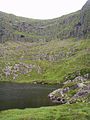 Loch Doon (Loch an Pheidlar) - geograph.org.uk - 219680.jpg 450 × 600; 101 KB
-
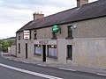 O'Kelly's Pub, Ballickmoyler - geograph.org.uk - 682714.jpg 448 × 336; 23 KB
-
 Old house in Ballickmoyler - geograph.org.uk - 684583.jpg 640 × 480; 107 KB
-
 Owennafeana river - geograph.org.uk - 219611.jpg 450 × 600; 104 KB
-
 Raised bog - geograph.org.uk - 219199.jpg 600 × 450; 79 KB
-
 Ridge in the bog - geograph.org.uk - 219188.jpg 600 × 450; 63 KB
-
 Tra Fhormaoileach (Fermoyle strand) - geograph.org.uk - 219585.jpg 600 × 450; 51 KB
-

-
 Waves - geograph.org.uk - 219597.jpg 600 × 450; 48 KB
-
 Abandoned house at Mullaghveal - geograph.org.uk - 219706.jpg 600 × 450; 106 KB
-
 Abandoned house in Mullaghveal - geograph.org.uk - 219709.jpg 600 × 450; 64 KB
-
 An Sas (Sauce creek) - geograph.org.uk - 219174.jpg 600 × 450; 86 KB
-
 Brandon bay - geograph.org.uk - 219727.jpg 600 × 450; 52 KB
-
 Brandon beach - geograph.org.uk - 219615.jpg 600 × 450; 51 KB
-
 Brandon Point - geograph.org.uk - 219035.jpg 600 × 450; 79 KB
-
 Cnoc Duileibhe (Knockdeelea) - geograph.org.uk - 219124.jpg 600 × 450; 60 KB
-
 Cotton grass - geograph.org.uk - 219142.jpg 600 × 450; 106 KB
-
 Look out post - geograph.org.uk - 219103.jpg 600 × 450; 61 KB
-
 Rocks on a ridge - geograph.org.uk - 219211.jpg 600 × 450; 66 KB
-
 Stream - geograph.org.uk - 219220.jpg 600 × 450; 95 KB
-
 Valley - geograph.org.uk - 219217.jpg 600 × 450; 51 KB
-
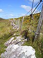 Wall and fence - geograph.org.uk - 219225.jpg 450 × 600; 115 KB
-


_-_geograph.org.uk_-_219157.jpg)


_-_geograph.org.uk_-_219607.jpg)


_-_geograph.org.uk_-_219715.jpg)

_-_geograph.org.uk_-_219680.jpg)


_-_geograph.org.uk_-_219585.jpg)


_-_geograph.org.uk_-_219174.jpg)


_-_geograph.org.uk_-_219124.jpg)


_-_geograph.org.uk_-_219666.jpg)