Category:Rhayader
Jump to navigation
Jump to search
town in Wales, United Kingdom  | |||||
| Upload media | |||||
| Instance of | |||||
|---|---|---|---|---|---|
| Location | Rhayader, Powys, Wales | ||||
| Located in or next to body of water | |||||
| official website | |||||
 | |||||
Cymraeg: Tref fechan wledig yng ngorllewin Powys yw Rhaeadr Gwy (Saesneg: Rhayader). Gorwedd ar lannau Afon Gwy.
Deutsch: Rhayader ( Walisisch: Rhaeadr Gwy, das bedeutet Wasserfall am Wye) ist ein kleines Städtchen (2.000 Einwohner) in der Grafschaft Radnorshire in Mittelwales, Großbritannien im Tal des Flusses Wye.
English: Rhayader , is a busy and historic market town in Powys, Mid Wales. It is the first town on the banks of the River Wye, some 20 miles from its source on the Plynlimon range of the Cambrian Mountains.
Nederlands: Rhayader is een plaats in Wales, in het bestuurlijke graafschap en het ceremoniële behouden graafschap Powys. De plaats telt 2.075 inwoners.
Subcategories
This category has the following 11 subcategories, out of 11 total.
2
B
- Bryniargo House, Rhayader (5 F)
C
- Rhayader Clock Tower (33 F)
H
P
R
- Rhayader railway station (10 F)
- Rhayader Tannery (29 F)
- River Wye at Rhayader (12 F)
S
- Shops in Rhayader (6 F)
Media in category "Rhayader"
The following 200 files are in this category, out of 1,172 total.
(previous page) (next page)-
 "Water Mark" at the head of the Elan Valley - geograph.org.uk - 6054491.jpg 3,599 × 2,399; 1.65 MB
-
 (Rhayader panto) (6435402627).jpg 446 × 612; 61 KB
-
 1-18 Brynheulog, Rhayader - geograph.org.uk - 3016662.jpg 640 × 445; 76 KB
-
 30 Ymhen 200 llath-200 yds ahead, Rhayader - geograph.org.uk - 5859644.jpg 1,024 × 1,012; 177 KB
-
 A change of Background - geograph.org.uk - 4065648.jpg 1,024 × 683; 226 KB
-
 A Claerwen Reservoir view - geograph.org.uk - 4102157.jpg 1,024 × 768; 120 KB
-
 A corner of Claerwen Reservoir in a downpour - geograph.org.uk - 4102099.jpg 1,024 × 768; 96 KB
-
 A corner on the Claerwen Reservoir track - geograph.org.uk - 4102128.jpg 1,024 × 768; 170 KB
-
 A fine stand of trees by the reservoir - geograph.org.uk - 5917842.jpg 1,024 × 768; 277 KB
-
 A Sad memorial - geograph.org.uk - 4072343.jpg 1,024 × 683; 103 KB
-
 A sylvan scene in Glyn Gwy - geograph.org.uk - 248235.jpg 640 × 480; 145 KB
-
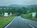 A44 approaching Rhayader from the east - geograph.org.uk - 1526673.jpg 640 × 480; 103 KB
-
 A44 direction sign alongside Dark Lane, Rhayader - geograph.org.uk - 5875978.jpg 1,024 × 767; 153 KB
-
 A44 east of Rhayader - geograph.org.uk - 5859637.jpg 1,024 × 968; 179 KB
-
 A470 (South Street) Rhayader - geograph.org.uk - 4996239.jpg 640 × 480; 456 KB
-
 A470 towards the centre of Rhayader - geograph.org.uk - 6015580.jpg 1,024 × 903; 208 KB
-
 A470, South of Rhayader - geograph.org.uk - 4996262.jpg 640 × 480; 381 KB
-
 Abandoned agricultural machinery - geograph.org.uk - 2320427.jpg 640 × 480; 110 KB
-
 Abandoned mine building in Elan Valley - geograph.org.uk - 5554435.jpg 4,000 × 2,250; 3.26 MB
-
 Aber Caethon Crossroads, B4518 - geograph.org.uk - 4999187.jpg 640 × 427; 407 KB
-
 Aber Glanhirin - geograph.org.uk - 4265090.jpg 1,024 × 768; 111 KB
-
 Aber Glanhirin - geograph.org.uk - 4554026.jpg 1,024 × 680; 261 KB
-
 Aber Glanhirin farm - geograph.org.uk - 6316608.jpg 1,024 × 700; 860 KB
-
 Abergwngu - geograph.org.uk - 4252981.jpg 1,024 × 768; 113 KB
-
 Abergwyngu - geograph.org.uk - 4553995.jpg 800 × 531; 119 KB
-
 Abergwyngu - geograph.org.uk - 4553998.jpg 800 × 531; 97 KB
-

-
 Above the Claerwen Reservoir - geograph.org.uk - 4102137.jpg 1,024 × 721; 124 KB
-
 Above the Claerwen Reservoir - geograph.org.uk - 4102241.jpg 768 × 1,024; 99 KB
-
 Above the Dyfnant arm of Claerwen Reservoir - geograph.org.uk - 4102150.jpg 768 × 1,024; 187 KB
-
-
 Across the Penygarreg - geograph.org.uk - 4213525.jpg 1,024 × 683; 162 KB
-
 Afon Claerwen - geograph.org.uk - 4250960.jpg 1,024 × 499; 136 KB
-
 Afon Claerwen - geograph.org.uk - 4346927.jpg 1,798 × 1,199; 377 KB
-
 Afon Claerwen - geograph.org.uk - 5917856.jpg 1,024 × 768; 166 KB
-
 Afon Claerwen and Ciloerwynt - geograph.org.uk - 4250971.jpg 1,023 × 1,024; 334 KB
-
 Afon Elan (River Elan) - geograph.org.uk - 4912156.jpg 640 × 481; 675 KB
-
 Afon Elan - geograph.org.uk - 4554003.jpg 800 × 531; 99 KB
-
 Afon Elan - geograph.org.uk - 5732663.jpg 2,853 × 2,025; 914 KB
-
 Afon Elan - geograph.org.uk - 5877704.jpg 4,000 × 3,000; 4.67 MB
-
 Afon Elan - geograph.org.uk - 5877709.jpg 4,000 × 3,000; 5.34 MB
-
 Afon Elan - geograph.org.uk - 5917901.jpg 1,024 × 768; 180 KB
-
 Afon Elan and bridge - geograph.org.uk - 4108402.jpg 1,333 × 1,000; 1.24 MB
-
 Afon Elan and Penygarreg Valve Tower - geograph.org.uk - 5003142.jpg 640 × 480; 557 KB
-
 Afon Elan from Pont ar Elan - geograph.org.uk - 6007499.jpg 1,060 × 1,600; 386 KB
-
 Afon Elan west of Rhayader - geograph.org.uk - 4257849.jpg 1,600 × 1,180; 673 KB
-
 Afon Ystwyth at Blaen-y-cwm - geograph.org.uk - 4552386.jpg 1,024 × 680; 277 KB
-
-
 Alongside Garreg Ddu Reservoir - geograph.org.uk - 4362028.jpg 530 × 800; 563 KB
-
 Altar flowers - geograph.org.uk - 4070720.jpg 1,024 × 683; 96 KB
-
 Altar ^ Chancel Window - geograph.org.uk - 4070525.jpg 533 × 800; 55 KB
-
 Another Sign - geograph.org.uk - 4265104.jpg 1,024 × 768; 290 KB
-
 Any which way - geograph.org.uk - 1861598.jpg 2,048 × 1,536; 1.46 MB
-

-
 Approaching Pont ar Elan - geograph.org.uk - 5005232.jpg 640 × 427; 449 KB
-
 Approaching Rhayader on the Wye Valley Walk - geograph.org.uk - 2998880.jpg 2,592 × 1,944; 1.72 MB
-
 Approaching the bridge - geograph.org.uk - 4252978.jpg 1,024 × 745; 97 KB
-
 At the foot of the Claerwen dam - geograph.org.uk - 4250946.jpg 1,024 × 678; 183 KB
-
 At the milkbar - geograph.org.uk - 4549595.jpg 800 × 531; 92 KB
-

-
 Axbbeycwmhir junction from A44 - geograph.org.uk - 3553476.jpg 640 × 393; 75 KB
-
 B4518 by Caban-coch Reservoir in Powys - geograph.org.uk - 6214043.jpg 1,280 × 960; 1.52 MB
-
 B4518 by Caban-coch Reservoir in Powys - geograph.org.uk - 6214124.jpg 1,440 × 960; 1.35 MB
-
 B4518 entering Rhayader - geograph.org.uk - 3553465.jpg 640 × 397; 60 KB
-
 B4518 near to Elan Village - geograph.org.uk - 4999218.jpg 640 × 480; 445 KB
-
 B4518 near to Llansantffraed-Cwmdeuddwr - geograph.org.uk - 4999175.jpg 640 × 480; 377 KB
-
 B4518, Clas Barn and Carn Gafallt - geograph.org.uk - 4996257.jpg 640 × 480; 356 KB
-
 B4518, Elan Valley - geograph.org.uk - 4999183.jpg 640 × 480; 480 KB
-
 B4518, Llansantffraed-Cwmdeuddwr - geograph.org.uk - 4996247.jpg 640 × 427; 312 KB
-

-
 B4518, South West of Rhayader - geograph.org.uk - 4996241.jpg 640 × 480; 479 KB
-
 Back of Craig Goch dam when full - geograph.org.uk - 4830712.jpg 3,264 × 2,448; 2 MB
-
 Back to Pont ar Elan - geograph.org.uk - 4213232.jpg 1,024 × 683; 118 KB
-
 Bailey Bridge over Afon Claerwen - geograph.org.uk - 4647731.jpg 640 × 480; 115 KB
-
 Banc Treheslog - geograph.org.uk - 4458157.jpg 640 × 480; 65 KB
-
 Below Caban Coch Dam - geograph.org.uk - 4351950.jpg 800 × 530; 709 KB
-
 Below Claerwen Dam - geograph.org.uk - 4354622.jpg 530 × 800; 588 KB
-
 Below the Caban Coch Dam, Elan Valley - geograph.org.uk - 5162906.jpg 2,500 × 1,875; 1.23 MB
-
 Below the Caban Coch Dam, Elan Valley - geograph.org.uk - 5162917.jpg 2,500 × 1,834; 1.11 MB
-
 Below the Caban Coch Dam, Elan Valley - geograph.org.uk - 5162981.jpg 2,500 × 1,846; 1.23 MB
-
 Benches and litter bin on a Rhayader corner - geograph.org.uk - 5920223.jpg 1,024 × 768; 302 KB
-
 Benchmark near the dam - geograph.org.uk - 4215191.jpg 533 × 800; 209 KB
-
 Benchmark on the Cwmdauddwr Arms, Rhayader - geograph.org.uk - 5122389.jpg 1,200 × 1,600; 374 KB
-
 Bend in the A470, Rhayader - geograph.org.uk - 6015543.jpg 1,024 × 760; 172 KB
-
 Bethany Chapel burial ground, Rhayader - geograph.org.uk - 5912389.jpg 832 × 1,024; 249 KB
-
 Bethany Chapel information board, Rhayader - geograph.org.uk - 5860137.jpg 746 × 1,024; 181 KB
-
 Bethany Chapel, Rhayader - geograph.org.uk - 3021625.jpg 640 × 480; 63 KB
-
 Bethel Baptist Chapel - geograph.org.uk - 3623223.jpg 530 × 800; 436 KB
-
 Bethel Baptist Church, Rhayader - geograph.org.uk - 2101192.jpg 2,000 × 1,311; 2.23 MB
-
 Bethel Baptist Church, Rhayader - geograph.org.uk - 3016832.jpg 640 × 405; 57 KB
-

-
 Blue plaque on South Gate - geograph.org.uk - 3623211.jpg 800 × 530; 544 KB
-
 Both ways lead to Rhayader - geograph.org.uk - 5859941.jpg 1,024 × 853; 264 KB
-
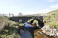
 Bridge across the River Wye - geograph.org.uk - 6148378.jpg 1,920 × 1,280; 1.38 MB
-

-
 Bridge at Rahyadergwy.jpeg 900 × 769; 487 KB
-
 Bridge below Claerwen Dam - geograph.org.uk - 4361062.jpg 800 × 530; 585 KB
-
 Bridge crossing Nant y Ffald - geograph.org.uk - 4554886.jpg 1,024 × 680; 315 KB
-
 Bridge Downstream - geograph.org.uk - 4212415.jpg 1,024 × 683; 180 KB
-
 Bridge near Penygarreg - geograph.org.uk - 4134929.jpg 2,001 × 1,750; 1.76 MB
-
 Bridge on the Elan - geograph.org.uk - 4212401.jpg 1,024 × 683; 238 KB
-
 Bridge on the Nant-y-ffald - geograph.org.uk - 4265098.jpg 1,024 × 768; 165 KB
-
 Bridge over Nant Botalog - geograph.org.uk - 5005370.jpg 640 × 480; 427 KB
-
 Bridge over Nant Cletwr - geograph.org.uk - 5004551.jpg 640 × 480; 429 KB
-
 Bridge over Nant Dolfolau - geograph.org.uk - 5002909.jpg 640 × 427; 389 KB
-
 Bridge over Nant y Ffald - geograph.org.uk - 4554889.jpg 800 × 531; 138 KB
-
 Bridge over Nant y Ffald - geograph.org.uk - 5005283.jpg 640 × 480; 456 KB
-

-
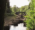
 Bridge over the River Wye - geograph.org.uk - 4599110.jpg 4,320 × 3,240; 5.02 MB
-
 Bridge over the Wye - geograph.org.uk - 607754.jpg 640 × 428; 138 KB
-
 Bridge Street, Cwmdauddwr - geograph.org.uk - 6148385.jpg 1,920 × 1,280; 1,015 KB
-
 Bridge Street, Rhayader - geograph.org.uk - 4996184.jpg 640 × 427; 400 KB
-
 Bridge Street, Rhayader - geograph.org.uk - 6148408.jpg 1,796 × 1,052; 1.14 MB
-
 Bridge Street, Rhayader - geograph.org.uk - 6149219.jpg 1,600 × 1,200; 379 KB
-
 Bridges over Afon Elan - geograph.org.uk - 4257861.jpg 1,600 × 844; 298 KB
-
 Bridleway and track - geograph.org.uk - 4554893.jpg 800 × 531; 117 KB
-
 Bridleway parallel to the River Wye - geograph.org.uk - 4325406.jpg 640 × 426; 509 KB
-
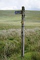 Bridleway sign - geograph.org.uk - 4552609.jpg 531 × 800; 122 KB
-
 Bridleway to Esgair Perfedd - geograph.org.uk - 4556317.jpg 1,024 × 680; 300 KB
-
 Brightwells in Rhayader - geograph.org.uk - 5920042.jpg 1,024 × 688; 135 KB
-
 Brynheulog, Rhayader - geograph.org.uk - 6148417.jpg 1,920 × 1,280; 1.2 MB
-
 Buildings by the River Wye, Rhayader - geograph.org.uk - 6149224.jpg 1,600 × 1,200; 397 KB
-
 Bungalow on East Street, Rhayader - geograph.org.uk - 6148419.jpg 1,888 × 1,230; 1.45 MB
-
 Bungalows beside the B4518 near Rhayader - geograph.org.uk - 2113322.jpg 2,000 × 1,194; 2.39 MB
-
 By the Claerwen Reservoir - geograph.org.uk - 4102144.jpg 768 × 1,024; 192 KB
-
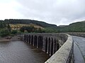
 Caban Coch Dam - geograph.org.uk - 4108366.jpg 1,333 × 1,000; 1.4 MB
-
 Caban Coch Dam - geograph.org.uk - 4352819.jpg 530 × 800; 687 KB
-
 Caban Coch Dam - geograph.org.uk - 4353088.jpg 800 × 530; 588 KB
-
 Caban Coch Dam - geograph.org.uk - 4726006.jpg 1,600 × 1,200; 638 KB
-
 Caban Coch Dam - geograph.org.uk - 4912397.jpg 640 × 481; 530 KB
-
 Caban Coch Dam - geograph.org.uk - 5917813.jpg 1,024 × 768; 184 KB
-
 Caban Coch Dam top car park - geograph.org.uk - 5877665.jpg 4,000 × 3,000; 4.6 MB
-
 Caban Coch Reflections - geograph.org.uk - 4912475.jpg 640 × 481; 486 KB
-
 Caban Coch Reservoir - geograph.org.uk - 4912464.jpg 640 × 481; 469 KB
-
 Caban Coch Reservoir - geograph.org.uk - 5877667.jpg 4,000 × 3,000; 4.5 MB
-
 Caban Coch Reservoir - geograph.org.uk - 5917828.jpg 1,024 × 768; 149 KB
-

-

-
 Caban-coch Dam - geograph.org.uk - 4072436.jpg 1,024 × 496; 117 KB
-
 Caban-coch Reservoir - geograph.org.uk - 4072431.jpg 1,024 × 683; 123 KB
-
 Caban-coch Reservoir and Cnwch in Powys - geograph.org.uk - 6214096.jpg 1,280 × 960; 1.63 MB
-
 Caban-coch Reservoir and Cnwch in Powys - geograph.org.uk - 6214119.jpg 1,280 × 960; 1.8 MB
-
 Caban-coch Reservoir in Powys - geograph.org.uk - 6214059.jpg 1,280 × 960; 1.41 MB
-
 Caban-coch Reservoir south-west of Rhayader in Powys - geograph.org.uk - 6213069.jpg 1,440 × 960; 1.25 MB
-
 Caban-Coch sawmill, Elan Valley - geograph.org.uk - 3996294.jpg 4,048 × 2,175; 4.01 MB
-
 Canmlwyddiant Elan Centenary - geograph.org.uk - 4074407.jpg 600 × 800; 104 KB
-
 Car Park, Llannerch Cawr - geograph.org.uk - 4532250.jpg 4,608 × 3,456; 3.73 MB
-
 Car parked by Rhayader quarry (1293659).jpg 1,000 × 711; 107 KB
-
 Carn Wen - geograph.org.uk - 5237502.jpg 3,776 × 2,520; 4.01 MB
-
 Cattle grid near Glanllyn - geograph.org.uk - 4556986.jpg 800 × 531; 148 KB
-

-
 Cerrig Llwydion - geograph.org.uk - 4549612.jpg 1,024 × 680; 302 KB
-
 Chancel to the Nave - geograph.org.uk - 4070718.jpg 533 × 800; 85 KB
-
 Chancel Windows - geograph.org.uk - 4070523.jpg 1,024 × 683; 78 KB
-
 Chobblebox, Rhayader - geograph.org.uk - 5861091.jpg 1,024 × 768; 189 KB
-
 Church Street, Rhayader - geograph.org.uk - 5153430.jpg 3,956 × 2,940; 3.62 MB
-
 Churchyard and houses, Rhayader - geograph.org.uk - 2526776.jpg 950 × 713; 317 KB
-
 Ciloerwynt Farm, Claerwen valley - geograph.org.uk - 5754079.jpg 1,200 × 827; 224 KB
-
 Claerwen Dam - geograph.org.uk - 4354510.jpg 800 × 530; 609 KB
-
 Claerwen Dam - geograph.org.uk - 4354514.jpg 530 × 800; 550 KB
-
 Claerwen Dam - geograph.org.uk - 4354523.jpg 530 × 800; 567 KB
-
 Claerwen Dam - geograph.org.uk - 4354616.jpg 530 × 800; 643 KB
-
 Claerwen Dam - geograph.org.uk - 4354617.jpg 800 × 530; 615 KB
-
 Claerwen Dam - geograph.org.uk - 4354626.jpg 800 × 530; 531 KB
-
 Claerwen Reservoir - geograph.org.uk - 5115983.jpg 2,399 × 1,599; 763 KB
-
 Claerwen Reservoir - geograph.org.uk - 5917850.jpg 1,024 × 768; 171 KB
-

-
 Claerwen reservoir shoreline - geograph.org.uk - 5990039.jpg 1,024 × 681; 679 KB
-
 Claerwen Reservoir track - geograph.org.uk - 4102299.jpg 1,024 × 737; 161 KB
-

-
 Claerwen valley view - geograph.org.uk - 5754088.jpg 1,200 × 962; 374 KB
-

-
 Cliff face, Elan Valley - geograph.org.uk - 6073527.jpg 3,008 × 1,612; 588 KB
-
 Clock tower in the centre of Rhayader from East Street - geograph.org.uk - 5146541.jpg 2,000 × 1,500; 441 KB
-
 Clock Tower, Rhayader - geograph.org.uk - 4659141.jpg 1,707 × 1,173; 413 KB
-
 Clock Tower, Rhayader - geograph.org.uk - 5128670.jpg 1,600 × 1,200; 358 KB
-
 Clock Tower, Rhayader - geograph.org.uk - 5663894.jpg 1,600 × 1,035; 290 KB
-
 Close up of the Sign - geograph.org.uk - 4264973.jpg 1,024 × 768; 282 KB
-
 Cluster of icicles on rock - geograph.org.uk - 5754628.jpg 1,200 × 742; 312 KB
-
 Cnwch Farm near Elan - geograph.org.uk - 4146831.jpg 3,051 × 1,775; 2.54 MB
-
 Cnwch Wood above the Elan Valley - geograph.org.uk - 3015632.jpg 640 × 480; 97 KB
-
 Co-op lorry in East Street, Rhayader - geograph.org.uk - 5875884.jpg 837 × 1,024; 139 KB
-
 Coates Car Sales, Rhayader - geograph.org.uk - 3016589.jpg 640 × 480; 62 KB
-
 Colourful bus shelters in Rhayader - geograph.org.uk - 5869057.jpg 1,024 × 690; 173 KB
-
 Country road descending above Nant Glanllyn - geograph.org.uk - 4556955.jpg 1,024 × 680; 324 KB
-
 Covered in moss - geograph.org.uk - 1294096.jpg 640 × 426; 112 KB
-
 Crag by the Claerwen Reservoir track - geograph.org.uk - 4102274.jpg 768 × 1,024; 179 KB
-
 Crags south-west of Elan Village in Powys - geograph.org.uk - 6214128.jpg 1,280 × 960; 1.46 MB
-
 Craig Cnwch - geograph.org.uk - 4074399.jpg 1,024 × 768; 124 KB
-
 Craig Goch dam - geograph.org.uk - 4283308.jpg 1,232 × 820; 1.11 MB
-
 Craig Goch Dam - geograph.org.uk - 4362118.jpg 800 × 530; 570 KB
-
 Craig Goch Dam - geograph.org.uk - 4362123.jpg 530 × 800; 524 KB
-
 Craig Goch Dam - geograph.org.uk - 4362124.jpg 530 × 800; 614 KB
-
 Craig Goch Dam - geograph.org.uk - 4362126.jpg 800 × 530; 691 KB
-
 Craig Goch dam - geograph.org.uk - 4759302.jpg 1,090 × 768; 1.27 MB
-
 Craig Goch Dam - geograph.org.uk - 5732669.jpg 3,599 × 2,399; 1.45 MB
-
 Craig Goch Dam - geograph.org.uk - 5917888.jpg 1,024 × 768; 190 KB
-
 Craig Goch dam and reservoir - geograph.org.uk - 5232861.jpg 800 × 534; 108 KB
-
 Craig Goch Dam and Valve Tower - geograph.org.uk - 5004235.jpg 640 × 427; 442 KB
-
 Craig Goch Dam in the Elan Valley - geograph.org.uk - 5859959.jpg 1,024 × 786; 252 KB

_(6435402627).jpg)


_Rhayader_-_geograph.org.uk_-_4996239.jpg)


_-_geograph.org.uk_-_4912156.jpg)


.jpg)


