Category:Riding Mill
Jump to navigation
Jump to search
village in Northumberland, United Kingdom  | |||||
| Upload media | |||||
| Instance of | |||||
|---|---|---|---|---|---|
| Location | Broomhaugh and Riding, Northumberland, North East England, England | ||||
 | |||||
English: * Riding Mill Parish Council web site
Subcategories
This category has the following 3 subcategories, out of 3 total.
R
- Riding Mill railway station (22 F)
S
- Styford Bridge (2 F)
Media in category "Riding Mill"
The following 47 files are in this category, out of 47 total.
-
 Bend on the River Tyne downstream of Riding Mill - geograph.org.uk - 1823040.jpg 1,600 × 1,200; 560 KB
-
 Bend on the River Tyne downstream of Riding Mill - geograph.org.uk - 1823062.jpg 1,600 × 1,017; 562 KB
-

-
 Footbridge and Ford, Ridingmill Burn - geograph.org.uk - 4759060.jpg 1,066 × 800; 390 KB
-
 Footbridge and Ford, Ridingmill Burn - geograph.org.uk - 4759063.jpg 1,066 × 800; 424 KB
-
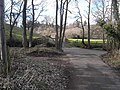
 Footpath and Track towards Ridingmill Burn - geograph.org.uk - 4759070.jpg 1,066 × 800; 355 KB
-
 Footpath towards Riding Mill - geograph.org.uk - 4759259.jpg 1,066 × 800; 257 KB
-
 Ford at Dipton Foot - geograph.org.uk - 1193523.jpg 640 × 480; 123 KB
-
 High Plains drifters - geograph.org.uk - 456173.jpg 640 × 480; 102 KB
-
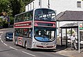 Newcastle 'bus at Riding Mill - August 2016 - geograph.org.uk - 5088468.jpg 1,250 × 860; 1.01 MB
-
 Newsagent, Riding Mill - August 2016 - geograph.org.uk - 5088472.jpg 1,250 × 1,191; 1.59 MB
-
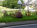
 Old Drinking Trough, now a floral display - geograph.org.uk - 3000068.jpg 4,320 × 3,240; 4.17 MB
-
 Path and sike feeding Ridingmill Burn - geograph.org.uk - 3398604.jpg 640 × 480; 143 KB
-
 Poppies on the A68 - geograph.org.uk - 6062.jpg 640 × 480; 116 KB
-
 Railway approaching Riding Mill Station - geograph.org.uk - 5400226.jpg 5,880 × 3,920; 7.19 MB
-
 River Tyne at Riding Mill - geograph.org.uk - 5279338.jpg 5,312 × 2,988; 5.12 MB
-
 Riverside Footpath near Riding Mill - geograph.org.uk - 2203943.jpg 600 × 450; 368 KB
-
 Road leading to Riding Mill - geograph.org.uk - 2203987.jpg 600 × 450; 287 KB
-

-
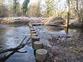
 Stepping stones over Riding Mill burn - geograph.org.uk - 1120143.jpg 640 × 480; 103 KB
-
 Stepping stones over Ridingmill Burn - geograph.org.uk - 5279391.jpg 5,312 × 2,988; 7.53 MB
-
 Stepping stones over the Ridingmill Burn - geograph.org.uk - 3243953.jpg 1,024 × 768; 278 KB
-

-
 Stile in Robson's Plantation - geograph.org.uk - 1530347.jpg 640 × 480; 151 KB
-
 The A695 through Riding Mill - geograph.org.uk - 5401250.jpg 5,940 × 3,960; 4.7 MB
-
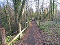 The footpath from the station, Riding Mill - geograph.org.uk - 3254038.jpg 1,024 × 768; 342 KB
-
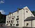
 The Manor House, Riding Mill - geograph.org.uk - 2203993.jpg 600 × 450; 265 KB
-
 The stripey bikes of Riding Mill (1) - geograph.org.uk - 4633476.jpg 640 × 480; 576 KB
-
 The stripey bikes of Riding Mill (2) - geograph.org.uk - 4633483.jpg 640 × 480; 561 KB
-
 The stripey bikes of Riding Mill (3) - geograph.org.uk - 4633484.jpg 640 × 480; 572 KB
-
 The stripey bikes of Riding Mill (4) - geograph.org.uk - 4633491.jpg 480 × 640; 188 KB
-
 The stripey bikes of Riding Mill (5) - geograph.org.uk - 4633495.jpg 640 × 480; 535 KB
-
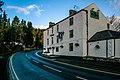 The Wellington - geograph.org.uk - 4045129.jpg 3,888 × 2,592; 1.46 MB
-
 The Wellington, Riding Mill - August 2016 - geograph.org.uk - 5088465.jpg 1,250 × 832; 754 KB
-
 The Wellington, Riding Mill - geograph.org.uk - 490431.jpg 640 × 510; 77 KB
-
 Track down to Riding Mill - geograph.org.uk - 5400184.jpg 5,940 × 3,960; 6.76 MB
-
 Tynedale Rugby Football Club - geograph.org.uk - 692560.jpg 640 × 480; 80 KB
-
 Underwood Road, Riding Mill - geograph.org.uk - 4447741.jpg 1,024 × 768; 230 KB
-
 Underwood Road, Riding Mill - geograph.org.uk - 4447755.jpg 1,024 × 768; 389 KB
-
 Wentworth Grange, Riding Mill - geograph.org.uk - 499173.jpg 640 × 480; 104 KB
-
 High Plains High Jumps - geograph.org.uk - 456170.jpg 640 × 480; 88 KB
-
 Hillside above Corbridge - geograph.org.uk - 692556.jpg 640 × 480; 69 KB
-
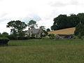 Meadows and Southwood Cottage - geograph.org.uk - 500387.jpg 640 × 480; 70 KB
-
 Prospect Hill Farm - geograph.org.uk - 692557.jpg 640 × 480; 80 KB
-
 Roadside trees in winter - geograph.org.uk - 692558.jpg 640 × 480; 114 KB
-
 Tynedale Rugby Football Club - geograph.org.uk - 692562.jpg 640 × 480; 49 KB
-
 View from footpath near High Plains - geograph.org.uk - 456162.jpg 640 × 480; 109 KB


_-_geograph.org.uk_-_4633476.jpg)
_-_geograph.org.uk_-_4633483.jpg)
_-_geograph.org.uk_-_4633484.jpg)
_-_geograph.org.uk_-_4633491.jpg)
_-_geograph.org.uk_-_4633495.jpg)


