Category:River Parrett Trail
Jump to navigation
Jump to search

Long-distance footpath in Dorset and Somerset, England  | |||||
| Upload media | |||||
| Instance of | |||||
|---|---|---|---|---|---|
| Location | Dorset, South West England, England | ||||
| Connects with | |||||
| Length |
| ||||
| Terminus | |||||
| |||||
Media in category "River Parrett Trail"
The following 26 files are in this category, out of 26 total.
-
 Burrow Mump 03.jpg 5,152 × 3,864; 4.52 MB
-
 Burrowbridge 01.jpg 5,152 × 3,864; 4.37 MB
-
 Burrowbridge 02.jpg 5,152 × 3,864; 4.4 MB
-
 Canal at Bridgwater - geograph.org.uk - 22244.jpg 640 × 480; 125 KB
-
 Field, Bower Hinton - geograph.org.uk - 1207583.jpg 640 × 480; 120 KB
-

-
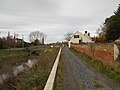
 Huntworth Bridge - geograph.org.uk - 1691036.jpg 640 × 426; 62 KB
-
 ParrettTrailmarker.jpg 1,704 × 2,272; 1.07 MB
-
 Path by the River Parrett - geograph.org.uk - 1503762.jpg 640 × 480; 109 KB
-
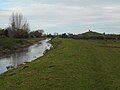
 River Parrett at Creedy Bridge - geograph.org.uk - 1503750.jpg 640 × 480; 112 KB
-
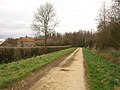
 River Parrett Trail - geograph.org.uk - 1207825.jpg 640 × 480; 85 KB
-
 River Parrett Trail - geograph.org.uk - 1503790.jpg 640 × 480; 83 KB
-
 River Parrett Trail - geograph.org.uk - 1690888.jpg 640 × 480; 84 KB
-
 River Parrett Trail - geograph.org.uk - 622665.jpg 640 × 480; 87 KB
-
 River Parrett Trail at Cartgate Farm - geograph.org.uk - 1207859.jpg 640 × 480; 90 KB
-
 River Parrett Trail at Little Load.jpg 640 × 480; 47 KB
-
 River Parrett Trail near Bower Hinton - geograph.org.uk - 1207799.jpg 640 × 480; 125 KB
-
 Rivertone.jpg 640 × 480; 113 KB
-
 SomersetLevelsViewfromparrett.jpg 1,804 × 1,229; 504 KB
-
 South of Wigborough - geograph.org.uk - 1503617.jpg 640 × 480; 85 KB
-
 Stile beside Willis's Lane, Perrott Hill. - geograph.org.uk - 680830.jpg 402 × 640; 140 KB
-
 SwanAndcygnets.jpg 2,024 × 1,635; 1.43 MB
-

-
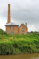 WestonZoylandpumpingstation.jpg 1,319 × 1,981; 784 KB
-
 Parsonage Farm - geograph.org.uk - 460686.jpg 640 × 480; 100 KB
-


