Category:River Ray, Buckinghamshire and Oxfordshire
Jump to navigation
Jump to search
river in Oxfordshire and Buckinghamshire in the United Kingdom  | |||||
| Upload media | |||||
| Instance of | |||||
|---|---|---|---|---|---|
| Location | Buckinghamshire, South East England, England | ||||
| Mouth of the watercourse | |||||
| Tributary |
| ||||
 | |||||
Media in category "River Ray, Buckinghamshire and Oxfordshire"
The following 13 files are in this category, out of 13 total.
-
 20200710 River Ray, Lower Arncott.jpg 3,024 × 4,032; 6.48 MB
-
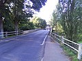
 Bridge over River Ray - geograph.org.uk - 1265360.jpg 480 × 640; 161 KB
-
 Meeting of streams of the River Ray - geograph.org.uk - 1266784.jpg 480 × 640; 153 KB
-
 New River Ray at Oddington - geograph.org.uk - 386616.jpg 640 × 480; 242 KB
-
 Ordnance Survey Sheet SP 51 Islip, Published 1951.jpg 7,409 × 7,499; 4.08 MB
-
 River Ray - geograph.org.uk - 464921.jpg 640 × 425; 119 KB
-
 River Ray at Gallows Bridge Farm.JPG 6,016 × 4,000; 11.14 MB
-
 River Ray at Islip - geograph.org.uk - 673377.jpg 640 × 480; 105 KB
-
 River Ray Floods, Sunset - geograph.org.uk - 304267.jpg 640 × 430; 70 KB
-
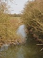
 River Ray, Grendon Wood - geograph.org.uk - 1261280.jpg 640 × 480; 142 KB
-
 River Ray, Otmoor - geograph.org.uk - 384485.jpg 480 × 640; 286 KB
-
 Roadbridge Over River Ray, Islip - geograph.org.uk - 1472163.jpg 640 × 480; 105 KB
-
 The River Ray - geograph.org.uk - 742841.jpg 640 × 475; 90 KB


