Category:River Severn - maps
Jump to navigation
Jump to search
Media in category "River Severn - maps"
The following 28 files are in this category, out of 28 total.
-
-
 64 of 'About England- or, First lessons in English Geography' (11301035054).jpg 1,221 × 1,186; 281 KB
-
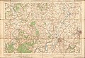
 COMMERCIAL INTELLIGENCE JOURNAL (CANADA) 1921 pt. 1 (1921) (14784777222).jpg 2,378 × 1,712; 622 KB
-
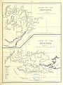
 FMIB 37985 Noose Sandbank.jpeg 839 × 714; 57 KB
-
 FMIB 37998 Course of the River Severn from Gloucester to the Severn Tunnel.jpeg 792 × 1,587; 427 KB
-
 Ordnance Survey Drawings - Ironbridge, Telford and Wrekin (OSD 213).jpg 5,840 × 4,175; 3.86 MB
-
 Ordnance Survey Drawings - Tewkesbury (OSD 173).jpg 4,000 × 2,553; 4.39 MB
-
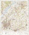
 Ordnance Survey One-Inch Sheet 103 Stroud & Chepstow, Published 1919.jpg 11,874 × 8,910; 11.76 MB
-
 Ordnance Survey One-Inch Sheet 118 Shrewsbury, Published 1947.jpg 10,951 × 12,826; 16.51 MB
-
 Ordnance Survey One-Inch Sheet 118 Shrewsbury, Published 1961.jpg 8,268 × 9,870; 11.83 MB
-
 Ordnance Survey One-Inch Sheet 128 Montgomery & Llandrindod Wells, Published 1966.jpg 8,285 × 9,865; 12.59 MB
-
 Ordnance Survey One-Inch Sheet 128 Montgomery and Llandrindod Wells, Published 1947.jpg 8,180 × 9,568; 12.17 MB
-
 Ordnance Survey One-Inch Sheet 130 Kidderminster, Published 1947.jpg 10,921 × 12,779; 18.93 MB
-
 Ordnance Survey One-Inch Sheet 130 Kidderminster, Published 1967.jpg 8,317 × 9,880; 13.52 MB
-
 Ordnance Survey One-Inch Sheet 143 Gloucester & Malvern, Published 1946.jpg 8,181 × 9,556; 12.07 MB
-
 Ordnance Survey One-Inch Sheet 143 Gloucester & Malvern, Published 1953.jpg 8,327 × 9,966; 12.85 MB
-
 Ordnance Survey One-Inch Sheet 143 Gloucester & Malvern, Published 1968.jpg 8,331 × 9,901; 11.58 MB
-
 Ordnance Survey One-Inch Sheet 155 Bristol & Newport, Published 1946.jpg 10,929 × 12,822; 17.45 MB
-
 Ordnance Survey One-Inch Sheet 155 Bristol & Newport, Published 1953.jpg 8,282 × 9,952; 12.01 MB
-
 Ordnance Survey One-Inch Sheet 155 Bristol & Newport, Published 1972.jpg 11,058 × 13,150; 47.6 MB
-
 Ordnance Survey One-Inch Sheet 156 Bristol & Stroud, Published 1946.jpg 10,939 × 12,823; 18.14 MB
-
 Ordnance Survey One-Inch Sheet 156 Bristol & Stroud, Published 1953.jpg 8,245 × 9,924; 10.47 MB
-
 Ordnance Survey One-Inch Sheet 156 Bristol & Stroud, Published 1972.jpg 11,086 × 13,175; 48.11 MB
-
 Ordnance Survey One-Inch Sheet 92 Gloucester & Forest of Dean, Published 1919.jpg 12,150 × 8,410; 43.4 MB
-
 Ordnance Survey One-Inch Tourist Map of the Wye Valley & Lower Severn, published 1961.jpg 13,124 × 16,665; 27.94 MB
-
 River Severn map.png 2,006 × 1,625; 3.98 MB
-
 RiverSevernMap.jpg 871 × 774; 389 KB
-
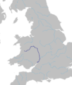 Severn River Route.png 1,268 × 1,492; 179 KB
.jpg)
.jpg)
_1921_pt._1_(1921)_(14784777222).jpg)


.jpg)
.jpg)


