Category:Road maps of Thailand
Jump to navigation
Jump to search
Media in category "Road maps of Thailand"
The following 22 files are in this category, out of 22 total.
-
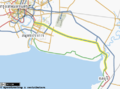 Bang Na Expressway.png 482 × 358; 122 KB
-
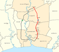 Bangkok Eastern Outer Ring Road.png 1,470 × 1,300; 290 KB
-
 Bangkok Southern Outer Ring Road and Expressway.png 1,470 × 1,300; 292 KB
-
 Bangkok Western Outer Ring Road.png 1,470 × 1,300; 303 KB
-
 Chiang Rai Road Network.png 3,192 × 3,300; 1.74 MB
-
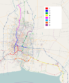
 EXAT system overview map.svg 692 × 956; 357 KB
-
 Map of Thai Motorway Route 7.png 1,052 × 1,850; 532 KB
-
 Map of Thanon Kanchanaphisek and Kanchanaphisek Expressway.png 1,052 × 1,850; 531 KB
-
 Pak Kret map.svg 761 × 776; 1.44 MB
-
 TH HW 1016 map 2.png 3,920 × 3,300; 1.37 MB
-
 TH HW 1290 map 2.png 4,485 × 3,304; 1.64 MB
-
 Thai expressway system overview map.png 1,239 × 1,486; 1,011 KB
-
 Thai Motorway Route 7 - EN.png 1,464 × 1,858; 381 KB
-
 Thai Motorway Route 7.png 1,464 × 1,858; 362 KB
-
 Thailand Route 106.svg 586 × 828; 180 KB
-
 Thailand Route 12.png 341 × 600; 105 KB
-
 Thanon Mittraphap.png 892 × 1,500; 104 KB
-
 Thanon Phahonyothin.png 892 × 1,500; 109 KB
-
 Thanon Phet Kasem SVG.svg 1,051 × 1,849; 1.46 MB
-
 Thanon Phet Kasem.png 1,051 × 1,849; 545 KB
-
 Thanon Sukhumvit.png 892 × 1,500; 103 KB
-
 Un-thailand.png 2,348 × 2,947; 1.63 MB


