Category:Road signs in Lowndes County, Georgia
Jump to navigation
Jump to search
Counties of Georgia: Appling · Atkinson · Bacon · Baker · Banks · Barrow · Bartow · Ben Hill · Berrien · Brantley · Brooks · Bryan · Butts · Calhoun · Camden · Carroll · Charlton · Chatham · Chattooga · Cherokee · Clay · Clayton · Clinch · Cobb · Coffee · Colquitt · Columbia · Cook · Coweta · Crawford · Crisp · Dade · Dawson · Decatur · DeKalb · Dodge · Dooly · Dougherty · Douglas · Early · Effingham · Evans · Floyd · Forsyth · Franklin · Fulton · Gilmer · Glynn · Gordon · Grady · Greene · Gwinnett · Habersham · Hall · Haralson · Harris · Hart · Henry · Houston · Irwin · Jasper · Jeff Davis · Jefferson · Lamar · Lanier · Laurens · Lee · Liberty · Long · Lowndes · Lumpkin · Macon · Madison · Marion · McIntosh · Miller · Mitchell · Monroe · Montgomery · Murray · Peach · Pierce · Pike · Polk · Pulaski · Putnam · Randolph · Rockdale · Schley · Seminole · Spalding · Stephens · Stewart · Sumter · Talbot · Tattnall · Taylor · Telfair · Terrell · Thomas · Tift · Toombs · Towns · Troup · Turner · Upson · Walker · Ware · Wayne · Wheeler · White · Whitfield · Wilcox · Worth
City-counties: Athens–Clarke · Augusta–Richmond · Columbus–Muscogee · Georgetown–Quitman · Macon–Bibb · Preston–Webster · Statenville–Echols
City-counties: Athens–Clarke · Augusta–Richmond · Columbus–Muscogee · Georgetown–Quitman · Macon–Bibb · Preston–Webster · Statenville–Echols
Subcategories
This category has the following 2 subcategories, out of 2 total.
R
- Road signs in Valdosta, Georgia (18 F)
Media in category "Road signs in Lowndes County, Georgia"
The following 177 files are in this category, out of 177 total.
-
 3323 Bemiss Rd, Lowndes County.jpg 4,320 × 3,240; 4.33 MB
-
 Barretts sign, GA125nb.JPG 4,320 × 3,240; 4.38 MB
-
 Bojangles', GA125, Valdosta.jpg 5,184 × 3,456; 6.71 MB
-
 Boys and Girls Club Valdosta North St 2.jpg 3,072 × 2,304; 1.12 MB
-
 Brooks County Line marker, GA SR 122 WB.JPG 4,320 × 3,240; 4.49 MB
-
 Brooks County line, GA31SB.jpg 5,184 × 3,456; 6.49 MB
-
 Brooks County line, SR133 NW.JPG 4,320 × 3,240; 4.44 MB
-
 Budd Plaza, Valdosta.JPG 3,072 × 2,304; 2.96 MB
-
 Cheddar's Casual Cafe, Valdosta.JPG 4,320 × 3,240; 4.52 MB
-
 Clyattville Nankin Rd Flooding Blocked.JPG 3,072 × 2,304; 3.12 MB
-
 Clyattville sign, GA 31 NB.JPG 4,320 × 3,240; 4.55 MB
-
 Clyattville sign, GA 31 SB.JPG 4,320 × 3,240; 4.5 MB
-
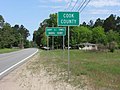 Cook County limit, US41NB.JPG 4,608 × 3,456; 6.07 MB
-
 Dasher City Limit sign on US 41 NB.JPG 3,072 × 2,304; 2.97 MB
-
 Dasher Sign US 41 NB.JPG 3,072 × 2,304; 3.12 MB
-
 Delmar limits, US84 WB.JPG 4,320 × 3,240; 4.54 MB
-
 Driving East on Gornto Rd just past N Oak St.JPG 4,320 × 3,240; 4.39 MB
-
 Earl Wetherington Foot Bridge over Sugar Creek.jpg 3,072 × 2,304; 2.9 MB
-
 Echols County Border sign on GA SR 94.JPG 3,072 × 2,304; 3.04 MB
-
 South Lowndes Recreation Complex Sign.JPG 3,072 × 2,304; 3.03 MB
-
 First Federal Savings of Valdosta (SW corner).JPG 3,072 × 2,304; 2.95 MB
-
 GA 31 North (29109705331).jpg 1,200 × 800; 597 KB
-
 GA 31 Right in Valdosta (28568132843).jpg 1,200 × 800; 751 KB
-
 GA 376 End Clyattville.JPG 3,072 × 2,304; 3.12 MB
-
 GA 376 Hwy 41 Int WB.JPG 3,072 × 2,304; 3.15 MB
-
 GA31n-US41GA7ns-US41bGA7bSigns (28565713594).jpg 1,200 × 800; 572 KB
-
 GA94 end at Inner Perimeter Rd.JPG 5,152 × 3,864; 8 MB
-
 GASR31 Truck Route End, Lowndes County.jpg 5,184 × 3,456; 8.89 MB
-
 Georgia I75nb Belville Rd Overpass.JPG 4,608 × 3,456; 4.36 MB
-
 Georgia I75nb Exit 11 .5 mile.JPG 4,320 × 3,240; 4.43 MB
-
 Georgia I75nb Exit 11 1 mile.JPG 4,608 × 3,456; 4.18 MB
-
 Georgia I75nb Exit 11.JPG 4,608 × 3,456; 4.45 MB
-
 Georgia I75nb Exit 13 .5 mile 2024.jpg 5,184 × 3,456; 4.41 MB
-
 Georgia I75nb Exit 13 .5 mile.JPG 5,184 × 3,456; 4.41 MB
-
 Georgia I75nb Exit 13 1 mile 2024.jpg 5,184 × 3,456; 4.18 MB
-
 Georgia I75nb Exit 13 1 mile.JPG 4,608 × 3,456; 4.29 MB
-
 Georgia I75nb Exit 13.JPG 4,608 × 3,456; 4.25 MB
-
 Georgia I75nb Exit 16 .5 mile.JPG 5,184 × 3,456; 4.23 MB
-
 Georgia I75nb Exit 16 1 mile 2024.jpg 5,184 × 3,456; 4.42 MB
-
 Georgia I75nb Exit 16 1 mile.JPG 5,184 × 3,456; 4.27 MB
-
 Georgia I75nb Exit 18 1 mile.JPG 5,184 × 3,456; 5.01 MB
-
 Georgia I75nb Exit 18 Only.JPG 5,184 × 3,456; 5.19 MB
-
 Georgia I75nb Exit 18.JPG 5,184 × 3,456; 4.43 MB
-
 Georgia I75nb Exit 2 1 mile 2024.jpg 5,184 × 3,456; 4.09 MB
-
 Georgia I75nb Exit 2 1 mile.jpg 5,184 × 3,456; 4.3 MB
-
 Georgia I75nb Exit 2.JPG 5,184 × 3,456; 4.45 MB
-
 Georgia I75nb Exit 22 .5 mile.JPG 4,320 × 3,240; 4.45 MB
-
 Georgia I75nb Exit 22 1 mile.JPG 4,320 × 3,240; 4.45 MB
-
 Georgia I75nb Exit 22 N Valdosta Rd Overpass.JPG 5,184 × 3,456; 4.92 MB
-
 Georgia I75nb Exit 29 .5 mile.JPG 5,184 × 3,456; 4.68 MB
-
 Georgia I75nb Exit 29 1 mile.JPG 5,184 × 3,456; 4.41 MB
-
 Georgia I75nb Exit 32 1 mile.JPG 4,320 × 3,240; 4.44 MB
-
 Georgia I75nb Exit 5 .5 mile.JPG 5,184 × 3,456; 4.52 MB
-
 Georgia I75nb Exit 5 1.25 miles.JPG 5,184 × 3,456; 4.31 MB
-
 Georgia I75nb Exit 5.JPG 5,184 × 3,456; 4.53 MB
-
 Georgia I75nb Georgia Visitor Center Exit.JPG 4,320 × 3,240; 4.47 MB
-
 Georgia I75nb Georgia Visitor Information Center 1 mile.jpg 5,184 × 3,456; 5.83 MB
-
 Georgia I75nb Georgia Visitor Information Center exit.jpg 5,184 × 3,456; 5.08 MB
-
 Georgia I75nb Georgia Welcome.JPG 4,608 × 3,456; 4.36 MB
-
 Georgia I75nb Hahira city limit.jpg 5,184 × 3,456; 4.73 MB
-
 Georgia I75nb Loch Laurel Rd Overpass.JPG 5,184 × 3,456; 4.33 MB
-
 Georgia I75nb Lowndes County border 2024.jpg 5,184 × 3,456; 4.02 MB
-
 Georgia I75nb Lowndes County line.JPG 4,320 × 3,240; 4.42 MB
-
 Georgia I75nb Old Clyattville Rd Overpass 2024.jpg 5,184 × 3,456; 4.34 MB
-
 Georgia I75nb Old Clyattville Rd Overpass.JPG 4,608 × 3,456; 4.15 MB
-
 Georgia I75nb SR31 Madison Hwy Overpass.JPG 4,608 × 3,456; 4.54 MB
-
 Georgia I75nb SR376 Lakes Blvd Overpass.JPG 5,184 × 3,456; 4.77 MB
-
 Georgia I75sb Exit 11 .5 mile.JPG 5,184 × 3,456; 4.76 MB
-
 Georgia I75sb Exit 11 1 mile.JPG 4,608 × 3,456; 3.47 MB
-
 Georgia I75sb Exit 11.JPG 4,608 × 3,456; 3.57 MB
-
 Georgia I75sb Exit 13 .5 mile.JPG 5,184 × 3,456; 4.74 MB
-
 Georgia I75sb Exit 13 1 mile.JPG 5,184 × 3,456; 4.42 MB
-
 Georgia I75sb Exit 13.JPG 5,184 × 3,456; 4.72 MB
-
 Georgia I75sb Exit 16 .5 mile.jpg 5,184 × 3,456; 4.64 MB
-
 Georgia I75sb Exit 16 1 mile.jpg 5,184 × 3,456; 4.62 MB
-
 Georgia I75sb Exit 16.jpg 5,184 × 3,456; 4.39 MB
-
 Georgia I75sb Exit 18 .5 mile.jpg 5,184 × 3,456; 4.31 MB
-
 Georgia I75sb Exit 18 1 mile.jpg 5,184 × 3,456; 4.76 MB
-
 Georgia I75sb Exit 2 .5 mile closer.jpg 5,184 × 3,456; 4.22 MB
-
 Georgia I75sb Exit 2 .5 mile.JPG 4,608 × 3,456; 3.41 MB
-
 Georgia I75sb Exit 2 1 mile.JPG 4,608 × 3,456; 3.36 MB
-
 Georgia I75sb Exit 2.JPG 4,608 × 3,456; 3.37 MB
-
 Georgia I75sb Exit 22 .5 mile.JPG 5,184 × 3,456; 4.59 MB
-
 Georgia I75sb Exit 22 1 mile.JPG 5,184 × 3,456; 4.55 MB
-
 Georgia I75sb Exit 22 Overpass - N. Valdosta Rd.JPG 4,320 × 3,240; 4.41 MB
-
 Georgia I75sb Exit 29 .5 mile.JPG 5,184 × 3,456; 4.12 MB
-
 Georgia I75sb Exit 29 1 mile.JPG 5,184 × 3,456; 4.65 MB
-
 Georgia I75sb Exit 29 Overpass - GA122.JPG 5,184 × 3,456; 4.56 MB
-
 Georgia I75sb Exit 5 .5 mile.JPG 4,608 × 3,456; 3.59 MB
-
 Georgia I75sb Exit 5 1 mile.JPG 4,608 × 3,456; 3.57 MB
-
 Georgia I75sb Exit 5.JPG 4,608 × 3,456; 3.46 MB
-
 Georgia I75sb GA133 Overpass.jpg 5,184 × 3,456; 4.23 MB
-
 Georgia I75Sb Lowndes County line.jpg 5,184 × 3,456; 4.09 MB
-
 Georgia I75sb Withlacoochee River.jpg 5,184 × 3,456; 4.29 MB
-
 Georgia State Line, GA 31 NB.JPG 4,320 × 3,240; 4.53 MB
-
 Georgia State Route 31 bridge Brooks County NB 06.JPG 4,608 × 3,456; 3.54 MB
-
 Georgia State Route 7 41 Signs.JPG 3,072 × 2,304; 2.79 MB
-
 Georgia State Route 7 Alternate end, Valdosta.JPG 4,608 × 3,456; 4.78 MB
-
 Georgia State Route 7 Alternate end.JPG 4,320 × 3,240; 4.53 MB
-
 Hahira city limit, Old US41 NB.JPG 5,152 × 3,864; 7.86 MB
-
 Hahira city limit, Union Rd NB.JPG 4,608 × 3,456; 6.46 MB
-
 Hahira city limit, US41SB.JPG 4,608 × 3,456; 6.09 MB
-
 Hahira Honeybee Festival 2019 01.jpg 5,184 × 3,456; 8 MB
-
 Hahira Honeybee Festival 2019 18.jpg 5,184 × 3,456; 8.49 MB
-
 Hahira Middle School 1.jpg 3,072 × 2,304; 1.3 MB
-
 Hahira welcome sign, US41SB.JPG 4,608 × 3,456; 6.65 MB
-
 Hahira Welcome Sign.jpg 3,072 × 2,304; 1.44 MB
-
 Hampton Inn (south face) on Meeting Pl.JPG 3,072 × 2,304; 3.05 MB
-
 Hwy 41 Bus N End, Valdosta.JPG 3,072 × 2,304; 2.96 MB
-
 Hwy 41 Bus S Beg, Valdosta.JPG 3,072 × 2,304; 3.07 MB
-
 Interstate 75 NB weigh station, Lowndes County, exit ramp.jpg 5,184 × 3,456; 5 MB
-
 Interstate 75 SB weigh station, Lowndes County, 1 mile ahead.jpg 5,184 × 3,456; 4.27 MB
-
 Interstate 75 SB weigh station, Lowndes County, exit ramp.jpg 5,184 × 3,456; 4.78 MB
-
 Interstate 75 SB weigh station, Lowndes County, signage.jpg 5,184 × 3,456; 4.31 MB
-
 James Beck Overpass Georgia State Route 7 Northbound 1.JPG 3,072 × 2,304; 2.97 MB
-
 James Beck Overpass Georgia State Route 7 Southbound.jpg 3,072 × 2,304; 1.19 MB
-
 Lake Park City Limits, Long Pond Rd, Lake Park.JPG 4,320 × 3,240; 4.56 MB
-
 Lakes Blvd RR Crossing EB.JPG 4,320 × 3,240; 4.45 MB
-
 Langdale Kia, Valdosta.JPG 4,320 × 3,240; 4.49 MB
-
 Lanier County border, GA122 EB.jpg 5,184 × 3,456; 6.57 MB
-
 Lanier County border, GA122eb.JPG 4,320 × 3,240; 4.5 MB
-
 Lanier County border, GA125nb.JPG 4,320 × 3,240; 4.43 MB
-
 Lanier County border, US221NB.JPG 4,320 × 3,240; 4.43 MB
-
 Lanier County border, US84 EB.JPG 4,608 × 3,456; 4.04 MB
-
 Liberty Christian Fellowship Church, Valdosta.JPG 3,072 × 2,304; 2.93 MB
-
 Lowndes County Border sign on GA SR 94.JPG 3,072 × 2,304; 2.93 MB
-
 Lowndes County border, from Boyette Rd in Lanier County.jpg 5,184 × 3,456; 7.98 MB
-
 Lowndes County border, Strickland Rd.jpg 5,184 × 3,456; 6.77 MB
-
 Lowndes County limit, Union Rd SB.JPG 4,608 × 3,456; 5.83 MB
-
 Lowndes County limit, US41SB.JPG 4,608 × 3,456; 5.6 MB
-
 Lowndes County line, GA31NB.jpg 5,184 × 3,456; 8.34 MB
-
 Lowndes County line, US84EB.JPG 4,608 × 3,456; 5.82 MB
-
 Lowndes County welcome sign, Skipper Bridge Rd SB.JPG 4,608 × 3,456; 6.21 MB
-
 Lowndes County welcome sign, US84 wb.JPG 4,320 × 3,240; 4.49 MB
-
 Lowndes County welcome sign, Val-Del Rd SB.JPG 4,608 × 3,456; 5.76 MB
-
 McKey Park.jpg 3,072 × 2,304; 1.65 MB
-
 Mile marker 26.8, Interstate 75NB, Lowndes County, Georgia.jpg 1,536 × 2,048; 632 KB
-
 Mile marker 27.2, Interstate 75NB, Lowndes County, Georgia.jpg 1,536 × 2,048; 565 KB
-
 Mineola Sign.JPG 4,320 × 3,240; 4.51 MB
-
 N 31 GA 376 Intersection.JPG 3,072 × 2,304; 3 MB
-
 N Toombs and Gornto Rd Intersection (looking N).JPG 4,320 × 3,240; 4.48 MB
-
 Naylor limits, US84 WB.JPG 4,320 × 3,240; 4.57 MB
-
 Old Army-Navy Surplus Store, Valdosta.JPG 4,320 × 3,240; 4.42 MB
-
 Old Lowndes County limit sign, US41SB.JPG 4,608 × 3,456; 4.7 MB
-
 Old Quitman Highway Bridge 1.jpg 5,184 × 3,456; 10.91 MB
-
 Palms Dining Hall (West face).JPG 4,320 × 3,240; 4.53 MB
-
 Philosophy and Religious Studies Department VSU.JPG 3,072 × 2,304; 3.1 MB
-
 Remerton Edgewood Dr Dead End used to have a bridge.JPG 3,072 × 2,304; 2.95 MB
-
 Roundabout, Country Club Dr., Valdosta.JPG 3,072 × 2,304; 3.09 MB
-
 South lane of Gornto Rd looking at N Oak Intersection.JPG 4,320 × 3,240; 4.47 MB
-
 Southeastern Federal Credit Union, Baytree Rd, Valdosta (SW corner).JPG 3,072 × 2,304; 3.07 MB
-
 Traffic light pole going up at Ashley St and Bemiss Rd, Valdosta.jpg 3,264 × 2,448; 2.4 MB
-
 US 84 GA 133 Intersection (South face).JPG 3,072 × 2,304; 2.96 MB
-
 US41nGA7n-US221nUS84GA38ewSigns (29109708271).jpg 2,400 × 1,600; 2.34 MB
-
 US41nGA7nGA31nSignsRoad (28565715294).jpg 2,400 × 1,600; 1.85 MB
-
 US41nGA7nRoad-GA94eSign (29109706431).jpg 2,400 × 1,600; 1.72 MB
-
 VA Outpatient Clinic, Valdosta.JPG 4,320 × 3,240; 4.46 MB
-
 Valdosta 2012 Tree Lighting Ceremony 2.JPG 3,072 × 2,304; 2.94 MB
-
 Valdosta 2012 Tree Lighting Ceremony 3.JPG 3,072 × 2,304; 2.9 MB
-
 Valdosta Ashley Street Clock.JPG 3,072 × 2,304; 3.14 MB
-
 Valdosta City Limit, Clay Rd.JPG 4,320 × 3,240; 4.43 MB
-
 Valdosta City Limit, Madison Highway NB.jpg 5,184 × 3,456; 5.67 MB
-
 Valdosta City Limit, Old Clyattville Road, Valdosta.JPG 4,320 × 3,240; 4.43 MB
-
 Valdosta GA 1st Presby Church03.jpg 3,264 × 2,448; 2.36 MB
-
 Valdosta GA Comm Hist Dist02.jpg 3,264 × 2,448; 1.69 MB
-
 Valdosta GA Fairview Hist Dist07.jpg 3,264 × 2,448; 2.46 MB
-
 Valdosta Mall, North Entrance on Baytree Rd.JPG 3,072 × 2,304; 2.83 MB
-
 VSU Communication Arts Mass Media 1.jpg 3,072 × 2,304; 1.45 MB
-
 VSU Flora Patterson and Georgia.JPG 3,072 × 2,304; 2.95 MB
-
 VSU Pedestrian Bridge over Oak Street 1.jpg 3,072 × 2,304; 1.32 MB
-
 VSU Pedestrian Bridge over Oak Street 2.jpg 3,072 × 2,304; 1.28 MB
-
 Welcome to Lowndes County, NW16th Ave, Hamilton County, Florida.jpg 5,184 × 3,456; 9.31 MB
-
 West Hill Ave Overpass 01.JPG 4,608 × 3,456; 4.68 MB
-
 West Hill Ave Overpass 03.JPG 4,608 × 3,456; 4.88 MB
-
 West Hill Ave Overpass 13.JPG 4,608 × 3,456; 4.54 MB
-
 Wisenbaker Building, Valdosta.JPG 4,320 × 3,240; 4.46 MB
-
 Withlacoochee River sign, GA 122, Lowndes County.JPG 4,320 × 3,240; 4.58 MB


.JPG)
.jpg)
.jpg)


.jpg)


_on_Meeting_Pl.JPG)


.JPG)


.JPG)


.JPG)

.JPG)
.jpg)
.jpg)
.jpg)


