Category:Road signs in White Pine County, Nevada
Jump to navigation
Jump to search
Media in category "Road signs in White Pine County, Nevada"
The following 198 files are in this category, out of 198 total.
-

-

-

-

-
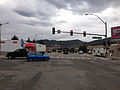
 2012.10.03.155620 Aultman Street x 6th Street Ely Nevada.jpg 1,920 × 1,280; 808 KB
-
 2012.10.03.160212 Aultman Street Ely Nevada.jpg 1,920 × 1,280; 1.07 MB
-
-

-

-

-

-

-
 2014-05-21 10 30 20 View west along Nevada State Route 490 entering Hercules Gap.JPG 3,264 × 2,448; 2.78 MB
-
 2014-05-21 10 34 14 Sign at the west end of Nevada State Route 490.JPG 3,264 × 2,448; 2.14 MB
-
 2014-05-21 10 34 23 West end of Nevada Route 490.JPG 3,264 × 2,448; 2.42 MB
-
 2014-05-21 10 34 53 First reassurance sign along eastbound Nevada State Route 490.JPG 3,264 × 2,448; 2.4 MB
-
 2014-05-21 10 39 08 View east along Nevada State Route 490 approaching Hercules Gap.JPG 3,264 × 2,448; 2.64 MB
-

-

-

-

-

-

-

-
 2014-05-21 12 23 06 View west along U.S. Route 50 just west of downtown Ely, Nevada.JPG 3,264 × 2,448; 2.44 MB
-
-

-

-
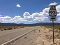
 2014-05-21 12 33 14 The junction of U.S. Route 50 and U.S. Route 93 in Ely, Nevada.JPG 3,264 × 2,448; 2.31 MB
-
 2014-05-21 13 17 50 Pony Express sign along U.S. Route 93 in Schellbourne, Nevada.JPG 3,264 × 2,448; 3.18 MB
-
 2014-05-21 13 18 53 Lincoln Highway marker along U.S. Route 93 in Schellbourne, Nevada.JPG 2,448 × 3,264; 4.66 MB
-

-

-
-

-

-

-
-

-

-

-

-

-

-

-
-

-

-

-
-

-

-
-
-

-

-

-

-

-

-

-

-

-

-

-
-

-

-

-

-

-

-

-

-

-

-

-

-

-

-

-

-

-

-

-

-

-

-

-

-

-

-

-

-

-

-

-

-
-

-

-
-

-

-

-

-

-

-

-

-

-

-

-

-

-

-

-

-

-

-

-

-

-

-

-

-

-

-

-

-

-

-

-

-

-

-

-

-

-

-

-

-

-

-

-

-

-

-
-

-

-

-

-

-
-

-

-

-

-

-

-

-

-

-

-

-

-

-

-

-

-

-
-

-

-

-

-
 2014-08-11 16 00 08 Sign at the entrance to Ward Charcoal Ovens State Historic Park.JPG 3,264 × 2,448; 3.46 MB
-

-

-

-

-

-

-

-

-

-

-

-

-

-

-
-
 Intersection of Nevada Routes 487 & 488 in Baker, Nevada.jpg 4,320 × 3,240; 4.3 MB
-
 NV487NVUTBorder1.jpg 640 × 427; 55 KB
-
 Start of Nevada Route 893.jpg 4,320 × 3,240; 5.41 MB
-
 U.S. Route 50 - Welcome to Nevada (37732981515).jpg 4,549 × 3,639; 17.72 MB
-
 US50Utahstate line.jpg 4,672 × 3,104; 10.01 MB


_near_U.S._Route_93_in_White_Pine_County,_Nevada.JPG)
_near_U.S._Route_93_in_White_Pine_County,_Nevada.JPG)
.JPG)
.JPG)
_near_the_west_end_of_former_Nevada_State_Route_489_in_Cherry_Creek,_Nevada.JPG)
_near_the_west_end_of_former_Nevada_State_Route_489_in_Cherry_Creek,_Nevada.JPG)


_in_White_Pine_County,_Nevada.JPG)
_in_White_Pine_County,_Nevada.JPG)


_in_White_Pine_County,_Nevada.JPG)
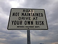
_about_0.2_miles_north_of_the_end_of_pavement_in_Shoshone,_Nevada.JPG)
_about_1.1_miles_north_of_the_end_of_pavement_in_Shoshone,_Nevada.JPG)
_near_the_north_end_at_U.S._Route_93_in_White_Pine_County,_Nevada.JPG)


_in_White_Pine_County,_Nevada.JPG)


_in_White_Pine_County,_Nevada.JPG)
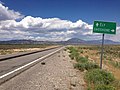
_about_6.2_miles_north_of_the_Utah_state_line_at_the_junction_with_Nevada_State_Route_488_(Lehman_Caves_Road)_in_Baker,_Nevada.JPG)
_at_the_junction_with_Nevada_State_Route_487_(Baker_Road)_in_Baker,_Nevada.JPG)
_in_Baker,_Nevada.JPG)
_about_4.5_miles_east_of_Great_Basin_National_Park_in_Baker,_Nevada.JPG)
_at_Great_Basin_National_Park,_Nevada.JPG)
_at_Great_Basin_National_Park,_Nevada.JPG)
_just_east_of_Great_Basin_National_Park,_Nevada.JPG)
_near_the_junction_with_Nevada_State_Route_487_(Baker_Road)_in_Baker,_Nevada.JPG)
_at_the_junction_with_Nevada_State_Route_487_(Baker_Road)_in_Baker,_Nevada.JPG)
_at_the_Utah_state_line_and_junction_with_Utah_State_Route_21_in_White_Pine_County,_Nevada.JPG)
_at_the_Utah_state_line_and_junction_with_Utah_State_Route_21_in_White_Pine_County,_Nevada.JPG)
_in_Millard_County,_Utah.JPG)
_in_Millard_County,_Utah.JPG)
_in_White_Pine_County,_Nevada.JPG)
_about_1.1_miles_north_of_the_Utah_state_line_in_White_Pine_County,_Nevada.JPG)
_about_4.5_miles_north_of_the_Utah_state_line_near_Baker,_Nevada.JPG)
_about_6.1_miles_north_of_the_Utah_state_line_at_the_junction_with_Nevada_State_Route_488_(Lehman_Caves_Road)_in_Baker,_Nevada.JPG)
_at_U.S._Routes_6_and_50_in_White_Pine_County,_Nevada.JPG)
_at_U.S._Routes_6_and_50_in_White_Pine_County,_Nevada.JPG)


_in_White_Pine_County,_Nevada.JPG)

_in_White_Pine_County,_Nevada.JPG)
_in_White_Pine_County,_Nevada.JPG)
_about_8.6_miles_north_of_U.S._Routes_6_and_50_in_White_Pine_County,_Nevada.JPG)
_in_White_Pine_County,_Nevada.JPG)
_near_the_south_end_at_U.S._Routes_6_and_50_in_White_Pine_County,_Nevada.JPG)


_in_White_Pine_County,_Nevada.JPG)
_in_White_Pine_County,_Nevada.JPG)
_in_White_Pine_County,_Nevada.JPG)
_in_White_Pine_County,_Nevada.JPG)
_in_White_Pine_County,_Nevada.JPG)
_about_27.7_miles_north_of_U.S._Route_50_in_White_Pine_County,_Nevada.JPG)
_about_23.3_miles_north_of_U.S._Route_50_in_Strawberry,_Nevada.JPG)
_about_23.3_miles_north_of_U.S._Route_50_in_Strawberry,_Nevada.JPG)
_about_22.6_miles_north_of_U.S._Route_50_in_White_Pine_County,_Nevada.JPG)
_at_U.S._Route_50_in_White_Pine_County,_Nevada.JPG)


_in_White_Pine_County,_Nevada.JPG)


_in_White_Pine_County,_Nevada.jpg)
.jpg)
_and_the_south_end_of_Success_Summit_Road_in_Cave_Lake_State_Park,_Nevada.jpg)
_in_White_Pine_County,_Nevada.JPG)
_in_White_Pine_County,_Nevada.JPG)
_and_the_south_end_of_Success_Summit_Road_in_Cave_Lake_State_Park,_Nevada.jpg)
_about_6.4_miles_north_of_U.S._Routes_6,_50_and_93_in_Cave_Lake_State_Park,_Nevada.jpg)
_about_10.4_miles_north_of_the_end_of_pavement_in_White_Pine_County,_Nevada.JPG)


.jpg)

-cropped.jpg)
.JPG)