Category:Roads in Perth, Western Australia
Jump to navigation
Jump to search
English: Major roads, highways and freeways in metropolitan Perth, Western Australia
Wikimedia category | |||||
| Upload media | |||||
| Instance of | |||||
|---|---|---|---|---|---|
| Category combines topics | |||||
| Perth | |||||
capital city of Western Australia, Australia  .jpg)   | |||||
| Instance of | |||||
| Part of | |||||
| Named after | |||||
| Location | Western Australia, AUS | ||||
| Located in or next to body of water | |||||
| Inception |
| ||||
| Population |
| ||||
| Area |
| ||||
| Elevation above sea level |
| ||||
| Different from | |||||
| official website | |||||
 | |||||
Subcategories
This category has the following 75 subcategories, out of 75 total.
A
- Alexander Drive (10 F)
B
- Balcatta Road (5 F)
- Beechboro Road (10 F)
- Benara Road (7 F)
C
- Canning Road, Kalamunda (3 F)
- Cockburn Road (8 F)
E
- Erindale Road (11 F)
F
- Flinders Street, Perth (4 F)
G
- Gnangara Road (4 F)
- Graham Farmer Freeway (10 F)
- Grand Promenade (Perth) (13 F)
H
- Hepburn Avenue (10 F)
J
- Joondalup Drive (1 F)
K
- Kalamunda Road (5 F)
- Karel Avenue (3 F)
- Karrinyup Road (6 F)
- Kwinana Beach Road (9 F)
L
M
- Main Street, Perth (5 F)
- Marshall Road (2 F)
- Mill Point Road (11 F)
- Mirrabooka Avenue (2 F)
- Morley Drive (17 F)
- Mundaring Weir road (33 F)
- Mundijong Road (2 F)
N
- Nicholson Road (12 F)
- North Lake Road (3 F)
O
- Ocean Reef Road (3 F)
P
R
- Reid Highway (31 F)
- Rockingham Beach Road (6 F)
- Romeo Road (8 F)
S
- South Street, Fremantle (1 F)
- Southern River road (9 F)
- Stock Road, Perth (12 F)
T
- Thomas Road, Perth (7 F)
W
- Walter Road (2 F)
- Wanneroo Road (24 F)
- Weir Village Road (1 F)
- West Coast Drive, Perth (9 F)
- West Coast Highway, Perth (6 F)
- Whitfords Avenue (6 F)
Media in category "Roads in Perth, Western Australia"
The following 56 files are in this category, out of 56 total.
-
 Benara Rd E from Altone Park.jpg 1,600 × 1,200; 576 KB
-
 Berwick St SE from Hillview Tce.jpg 1,024 × 768; 179 KB
-
 Brearley Avenue 2017 before closure 1.jpg 3,264 × 2,448; 2.48 MB
-
 Brearley Avenue 2017 before closure 2.jpg 3,264 × 2,448; 2.62 MB
-
 Caledonian Avenue Midland line level crossing, Maylands 1.jpg 4,032 × 3,024; 3.43 MB
-
 Caledonian Avenue Midland line level crossing, Maylands 2.jpg 4,032 × 3,024; 3.18 MB
-
 Carine caravan park Old Balcatta Road 2017.jpg 3,264 × 2,448; 3.02 MB
-
 Carrington St at cemetery looking S.jpg 1,600 × 1,200; 830 KB
-
 City of Perth Parking Inspectors.jpg 1,024 × 680; 316 KB
-
 E37 AlexanderDr-MorleyDr sign.jpg 3,200 × 2,400; 2.17 MB
-
 E37 AlexanderDr-MorleyDr.jpg 3,680 × 2,760; 2.61 MB
-
 E37 AlexanderDr.jpg 3,680 × 2,760; 2.47 MB
-
 E37 BeaufortSt.jpg 3,680 × 2,760; 2.59 MB
-
 E37 BeechboroRdN.jpg 3,555 × 2,596; 2.45 MB
-
 E37 MorleyDr.jpg 3,680 × 2,760; 2.47 MB
-
 E37 WestSwanRd.jpg 3,680 × 2,760; 2.84 MB
-
 E37 Winthrop Ave direction sign.jpg 3,680 × 2,760; 2.44 MB
-
 E37 Winthrop Ave north of Stirling Hwy.jpg 3,680 × 2,760; 2.46 MB
-
 East Parade at East Perth railway station looking north.jpg 4,032 × 3,024; 2.55 MB
-
 East Parade at East Perth railway station looking south.jpg 4,032 × 3,024; 2.6 MB
-
 Gossage Road in Oldbury, Western Australia, August 2022.jpg 3,264 × 2,448; 2.76 MB
-
 Green St E from Waterloo.jpg 4,624 × 3,468; 4.1 MB
-
 Green St W from Waterloo.jpg 4,624 × 3,468; 4.33 MB
-
 Hester Avenue, Merriwa.jpg 2,848 × 2,136; 1.12 MB
-
 High Rd E from nr Vahland.jpg 1,600 × 1,200; 529 KB
-
 Kalamunda Mundaring Weir Road leaving town.jpg 3,264 × 2,448; 3.57 MB
-
 Leighton Foot Bridge And Former Rail Yard.jpg 1,600 × 1,200; 955 KB
-
 Malaga Dr start at Crimea.jpg 1,600 × 1,200; 614 KB
-
 Marangaroo Dr W from Highclere.jpg 1,600 × 1,200; 608 KB
-
 Mead Homestead, Leda, November 2020 01.jpg 4,608 × 3,456; 3.19 MB
-
 Memorial Drive at Rockingham RSL, April 2021.jpg 3,264 × 2,448; 2.65 MB
-
 Millhouse Road, Belhus, Western Australia, July 2021.jpg 3,466 × 2,507; 2.09 MB
-
 North Beach Rd W from Duffy.jpg 1,024 × 768; 187 KB
-
 OIC floreat underwood avenue.jpg 1,600 × 1,200; 1.02 MB
-
 OIC jandakot jandakot rd E from cessna.jpg 1,600 × 1,200; 445 KB
-
 OIC karnup paganoni rd E from railway.jpg 1,600 × 1,200; 453 KB
-
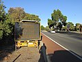
 OIC main roads counting device at crimea.jpg 1,200 × 1,600; 669 KB
-
 OIC oceanic drive W from forum.jpg 1,600 × 1,200; 561 KB
-
 OIC st james bend in berwick.jpg 1,600 × 1,200; 537 KB
-

-
 Oxford Street, Leederville.jpg 2,048 × 1,536; 829 KB
-
 Paterson st Mundijong gnangarra.JPG 3,008 × 2,000; 2.77 MB
-
 Perth Outback 2.jpg 2,448 × 3,264; 1.65 MB
-
 Perth Outback.jpg 2,448 × 3,264; 1.65 MB
-
 Sackville Terrace in Doubleview, Western Australia.JPG 3,240 × 4,320; 5.38 MB
-
 Switch point zigzag 01 gnangarra.JPG 3,008 × 2,000; 2.83 MB
-
 Train crossing camera Kelvin Rd Maddington-1.jpg 754 × 1,024; 161 KB
-
 Train crossing camera Kelvin Rd Maddington-2.jpg 678 × 1,024; 177 KB
-
 Vahland N from Werribee.jpg 2,880 × 2,160; 3.7 MB
-
 Vahland S from Werribee.jpg 2,880 × 2,160; 4.12 MB
-
 View of College Park and Bostock Road in Nedlands, Western Australia.JPG 4,320 × 3,240; 5.33 MB
-
 View of College Park and Princess Road in Nedlands, Western Australia.JPG 4,320 × 3,240; 4.94 MB
-
 Walcott St SE from Hill.jpg 1,600 × 1,200; 593 KB
-
 Walter Road E from Wicks.jpg 1,600 × 1,200; 553 KB
-
 Walter Road East near Abingdon Street, Western Australia.jpg 4,032 × 3,024; 1.61 MB
-
 WTJ Jim Owens Shenton Avenue Joondalup.jpg 4,752 × 3,168; 6.27 MB


