Category:Roads in Upper Freehold Township, New Jersey
Jump to navigation
Jump to search
Subcategories
This category has the following 4 subcategories, out of 4 total.
C
Media in category "Roads in Upper Freehold Township, New Jersey"
The following 70 files are in this category, out of 70 total.
-

-

-

-

-

-

-

-

-

-

-

-

-

-

-

-

-

-

-

-

-

-

-

-

-

-
-

-

-

-

-

-

-

-

-

-

-

-

-

-

-
-
-

-

-
 Arneytown, NJ.jpg 2,667 × 2,020; 1.16 MB
-
 Cooleys Corner, NJ.jpg 2,594 × 1,985; 1.57 MB
-
 Coxs Corner, NJ.jpg 2,816 × 1,726; 1.05 MB
-
 CR 539 NJ 37 bridge closeup 1.JPG 2,151 × 2,642; 2.15 MB
-
 CR 539 NJ 37 wide shot.JPG 2,645 × 1,984; 1.22 MB
-
 Cream Ridge, NJ from CR 539 at CR 27.jpg 1,926 × 1,444; 750 KB
-
 Davis Station, NJ.jpg 1,962 × 1,533; 649 KB
-
 Ellisdale, NJ.jpg 2,698 × 1,820; 1.12 MB
-
 Emleys Hill, NJ.jpg 2,816 × 2,112; 1.73 MB
-
 Homes Mills, NJ.jpg 2,577 × 1,933; 1.72 MB
-
 Hornerstown, NJ.jpg 2,816 × 1,545; 1.2 MB
-
 I-195 narrow.jpg 614 × 819; 123 KB
-
 Kirbys Mills, NJ.jpg 2,516 × 1,925; 1.42 MB
-
 Nelsonville, NJ.jpg 1,704 × 1,278; 1.09 MB
-
 New Canton, NJ.jpg 1,975 × 1,481; 883 KB
-
 New Sharon, New Jersey.jpg 2,486 × 1,865; 1.36 MB
-
 Polhemustown, NJ.jpg 2,683 × 2,033; 1.16 MB
-
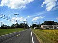
 Prospertown, NJ.jpg 987 × 691; 187 KB
-
 Pullentown, NJ.jpg 2,729 × 1,808; 1.07 MB
-
 Red Valley, NJ.jpg 2,272 × 1,704; 1.29 MB
-
 Robinsville, NJ (2).jpg 2,029 × 1,265; 841 KB
-
 Robinsville, NJ.jpg 2,013 × 1,401; 670 KB
-
 Shrewsbury, Upper Freehold, New Jersey.jpg 2,816 × 2,112; 1.23 MB
-
 Spring Mill, NJ.jpg 2,340 × 1,598; 1.18 MB
-
 Stone Tavern, NJ.jpg 2,816 × 1,699; 1.19 MB
-
 Upper Freehold Byway sign.jpg 2,120 × 2,826; 1.35 MB
_just_north_of_New_Canton-Stone_Tavern_Road_(County_Route_524)_along_the_border_of_Robbinsville_Township,_Mercer_County_and_Upper_Freehold_Township,_Monmouth_County_in_New_Jersey.jpg)
_at_New_Canton-Stone_Tavern_Road_(County_Route_524)_along_the_border_of_Robbinsville_Township,_Mercer_County_and_Upper_Freehold_Township,_Monmouth_County_in_New_Jersey.jpg)
_at_Interstate_195_(Central_Jersey_Expressway)_along_the_border_of_Robbinsville_Township,_Mercer_County_and_Upper_Freehold_Township,_Monmouth_County_in_New_Jersey.jpg)
_at_Herbert_Road_along_the_border_of_Robbinsville_Township,_Mercer_County_and_Upper_Freehold_Township,_Monmouth_County_in_New_Jersey.jpg)
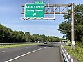
_at_Exit_8_(County_Route_539,_Hightstown,_Allentown)_on_the_border_of_Robbinsville_Township,_Mercer_County_and_Upper_Freehold_Township,_Monmouth_County_in_New_Jersey.jpg)
_overpass_on_the_border_of_Robbinsville_Township,_Mercer_County_and_Upper_Freehold_Township,_Monmouth_County_in_New_Jersey.jpg)
_just_north_of_Winchester_Boulevard_in_Upper_Freehold_Township,_Monmouth_County,_New_Jersey.jpg)
_at_Monmouth_County_Route_539_Alternate_and_Allentown-Davis_Station_Road_in_Upper_Freehold_Township,_Monmouth_County,_New_Jersey.jpg)
_at_Monmouth_County_Route_537_(Monmouth_Road)_in_Upper_Freehold_Township,_Monmouth_County,_New_Jersey.jpg)
_at_Monmouth_County_Route_539_Alternate_(Sharon_Station_Road)_in_Upper_Freehold_Township,_Monmouth_County,_New_Jersey.jpg)
_at_Monmouth_County_Route_526_Alternate_(Allentown_Bypass)_and_Galloping_Brook_Drive_in_Upper_Freehold_Township,_Monmouth_County,_New_Jersey.jpg)
_at_Yellow_Meetinghouse_Road_and_Red_Valley_Road_in_Upper_Freehold_Township,_Monmouth_County,_New_Jersey.jpg)
_at_Breza_Road-New_Road_in_Upper_Freehold_Township,_Monmouth_County,_New_Jersey.jpg)
_just_west_of_Doctors_Creek_in_Upper_Freehold_Township,_Monmouth_County,_New_Jersey.jpg)
_just_southwest_of_Interstate_195_(Central_Jersey_Expressway)_in_Upper_Freehold_Township,_Monmouth_County,_New_Jersey.jpg)
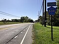
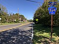
_at_Monmouth_County_Route_539_(Old_York_Road)_in_Upper_Freehold_Township,_Monmouth_County,_New_Jersey.jpg)
_at_Monmouth_County_Route_43_(Imlaystown-Hightstown_Road)_in_Upper_Freehold_Township,_Monmouth_County,_New_Jersey.jpg)
_just_southwest_of_Interstate_195_(Central_Jersey_Expressway)_in_Upper_Freehold_Township,_Monmouth_County,_New_Jersey.jpg)
_just_east_of_Exit_11_in_Upper_Freehold_Township,_Monmouth_County,_New_Jersey.jpg)
_just_west_of_Exit_11_in_Upper_Freehold_Township,_Monmouth_County,_New_Jersey.jpg)
_at_Millers_Mill_Road_on_the_border_of_Upper_Freehold_Township,_Monmouth_County_and_Jackson_Township,_Ocean_County_in_New_Jersey.jpg)
_at_Ocean_County_Route_20_(Millstream_Avenue)_on_the_border_of_Upper_Freehold_Township,_Monmouth_County_and_Plumsted_Township,_Ocean_County_in_New_Jersey.jpg)
_just_east_of_Ocean_County_Route_640_(Hawkin_Road)_and_Emleys_Hill_Road_on_the_border_of_Upper_Freehold_Township,_Monmouth_County_and_Jackson_Township,_Ocean_County_in_New_Jersey.jpg)
_at_Exit_11_(Imlaystown,_Coxs_Corner)_in_Upper_Freehold_Township,_Monmouth_County,_New_Jersey.jpg)
_at_Exit_8_(County_Route_539,_Hightstown,_Allentown)_on_the_border_of_Robbinsville_Township,_Mercer_County_and_Upper_Freehold_Township,_Monmouth_County_in_New_Jersey.jpg)
_at_Exit_11_(Coxs_Corner,_Imlaystown)_in_Upper_Freehold_Township,_Monmouth_County,_New_Jersey.jpg)
_at_the_exit_for_Interstate_195_WEST_(Trenton)_on_the_border_of_Upper_Freehold_Township,_Monmouth_County_%26_Robbinsville_Township,_Mercer_County_in_New_Jersey.jpg)
_at_the_exit_for_Interstate_195_EAST_(Shore_Points)_in_Upper_Freehold_Township,_Monmouth_County,_New_Jersey.jpg)
_just_southwest_of_Monmouth_County_Route_526_SPUR_(Allentown_Bypass)_in_Upper_Freehold_Township,_Monmouth_County,_New_Jersey.jpg)
_from_the_overpass_for_County_Routes_524_%26_539_(Old_York_Road)_on_the_border_of_Upper_Freehold_Township,_Monmouth_County_%26_Robbinsville_Township,_Mercer_County,_New_Jersey.jpg)
_from_the_overpass_for_County_Routes_524_and_539_(Old_York_Road)_in_Upper_Freehold_Township,_Monmouth_County,_New_Jersey.jpg)
_from_the_overpass_for_Monmouth_County_Route_43_(Imlaystown-Hightstown_Road)_in_Upper_Freehold_Township,_Monmouth_County,_New_Jersey.jpg)
_from_the_overpass_for_Monmouth_County_Route_43_(Imlaystown-Hightstown_Road)_in_Upper_Freehold_Township,_Monmouth_County,_New_Jersey.jpg)
_just_northeast_of_Interstate_195_on_the_border_of_Upper_Freehold_Township,_Monmouth_County_and_Robbinsville_Township,_Mercer_County_in_New_Jersey.jpg)
_just_northeast_of_Interstate_195_on_the_border_of_Robbinsville_Township,_Mercer_County_and_Upper_Freehold_Township,_Monmouth_County_in_New_Jersey.jpg)
_just_northeast_of_Interstate_195_on_the_border_of_Robbinsville_Township,_Mercer_County_and_Upper_Freehold_Township,_Monmouth_County_in_New_Jersey.jpg)
_at_Stone_Tavern_Road_on_the_border_of_Robbinsville_Township,_Mercer_County_and_Upper_Freehold_Township,_Monmouth_County_in_New_Jersey.jpg)
_between_Cliffwood_Drive_and_Hluchy_Road_on_the_border_of_Robbinsville_Township,_Mercer_County_and_Upper_Freehold_Township,_Monmouth_County_in_New_Jersey.jpg)
_between_Hluchy_Road_and_Cliffwood_Drive_on_the_border_of_Robbinsville_Township,_Mercer_County_and_Upper_Freehold_Township,_Monmouth_County_in_New_Jersey.jpg)
_at_Herbert_Road_on_the_border_of_Robbinsville_Township,_Mercer_County_and_Upper_Freehold_Township,_Monmouth_County_in_New_Jersey.jpg)
_just_south_of_Montgomery_Way_along_the_border_of_Robbinsvile_Township,_Mercer_County_and_Upper_Freehold_Township,_Monmouth_County_in_New_Jersey.jpg)
_just_north_of_County_Route_524_(Stone_Tavern_Road)_along_the_border_of_Robbinsvile_Township,_Mercer_County_and_Upper_Freehold_Township,_Monmouth_County_in_New_Jersey.jpg)
_and_County_Route_524_(New_Canton-Stone_Tavern_Road)_on_the_border_of_Robbinsville_Township,_Mercer_County_and_Upper_Freehold_Township,_Monmouth_County_in_New_Jersey.jpg)
_along_the_border_of_Upper_Freehold_Township,_Monmouth_County_and_Robbinsville_Township,_Mercer_County_in_New_Jersey.jpg)


.jpg)


