Category:Roman and late roman settlement (archaeological site, Frick)
Jump to navigation
Jump to search
| Object location | | View all coordinates using: OpenStreetMap |
|---|
archaeological site in Frick in the canton of Aargau, Switzerland  | |||||
| Upload media | |||||
| Instance of | |||||
|---|---|---|---|---|---|
| Part of | |||||
| Location | Frick, Laufenburg District, Aargau, Switzerland | ||||
| Street address |
| ||||
| Heritage designation | |||||
 | |||||
Media in category "Roman and late roman settlement (archaeological site, Frick)"
This category contains only the following file.
-
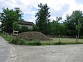 Frick bei Hauptstrasse 92.JPG 2,816 × 2,112; 1.75 MB