Category:Ronas Hill
Jump to navigation
Jump to search
450m high mountain in Shetland Islands, Scotland, UK  | |||||
| Upload media | |||||
| Instance of | |||||
|---|---|---|---|---|---|
| Location | Shetland Islands, Scotland | ||||
| Owned by |
| ||||
| Topographic prominence |
| ||||
| Elevation above sea level |
| ||||
 | |||||
Media in category "Ronas Hill"
The following 33 files are in this category, out of 33 total.
-
 Boulder field, Ronas Hill - geograph.org.uk - 3830440.jpg 640 × 360; 203 KB
-
 Chambered cairn - geograph.org.uk - 3830472.jpg 640 × 480; 277 KB
-
 Chambered cairn on the summit of Ronas Hill - geograph.org.uk - 3239827.jpg 1,024 × 681; 183 KB
-
 Collafirth Hill - geograph.org.uk - 345142.jpg 640 × 426; 67 KB
-
 Looking down the N ridge of Ronas Hill - geograph.org.uk - 1976105.jpg 2,816 × 2,112; 878 KB
-
 Low cloud over Ronas Hill - geograph.org.uk - 3239833.jpg 1,024 × 681; 139 KB
-
 Moorland on NE side of Ronas Hill - geograph.org.uk - 1973132.jpg 2,816 × 2,112; 1,023 KB
-
 Moorland on the north of Ronas Hill - geograph.org.uk - 1328834.jpg 640 × 480; 86 KB
-
 Rona's Hill, Shetland - C. Hullmandel.jpg 3,097 × 2,041; 2.95 MB
-
 Ronas Hill - geograph.org.uk - 334057.jpg 640 × 480; 123 KB
-
 Ronas Hill - geograph.org.uk - 334058.jpg 640 × 480; 117 KB
-
 Ronas Hill - geograph.org.uk - 334061.jpg 640 × 480; 129 KB
-
 Ronas Hill - geograph.org.uk - 3830427.jpg 640 × 360; 228 KB
-
 Ronas Hill - geograph.org.uk - 3982198.jpg 2,048 × 1,536; 1.5 MB
-
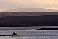
 Ronas Hill from Loch of Urafirth - geograph.org.uk - 3349487.jpg 1,024 × 681; 155 KB
-
 Ronas Hill from Skelberry, North Roe - geograph.org.uk - 3349014.jpg 1,024 × 682; 185 KB
-
 Ronas Hill from Yell Sound - geograph.org.uk - 2205682.jpg 800 × 535; 55 KB
-
 Ronashillcairn.jpg 640 × 480; 110 KB
-
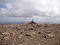
 Someone on Bigga (geograph 2051233).jpg 800 × 534; 157 KB
-
 Spring on N side of Ronas Hill - geograph.org.uk - 1976226.jpg 2,816 × 2,112; 770 KB
-
 Summit area, Ronas Hill - geograph.org.uk - 3830456.jpg 640 × 480; 267 KB
-
 Summit of Ronas Hill - geograph.org.uk - 3239817.jpg 1,024 × 683; 126 KB
-
 Summit of Ronas Hill - geograph.org.uk - 3239822.jpg 1,024 × 681; 160 KB
-
 Summit of Ronas Hill - geograph.org.uk - 3239829.jpg 1,024 × 681; 153 KB
-
 Summit register, Ronas Hill - geograph.org.uk - 3830462.jpg 1,024 × 768; 585 KB
-
 SW flank of Ronas Hill - geograph.org.uk - 1975225.jpg 2,816 × 2,112; 820 KB
-
 The Roonies - geograph.org.uk - 1328821.jpg 640 × 480; 58 KB
-
 Triangulation pillar, Ronas Hill - geograph.org.uk - 3830444.jpg 640 × 360; 220 KB
-
 View from Collafirth towards Ronas Hill - geograph.org.uk - 3239858.jpg 1,024 × 681; 166 KB
-

-
-
-
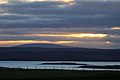
 Wind and Tide, Yell Sound (geograph 4642762).jpg 4,252 × 2,834; 2.82 MB


.jpg)


.jpg)