Category:Roundabouts in Leicestershire
Jump to navigation
Jump to search
Ceremonial counties of England: Bedfordshire · Berkshire · Buckinghamshire · Cambridgeshire · Cheshire · Cornwall · Cumbria · Derbyshire · Devon · Dorset · Durham · East Riding of Yorkshire · East Sussex · Essex · Gloucestershire · Greater London · Greater Manchester · Hampshire · Herefordshire · Hertfordshire · Isle of Wight · Kent · Lancashire · Leicestershire · Lincolnshire · Merseyside · North Yorkshire · Northamptonshire · Northumberland · Nottinghamshire · Oxfordshire · Rutland · Shropshire · Somerset · South Yorkshire · Staffordshire · Suffolk · Surrey · Tyne and Wear · Warwickshire · West Midlands · West Sussex · West Yorkshire · Wiltshire · Worcestershire
City-counties: Bristol ·
Former historic counties:
Other former counties:
City-counties: Bristol ·
Former historic counties:
Other former counties:
Subcategories
This category has only the following subcategory.
R
Media in category "Roundabouts in Leicestershire"
The following 41 files are in this category, out of 41 total.
-
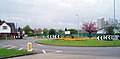
 Birstall Leicestershire - panoramio.jpg 648 × 486; 61 KB
-
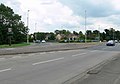
 Cotes Road, Barrow upon Soar - geograph.org.uk - 554107.jpg 640 × 461; 91 KB
-
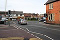
 Desford Road, Narborough - geograph.org.uk - 511842.jpg 640 × 470; 96 KB
-
 Forest Road roundabout, Loughborough - geograph.org.uk - 165410.jpg 640 × 314; 72 KB
-
 Jerusalem Island, Barrow-upon-Soar - geograph.org.uk - 677928.jpg 640 × 480; 128 KB
-
 Magna Park - geograph.org.uk - 619590.jpg 640 × 344; 52 KB
-
 Measham High Street - geograph.org.uk - 929010.jpg 640 × 455; 66 KB
-
 Meridian Way roundabout - geograph.org.uk - 1147015.jpg 640 × 433; 66 KB
-
 Near Gleveland road off Leicester Road near Birstall.jpg 3,280 × 2,464; 2.75 MB
-
 Ratby Lane roundabout, Kirby Muxloe - geograph.org.uk - 490349.jpg 640 × 417; 84 KB
-
 Roundabout - geograph.org.uk - 472598.jpg 640 × 426; 96 KB
-
 Roundabout on Meridian Way - geograph.org.uk - 1147021.jpg 640 × 409; 47 KB
-
 The Nook, Anstey. - geograph.org.uk - 384842.jpg 640 × 268; 72 KB
-
 Withers Way roundabout - geograph.org.uk - 727136.jpg 640 × 413; 53 KB
-
 A47 Normandy Way roundabout - geograph.org.uk - 669976.jpg 640 × 443; 64 KB
-
 Approach to the roundabout. - geograph.org.uk - 690305.jpg 640 × 480; 73 KB
-
 Belvoir Drive East. - geograph.org.uk - 387396.jpg 640 × 419; 89 KB
-

-
 Cort Crescent, Leicester - geograph.org.uk - 727120.jpg 640 × 462; 76 KB
-
 Fleckney, Leicestershire - geograph.org.uk - 418020.jpg 640 × 536; 112 KB
-
 Give way again^ - geograph.org.uk - 457121.jpg 640 × 377; 107 KB
-
 Glen Road roundabout - geograph.org.uk - 213265.jpg 640 × 480; 61 KB
-
 Glen Road roundabout - geograph.org.uk - 499577.jpg 640 × 450; 80 KB
-
 Jerusalem Island - geograph.org.uk - 687762.jpg 640 × 480; 133 KB
-

-
 Mini roundabout - geograph.org.uk - 497733.jpg 640 × 399; 91 KB
-
 Mini roundabout in Blaby - geograph.org.uk - 481624.jpg 620 × 640; 112 KB
-
 Mini roundabout in Blaby - geograph.org.uk - 481645.jpg 640 × 446; 120 KB
-
 Ratby Road, Groby - geograph.org.uk - 490765.jpg 640 × 484; 97 KB
-
 Roundabout - geograph.org.uk - 183771.jpg 640 × 396; 65 KB
-

-
 Roundabout near Glenfield, Leicester - geograph.org.uk - 489816.jpg 640 × 396; 78 KB
-
 Roundabout near Hill Top Farm - geograph.org.uk - 559064.jpg 640 × 428; 87 KB
-
 Roundabout on Halstead Road, Mountsorrel - geograph.org.uk - 150050.jpg 640 × 427; 111 KB
-
 Roundabout on Melton Road, Barrow on Soar - geograph.org.uk - 150722.jpg 640 × 427; 104 KB
-
 Roundabout, Thurmaston - geograph.org.uk - 38686.jpg 640 × 480; 99 KB
-
 Station Road, Bagworth - geograph.org.uk - 542280.jpg 640 × 441; 93 KB
-
 Syston roundabout - geograph.org.uk - 497745.jpg 640 × 539; 108 KB
-
 Syston, near Leicester - geograph.org.uk - 50025.jpg 640 × 267; 84 KB
-
 The Nook, Anstey - geograph.org.uk - 78624.jpg 640 × 427; 112 KB
-
 Wakes Road, Wigston - geograph.org.uk - 457434.jpg 640 × 442; 102 KB


