Category:Rue Jules Ferry (Montpellier)
Jump to navigation
Jump to search
| Object location | | View all coordinates using: OpenStreetMap |
|---|
street in Montpellier, France  | |||||
| Upload media | |||||
| Instance of | |||||
|---|---|---|---|---|---|
| Named after | |||||
| Location | Montpellier, Hérault, Occitania, Metropolitan France, France | ||||
 | |||||
Subcategories
This category has only the following subcategory.
P
Media in category "Rue Jules Ferry (Montpellier)"
The following 20 files are in this category, out of 20 total.
-
 091107 Montpellier IMG 9055.JPG 3,888 × 2,592; 4.38 MB
-
 File by Alexander Baranov - . (5231510934).jpg 2,544 × 1,696; 2.19 MB
-
 Montpellier - Tram 3 - Details (7716493822).jpg 3,072 × 4,096; 2.27 MB
-
 Montpellier - Tramway - Centre de la ville (7902419378).jpg 3,072 × 4,096; 2.46 MB
-
 Montpellier - Tramway - Centre de la ville (7902468124).jpg 3,072 × 4,096; 2.56 MB
-
 Montpellier - Tramway - Centre de la ville (7902503586).jpg 3,072 × 4,096; 2.41 MB
-
 Montpellier - Tramway - Centre de la ville (7902514200).jpg 4,096 × 3,072; 2.36 MB
-
 Montpellier - Tramway - Centre de la ville (7902518106).jpg 3,072 × 4,096; 2.64 MB
-
 Montpellier - Tramway - Centre de la ville (7902521734).jpg 4,096 × 3,072; 2.5 MB
-
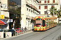
 Montpellier Rue Jules Ferry.jpg 4,592 × 3,001; 6.2 MB
-
 Montpellier T1 2012 Gare Saint-Roch.JPG 4,000 × 2,248; 1.88 MB
-
 Montpellier T3 2012 Gare Saint-Roch III.JPG 4,000 × 2,248; 1.95 MB
-
 Montpellier tram 2007 I 01.jpg 2,592 × 1,944; 2.45 MB
-
 Montpellier tram 2007 I 02.jpg 2,592 × 1,944; 2.53 MB
-
 Montpelliertram.jpg 600 × 449; 51 KB
-
 Rame Ligne 1 Tramway Montpellier Rue Jules Ferry - Montpellier (FR34) - 2021-07-12 - 1.jpg 3,024 × 4,032; 3.36 MB
-
 Rame Ligne 3 Tramway Montpellier Rue Jules Ferry - Montpellier (FR34) - 2021-07-12 - 1.jpg 4,032 × 3,024; 7.32 MB
-
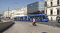
 Rue Jules Ferry - Montpellier (FR34) - 2021-07-12 - 1.jpg 4,032 × 3,024; 7.97 MB
-
 Tramway de Montpellier Ligne 1.JPG 4,000 × 2,248; 5.45 MB
-
 Tramway à Montpellier à proximité de la gare ferroviaire (juin 2019).jpg 4,032 × 3,024; 6.2 MB

.jpg)
.jpg)
.jpg)
.jpg)
.jpg)
.jpg)
.jpg)
.jpg)


_-_2021-07-12_-_1.jpg)
_-_2021-07-12_-_1.jpg)
_-_2021-07-12_-_1.jpg)

.jpg)