Category:Rue du Fort-Rheinsheim
Jump to navigation
Jump to search
thoroughfare in Ville Haute, Luxembourg  Rue du Fort-Rheinsheim  | |||||
| Upload media | |||||
| Instance of | |||||
|---|---|---|---|---|---|
| Named after |
| ||||
| Location | Ville Haute, Luxembourg, Canton of Luxembourg, Luxembourg | ||||
| Maintained by | |||||
| Start time |
| ||||
| Length |
| ||||
| Elevation above sea level |
| ||||
 | |||||
Media in category "Rue du Fort-Rheinsheim"
The following 4 files are in this category, out of 4 total.
-
 Luxembourg City 7 rue du Fort Rheinsheim front.jpg 3,219 × 2,948; 4.21 MB
-
 Luxembourg City 7 rue du Fort Rheinsheim oblique.jpg 3,317 × 4,052; 6.09 MB
-
 Luxembourg, rue du Fort Rheinsheim - nom de rue.jpg 2,698 × 1,534; 2.31 MB
-
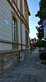 Rue du Fort-Rheinsheim.jpg 2,268 × 4,032; 2.13 MB

