Category:Ruins of farms in England
Jump to navigation
Jump to search
Subcategories
This category has the following 3 subcategories, out of 3 total.
Media in category "Ruins of farms in England"
The following 16 files are in this category, out of 16 total.
-
 Derelict farm building in Checkendon, Oxfordshire.jpg 1,600 × 1,203; 694 KB
-
 Footpath towards the site of Hunter Hill Farm, Ovenden - geograph.org.uk - 5025253.jpg 2,000 × 1,500; 899 KB
-
 Gateway on halifax FP91 at the ruins of Mixenden Fields Farm - geograph.org.uk - 5348335.jpg 2,000 × 1,500; 1.02 MB
-
-
 North America Farm ruins.jpg 1,200 × 759; 293 KB
-
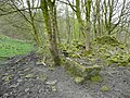
 Part of the site of -Hollas Fold, Hollas Lane, Norland - geograph.org.uk - 5634427.jpg 2,000 × 1,500; 1.46 MB
-
 Ruin at Toot Hill End, Sowerby - geograph.org.uk - 4878302.jpg 2,048 × 1,536; 857 KB
-
 Ruin of Fulshaw - geograph.org.uk - 5539741.jpg 5,184 × 3,456; 5.33 MB
-
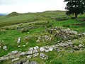
 Ruins of Field Head, Mixenden, Ovenden - geograph.org.uk - 5025394.jpg 2,000 × 1,500; 1.03 MB
-
 Ruins of Hunter Hill Farm, Ovenden - geograph.org.uk - 5025294.jpg 2,000 × 1,500; 1.04 MB
-
 Ruins of Moor End, Sowerby - geograph.org.uk - 4998786.jpg 2,048 × 1,536; 1.14 MB
-
 Ruins of Teeming Hill, Mixenden, Ovenden - geograph.org.uk - 5025357.jpg 2,000 × 1,500; 1.05 MB
-
 Ruins, Windmill Farm - geograph.org.uk - 104666.jpg 640 × 426; 188 KB
-
 Stile on Halifax FP98 at the ruins of Mixenden Fields Farm - geograph.org.uk - 5348334.jpg 2,000 × 1,500; 1.27 MB
-
 The remains of Ramsden, Halifax - geograph.org.uk - 5446605.jpg 2,000 × 1,500; 853 KB
-
 The ruins of the Water Scout farmhouse, Northowram - geograph.org.uk - 4928860.jpg 2,048 × 1,536; 1.28 MB


