Category:Rumšiškės in topographic maps
Jump to navigation
Jump to search
Media in category "Rumšiškės in topographic maps"
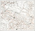
The following 9 files are in this category, out of 9 total.
-
 TKKP VII-1 Kowno.jpg 13,330 × 9,886; 32.85 MB
-
 1v map LXVII-2.jpg 7,825 × 8,091; 9.09 MB
-
 Shubert map - R13L03.jpg 7,944 × 5,799; 12.62 MB
-
 KdwR O22.jpeg 6,890 × 5,758; 13.02 MB
-
 Ltopo XII-16.jpg 10,656 × 9,590; 9.47 MB
-
 KAM map 1606.jpg 4,015 × 3,512; 8.48 MB
-
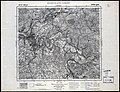 P29 S38 Kaunas 1935.jpg 11,209 × 8,581; 18.62 MB
-
 Lt topo 500.jpg 12,607 × 13,079; 9.37 MB
-
 R100 n-35-037.jpg 4,888 × 6,462; 8.47 MB


