Category:Ruthin
Jump to navigation
Jump to search
town and community in Denbighshire, Wales  Nantclwyd y Dre | |||||
| Upload media | |||||
| Spoken text audio | |||||
|---|---|---|---|---|---|
| Instance of | |||||
| Location | Denbighshire, Wales | ||||
| Said to be the same as | Ruthin | ||||
| official website | |||||
 | |||||
Български: Ридин, град в Уелс.
Cymraeg: Mae Rhuthun yn dref fechan, oedd â phoblogaeth o 5,218 yn 2001 (47% gwryw, 53% benyw, oed cyfartaledd 43.0). Hi yw tref sirol Sir Ddinbych, ac fe'i lleolir ar lan Afon Clwyd yn ne Dyffryn Clwyd. Cyfeirnod OS: SJ 12417 58306. Mae'r A494 a'r A525 yn rhedeg drwyddi.
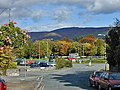
English: Ruthin is the county town of Denbighshire in north Wales. Located around a hill in the southern part of the Vale of Clwyd - the older part of the town, the castle and Saint Peter's Square are located on top of the hill, while many newer parts of the town are on the floodplain of the River Clwyd (which became apparent on several occasions in the late 1990s—new flood control works costing £3 million were inaugurated in autumn 2003). Ruthin also has villages on the outskirts of the town such as Pwllglas and Rhewl.
Español: Ruthin ( galés Rhuthun) es capital condadal de Denbighshire en el norte de Gales en el Reino Unido. Se encuentra en una colina en la zona meridional de Vale of Clwyd. En el censo del 2001 registró una pobleción de 5.218 habitantes
Euskara: Ruthin/Rhuthun Galesko iparraldean dagoen kostaldeko udalerria da, Denbighshire-ko hiriburua dena.
Polski: Ruthin ( wal. Rhuthun) - miasto w Wielkiej Brytanii, w północnej Walii. Ośrodek administracyjny hrabstwa Denbighshire. Liczba mieszkańców w 2001 roku wynosiła 5 218.
Subcategories
This category has the following 16 subcategories, out of 16 total.
2
A
B
C
- Caer Afallen (20 F)
- Cefn Coch, Ruthin (25 F)
- Coed Henblas Moated Site (17 F)
- Ruthin Craft Centre (7 F)
G
M
- Maen Huail (4 F)
R
- Ruthin railway station (10 F)
S
T
- Tom Pryce memorial, Ruthin (6 F)
Media in category "Ruthin"
The following 200 files are in this category, out of 566 total.
(previous page) (next page)-
 1 mile to Ruthin - geograph.org.uk - 6054056.jpg 4,000 × 3,000; 2.85 MB
-
 32-34 Clwyd Street, Ruthin - geograph.org.uk - 4689051.jpg 3,184 × 2,123; 1.75 MB
-
 34 Clwyd Street (former Clwyd Bank), Ruthin - geograph.org.uk - 4688976.jpg 3,184 × 2,123; 1.89 MB
-
 34 Clwyd Street (former Clwyd Bank), Ruthin - geograph.org.uk - 4689039.jpg 3,184 × 2,123; 1.75 MB
-
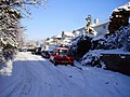
 A bit of snow in Ruthin - geograph.org.uk - 1151411.jpg 640 × 480; 52 KB
-
 A day for walking - geograph.org.uk - 1810848.jpg 640 × 480; 88 KB
-
 A garden visitor - geograph.org.uk - 5700119.jpg 640 × 483; 84 KB
-
 A GR postbox in Ruthin - geograph.org.uk - 5911313.jpg 1,202 × 1,600; 521 KB
-
 A smattering of snow - geograph.org.uk - 5697156.jpg 640 × 480; 113 KB
-
 A splash of colour - geograph.org.uk - 1830668.jpg 640 × 480; 134 KB
-
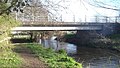
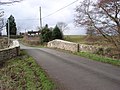
 A494 Bridge Ruthin.jpg 1,000 × 775; 210 KB
-
 A525 at Ruthin town boundary - geograph.org.uk - 3004945.jpg 640 × 479; 69 KB
-
 A525 Bridge Ruthin.jpg 1,221 × 690; 207 KB
-
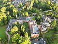
 Aerial view Ruthin - geograph.org.uk - 1189892.jpg 640 × 427; 94 KB
-
 Allotments off Greenfield Road, Ruthin - geograph.org.uk - 5788398.jpg 640 × 480; 114 KB
-
-
-

-

-

-

-

-

-

-

-

-

-

-

-

-

-
 B5105 at Ruthin town boundary - geograph.org.uk - 4465332.jpg 640 × 480; 59 KB
-
 B5105 near Firgrove - geograph.org.uk - 4465329.jpg 640 × 480; 107 KB
-
 Back of Crown House, Ruthin - geograph.org.uk - 981952.jpg 640 × 426; 58 KB
-
 Bagad de Briec - geograph.org.uk - 5825437.jpg 4,480 × 1,136; 3.14 MB
-
 Barclays Bank, Ruthin - geograph.org.uk - 4084338.jpg 3,984 × 2,218; 5.69 MB
-
 Barclays Bank, Ruthin - geograph.org.uk - 5493795.jpg 640 × 427; 87 KB
-
 Barclays Bank, St Peter's Square - geograph.org.uk - 3905044.jpg 640 × 419; 205 KB
-
 Barclays Bank, St Peter's Square - geograph.org.uk - 6055542.jpg 3,264 × 2,448; 1.99 MB
-
 Base of roadsign - geograph.org.uk - 4528276.jpg 531 × 800; 146 KB
-
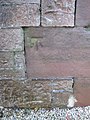
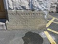
 Bench mark on 10 Market Street, Ruthin - geograph.org.uk - 1671747.jpg 640 × 480; 162 KB
-
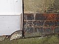
 Bench mark on the lodge to Ruthin Castle - geograph.org.uk - 1671608.jpg 480 × 640; 171 KB
-
-
 Blazers Fuel factory, Ruthin - geograph.org.uk - 4167518.jpg 640 × 480; 39 KB
-
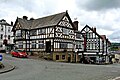
 Boars Head, Ruthin - geograph.org.uk - 5495189.jpg 640 × 478; 78 KB
-
 Boots Pharmacy, Ruthin - geograph.org.uk - 6152567.jpg 1,024 × 683; 171 KB
-
 Bottom of Market Street, Ruthin - geograph.org.uk - 612787.jpg 800 × 600; 334 KB
-
 Brickfields Lane, Ruthin - geograph.org.uk - 1122732.jpg 640 × 480; 88 KB
-
 Bridge over Dwr Ial near Wern - geograph.org.uk - 1579732.jpg 640 × 479; 97 KB
-
 Bryn Goodman, Ruthin - geograph.org.uk - 6052848.jpg 4,000 × 3,000; 2.65 MB
-
 Bryn Goodman, Ruthin, and a postbox - geograph.org.uk - 5911409.jpg 1,600 × 1,200; 708 KB
-
 Bryn Rhydd - geograph.org.uk - 6052913.jpg 4,000 × 3,000; 2.25 MB
-
 Bryn Rhydd, Rhuthun - geograph.org.uk - 990959.jpg 640 × 480; 83 KB
-
 Builders yard and office near Ruthin - geograph.org.uk - 4605796.jpg 1,024 × 768; 118 KB
-
 Building site on Llanfair Road - geograph.org.uk - 5697153.jpg 640 × 480; 75 KB
-
 Buildings in St Peter's Square, Ruthin - geograph.org.uk - 4687992.jpg 3,184 × 2,123; 1.83 MB
-
 Bwthyn Bach y Rhos Rhos Corrage.JPG 3,648 × 2,048; 1.56 MB
-
 Cae Ddol 1920, Ruthin.jpg 1,024 × 611; 101 KB
-
 Caerfallen - geograph.org.uk - 5309879.jpg 640 × 480; 72 KB
-
 Cafe in Ruthin town - geograph.org.uk - 4406951.jpg 640 × 360; 59 KB
-
 Camwater.jpg 865 × 613; 662 KB
-
 Canolfan Naylor Leyland Centre, Ruthin - geograph.org.uk - 3645990.jpg 680 × 1,024; 153 KB
-
 Cantaba Farm - geograph.org.uk - 4884908.jpg 640 × 480; 60 KB
-
 Capel Bathafarn, Market Street, Ruthin - geograph.org.uk - 5911290.jpg 1,199 × 1,600; 442 KB
-
 Car park off Market Street, Ruthin - geograph.org.uk - 1860767.jpg 864 × 648; 302 KB
-
 Carchar Rhuthun (Ruthin Gaol) - geograph.org.uk - 4688838.jpg 3,184 × 2,123; 1.98 MB
-
 Castle Farm field - geograph.org.uk - 5691844.jpg 640 × 480; 79 KB
-
 Castle Farm field. - geograph.org.uk - 5691837.jpg 640 × 480; 85 KB
-
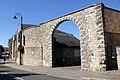
 Castle gate - panoramio (1).jpg 2,000 × 1,500; 1.61 MB
-
 Castle Mewes, Ruthin.JPG 1,024 × 709; 101 KB
-
 Castle Park on New Year's morning - geograph.org.uk - 2785125.jpg 640 × 480; 51 KB
-
 Castle Park, Ruthin-Rhuthun - geograph.org.uk - 4527752.jpg 800 × 531; 130 KB
-
 Castle Street - geograph.org.uk - 1189906.jpg 640 × 375; 62 KB
-
 Castle Street - geograph.org.uk - 5934614.jpg 683 × 1,024; 509 KB
-
 Castle Street - geograph.org.uk - 5934615.jpg 683 × 1,024; 476 KB
-
 Castle Street, Ruthin - easterly view.jpg 3,072 × 2,304; 1.73 MB
-
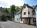
 Castle Street, Ruthin - geograph.org.uk - 1410120.jpg 640 × 480; 75 KB
-
 Castle Street, Ruthin - geograph.org.uk - 1571454.jpg 640 × 480; 70 KB
-
 Castle Street, Ruthin - geograph.org.uk - 1860812.jpg 1,024 × 768; 139 KB
-
 Castle Street, Ruthin - geograph.org.uk - 2302090.jpg 1,280 × 856; 156 KB
-
 Castle street, Ruthin - geograph.org.uk - 2302092.jpg 1,280 × 856; 175 KB
-
 Castle Street, Ruthin - geograph.org.uk - 4687926.jpg 4,000 × 2,667; 2.22 MB
-
 Castle Street, Ruthin - geograph.org.uk - 5934616.jpg 1,024 × 683; 482 KB
-
 Castle Street, Ruthin - geograph.org.uk - 646247.jpg 640 × 360; 55 KB
-
 Castle Street, Ruthin - westerly view.jpg 3,072 × 2,304; 1.72 MB
-
 Castle Wall and Garden, Ruthin - geograph.org.uk - 4690172.jpg 3,184 × 2,123; 3.5 MB
-
 Catholic Church - geograph.org.uk - 579130.jpg 640 × 480; 107 KB
-
 Cattle Grid by Rabbit Warren Hill - geograph.org.uk - 82499.jpg 640 × 480; 179 KB
-
 Cefn Coch - geograph.org.uk - 202790.jpg 640 × 480; 93 KB
-
 Centre of Ruthin - geograph.org.uk - 5934617.jpg 1,024 × 683; 512 KB
-

-
 Church and Castle Hotel, Ruthin, Denbighshire - geograph.org.uk - 3755295.jpg 1,600 × 934; 536 KB
-
 Church of St Mwrog ^ St Mary - geograph.org.uk - 6090830.jpg 2,880 × 2,160; 2.8 MB
-

-
 Clwyd Bank - geograph.org.uk - 5495225.jpg 640 × 427; 71 KB
-
 Clwyd Footbridge Ruthin.jpg 1,221 × 916; 256 KB
-
 Clwyd Street (Heol Clwyd), Ruthin - geograph.org.uk - 4688912.jpg 3,184 × 2,123; 1.79 MB
-
 Clwyd Street - geograph.org.uk - 5934620.jpg 1,024 × 683; 459 KB
-
 Clwyd Street from the Square - geograph.org.uk - 6057651.jpg 3,264 × 2,448; 1.84 MB
-
 Clwyd Street in Ruthin - geograph.org.uk - 5982193.jpg 4,000 × 3,000; 2.36 MB
-
 Clwyd Street viewed from St Peter's Square - geograph.org.uk - 6152564.jpg 1,024 × 683; 158 KB
-
 Clwyd Street, Ruthin - geograph.org.uk - 2301823.jpg 1,280 × 856; 188 KB
-
 Clwyd Street, Ruthin - geograph.org.uk - 5700124.jpg 640 × 480; 60 KB
-
 Clwyd Street, Ruthin - geograph.org.uk - 6057678.jpg 3,264 × 2,448; 2.85 MB
-
 Clwyd Street, Ruthin - geograph.org.uk - 6064181.jpg 3,191 × 2,393; 1.42 MB
-
 Clwyd Street, Ruthin - geograph.org.uk - 6064183.jpg 3,104 × 2,216; 1.97 MB
-
 Clwyd Street, Ruthin - geograph.org.uk - 981218.jpg 426 × 640; 65 KB
-
 Cofgolofn ar y chwith.JPG 3,648 × 2,048; 1.61 MB
-
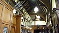
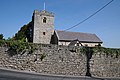
 Collegiate and Parochial Church of St Peter, Ruthin - geograph.org.uk - 4688037.jpg 5,184 × 3,456; 3.83 MB
-
 Cottages on Rhos Street, Ruthin - geograph.org.uk - 634895.jpg 640 × 480; 71 KB
-
 Craft fair on Ruthin Town Square - geograph.org.uk - 5813248.jpg 640 × 480; 83 KB
-
 Craft fair on Ruthin Town Square - geograph.org.uk - 5813252.jpg 640 × 480; 89 KB
-
 Cut Bench Mark, 59 Well Street - geograph.org.uk - 6152581.jpg 1,024 × 683; 118 KB
-

-
 Demolishing Crafnant - geograph.org.uk - 6026091.jpg 4,000 × 3,000; 2.43 MB
-
 Demolishing the roof at Crafnant - geograph.org.uk - 6026093.jpg 4,000 × 3,000; 2.46 MB
-
 Demolition of Exmewe House Ruthin.jpg 940 × 578; 608 KB
-
 Detail of church gates at Ruthin - geograph.org.uk - 5343374.jpg 4,726 × 3,545; 3.33 MB
-
 Dog Lane, Ruthin - geograph.org.uk - 6133277.jpg 1,080 × 810; 169 KB
-
 Doggie door - panoramio.jpg 2,048 × 1,536; 694 KB
-
 Door to Ruthin market hall - geograph.org.uk - 5911295.jpg 1,197 × 1,600; 430 KB
-
 Double rainbow over Erw Goch - geograph.org.uk - 6032439.jpg 4,288 × 3,216; 3.52 MB
-
 Dwr Iâl near Wern farm - geograph.org.uk - 5309876.jpg 640 × 480; 84 KB
-
 Eagles Stores, Clwyd Street, Ruthin - geograph.org.uk - 5492452.jpg 640 × 427; 76 KB
-
 Early morning in Ruthin - geograph.org.uk - 135138.jpg 640 × 480; 128 KB
-

-
 Elizabeth II Postbox, Mold Road, Ruthin - geograph.org.uk - 6152603.jpg 683 × 1,024; 159 KB
-
 Ellis Table Water vehicle, Ruthin.jpg 1,632 × 1,032; 717 KB
-
 Ellis table waters 002 - 1891, Ruthin.jpg 250 × 380; 28 KB
-
En-Ruthin.ogg 1.7 s; 27 KB
-

-
 Entrance to Carchar Rhuthun (Ruthin Gaol) - geograph.org.uk - 4688846.jpg 3,184 × 2,123; 2.13 MB
-
 Entrance to Carchar Rhuthun (Ruthin Gaol) - geograph.org.uk - 4688848.jpg 3,184 × 2,123; 2.36 MB
-
 Entrance to the Old Jail, Ruthin - geograph.org.uk - 981219.jpg 416 × 640; 61 KB
-
 ER II Postbox in Bryn Goodman, Ruthin - geograph.org.uk - 5911413.jpg 1,197 × 1,600; 429 KB
-
 Esso filling station, Denbigh Road - geograph.org.uk - 2763575.jpg 640 × 480; 51 KB
-
 Faded shop advertisement, Railway Terrace - geograph.org.uk - 6066887.jpg 4,000 × 3,000; 2.89 MB
-
 Farm buildings, Felin Ysguboriau - geograph.org.uk - 6056917.jpg 3,264 × 2,448; 1.48 MB
-
 Farmland at Llanfwrog - geograph.org.uk - 4527822.jpg 800 × 531; 108 KB
-
 Farmland to the west of Ruthin - geograph.org.uk - 5675779.jpg 640 × 480; 55 KB
-
 Festival Day in Ruthin - geograph.org.uk - 5395719.jpg 640 × 640; 85 KB
-
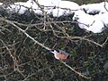
 Fieldfare in our garden - geograph.org.uk - 1122814.jpg 640 × 480; 113 KB
-
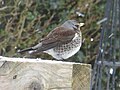 Fieldfare visiting my garden - geograph.org.uk - 5697145.jpg 640 × 480; 62 KB
-
 Fingers crossed for lots of plums this year^ - geograph.org.uk - 6109153.jpg 4,000 × 3,000; 2.75 MB
-
 Firgrove House - geograph.org.uk - 2992364.jpg 640 × 480; 160 KB
-
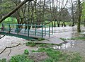
 Flood in Crispin Yard - geograph.org.uk - 5319996.jpg 640 × 480; 120 KB
-
 Flooding in Cae Ddol - geograph.org.uk - 5319997.jpg 640 × 480; 95 KB
-
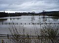 Flooding in Ruthin - geograph.org.uk - 5320092.jpg 640 × 472; 71 KB
-
 Floods in Ruthin - geograph.org.uk - 5720969.jpg 640 × 480; 57 KB
-

-

-
 Former railway cutting, behind Maes-y-Dre - geograph.org.uk - 6022633.jpg 4,000 × 3,000; 2.82 MB
-
 Formerly the Waterloo Inn - geograph.org.uk - 569841.jpg 503 × 640; 64 KB
-

-
-
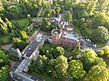
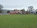
 Fund-raising outdoor concert in Nantclwyd y Dre - geograph.org.uk - 6056794.jpg 4,288 × 3,216; 6.08 MB
-
 Garden and walkway, Railway Terrace - geograph.org.uk - 981990.jpg 426 × 640; 57 KB
-
 Gareth Lynch Clwyd St Ruthin 1.tif 1,303 × 881, 2 pages; 2.58 MB
-
 Gareth Lynch Clwyd St Ruthin 10.tif 1,259 × 842, 2 pages; 2.32 MB
-
 Gareth Lynch Clwyd St Ruthin 11.tif 1,523 × 1,078, 2 pages; 3.96 MB
-
 Gareth Lynch Clwyd St Ruthin 2.tif 1,583 × 1,103, 2 pages; 2.99 MB
-
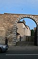
 Gate to Ruthin Castle - geograph.org.uk - 4690114.jpg 3,184 × 2,123; 2.65 MB
-
 Gateway at Ruthin Castle - geograph.org.uk - 4690130.jpg 3,184 × 2,123; 3.04 MB
-
 Gateway to Parc Cottage from Lôn Fawr - geograph.org.uk - 6031827.jpg 4,000 × 3,000; 2.97 MB
-
 Gateway to Ruthin Gaol - geograph.org.uk - 5492464.jpg 427 × 640; 80 KB
-
 Ghost sign for Railway Stores, Ruthin - geograph.org.uk - 6152575.jpg 683 × 1,024; 256 KB
-

-
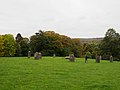 Gorsedd Stones Ruthin - panoramio (1).jpg 2,000 × 1,500; 982 KB
-
 Gorsedd Stones Ruthin - panoramio.jpg 2,000 × 1,500; 842 KB
-
 Gwyl Rhuthun-Ruthin Festival - geograph.org.uk - 5825434.jpg 4,000 × 3,000; 2.6 MB
-
 Happy snowman - geograph.org.uk - 131661.jpg 480 × 640; 93 KB
-
 Haulier's depot in Ruthin - geograph.org.uk - 4167511.jpg 640 × 480; 67 KB
-
 Hen arwydd ffordd - An old road sign - geograph.org.uk - 2193531.jpg 480 × 640; 48 KB
-
 High water in the River Clwyd - geograph.org.uk - 2922655.jpg 640 × 469; 114 KB
-
 Houses on Castle Street - geograph.org.uk - 1860810.jpg 1,024 × 768; 135 KB
-
 Houses on Erw Goch - geograph.org.uk - 5691821.jpg 640 × 480; 100 KB
-
 Houses on Mill Street - geograph.org.uk - 1860822.jpg 1,024 × 768; 209 KB
-
 Houses on Rhos Street-Stryd y Rhos - geograph.org.uk - 2871684.jpg 3,264 × 2,448; 4 MB
-
 HSBC Bank, Ruthin - geograph.org.uk - 3645968.jpg 1,024 × 680; 211 KB
-
 HSBC Bank, Ruthin - geograph.org.uk - 5496634.jpg 640 × 427; 66 KB
-
 HSBC Bank, Ruthin - geograph.org.uk - 6064187.jpg 3,264 × 2,448; 1.73 MB
-
 Inside Nat West Bank in Ruthin - geograph.org.uk - 4341792.jpg 640 × 360; 72 KB
-
 Kissing gate on Jericho Lane - geograph.org.uk - 4862659.jpg 640 × 480; 104 KB
-
 Kissing gate, Maesllan - geograph.org.uk - 6052911.jpg 4,000 × 3,000; 2.36 MB
-
 Lasio Wici Rhuthun Launch of Wici Rhuthun, Ruthin Denbighshire 01.JPG 4,272 × 2,848; 4.63 MB
-
 Lasio Wici Rhuthun Launch of Wici Rhuthun, Ruthin Denbighshire 02.JPG 4,272 × 2,848; 4.09 MB
-
 Learning how to swim - geograph.org.uk - 2922662.jpg 640 × 480; 74 KB
-
 Little frog in our garden pond - geograph.org.uk - 4167297.jpg 640 × 480; 120 KB
-
 Llanfwrog church - geograph.org.uk - 4527797.jpg 800 × 531; 121 KB
-
 Llanfwrog church - geograph.org.uk - 4527801.jpg 800 × 531; 123 KB
-
 Llanrhydd Street in the snow - geograph.org.uk - 6056865.jpg 4,288 × 3,216; 3.69 MB
-
 Llanrhydd Street, Ruthin - geograph.org.uk - 6017649.jpg 4,000 × 3,000; 2.96 MB
-

-

-
 Looking towards Ruthin from Llanfair - geograph.org.uk - 6090555.jpg 2,880 × 2,160; 2.83 MB
-
-
 Lych gate to Llanfwrog church - geograph.org.uk - 4527809.jpg 800 × 531; 131 KB
-
 Lôn Speirial Ucha - geograph.org.uk - 6052850.jpg 2,903 × 3,847; 3.77 MB
-
 Mae a Dirprwy yn Wici Rhuthun (diwrnod o sganio).JPG 4,272 × 2,848; 4.24 MB
-


,_Ruthin_-_geograph.org.uk_-_4688976.jpg)
,_Ruthin_-_geograph.org.uk_-_4689039.jpg)


_-_geograph.org.uk_-_4688838.jpg)


.jpg)


,_Ruthin_-_geograph.org.uk_-_4688912.jpg)


_-_geograph.org.uk_-_4688846.jpg)
_-_geograph.org.uk_-_4688848.jpg)


_on_Ruthin_Drill_Hall-Youth_Centre_-_geograph.org.uk_-_4084135.jpg)
_on_Ruthin_Drill_Hall-Youth_Centre_-_geograph.org.uk_-_4084145.jpg)


.jpg)


.JPG)
