Category:Rybnik-Gotartowice Airfield
Jump to navigation
Jump to search
| Object location | | View all coordinates using: OpenStreetMap |
|---|
 | |||||
| Upload media | |||||
| Instance of |
| ||||
|---|---|---|---|---|---|
| Location | Gotartowice, Rybnik, Silesian Voivodeship, Poland | ||||
| Date of official opening |
| ||||
| Elevation above sea level |
| ||||
| ICAO airport code |
| ||||
 | |||||
Polski: Lotnisko Rybnik-Gotartowice (kod ICAO: EPRG) od 1964 roku należy do Aeroklubu Rybnickiego Okręgu Węglowego (ROW).
English: Sports airfield near Rybnik.
Subcategories
This category has only the following subcategory.
P
Media in category "Rybnik-Gotartowice Airfield"
The following 30 files are in this category, out of 30 total.
-
 Airfield EPRG in Rybnik Gotartowice.jpg 2,048 × 1,536; 468 KB
-
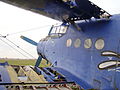
 Antonov (PZL-Mielec) An-2 Rybnik Idaszak-1.jpg 1,024 × 709; 370 KB
-
 Antonov (PZL-Mielec) An-2 Rybnik Idaszak-2.jpg 1,024 × 699; 385 KB
-
 Antonov An-2 SP-AMM 01.JPG 2,304 × 1,728; 1.02 MB
-
 Antonov An-2 SP-AMM 02.JPG 2,304 × 1,728; 1.04 MB
-
 Antonov An-2 SP-AMM 03.JPG 2,304 × 1,728; 1.02 MB
-
 Antonov An-2 SP-AMM 04.JPG 2,304 × 1,728; 1.07 MB
-
 Antonov An-2 SP-AMM 05.jpg 2,048 × 1,536; 809 KB
-
 Antonov An-2 SP-AMM 06.jpg 800 × 533; 127 KB
-
 Antonov An-2 SP-AMM 07.JPG 3,264 × 2,176; 1.73 MB
-
 Antonov An-2 SP-AMM 08.JPG 3,264 × 2,176; 1.68 MB
-
 Antonov An-2 SP-AMM 10.JPG 2,048 × 1,536; 1.01 MB
-
 Antonov An-2 SP-AMM 11.JPG 2,048 × 1,536; 974 KB
-
 Antonov An-2 SP-AMM 12.JPG 2,048 × 1,536; 978 KB
-
 Antonov An-2 SP-AMM 13.JPG 2,048 × 1,536; 1.08 MB
-
 Antonov An-2 SP-AMM 14.JPG 2,048 × 1,536; 1.03 MB
-
 Antonov An-2 SP-ANG 01.JPG 2,304 × 1,728; 1.05 MB
-
 Antonov An-2 SP-ANG 02.JPG 2,304 × 1,728; 1.05 MB
-
 Antonov An-2 SP-ANG 03.JPG 2,304 × 1,728; 1.03 MB
-
 Antonov An-2 SP-ANG 04.JPG 2,304 × 1,728; 1 MB
-
 Antonov An-2 SP-ANG 05.JPG 3,456 × 2,592; 3.13 MB
-
 Antonov An-2 SP-ANG 06.JPG 3,456 × 2,592; 944 KB
-
 Antonov An-2 SP-ANG 07.JPG 3,456 × 2,592; 1.03 MB
-
 Antonov An-2 SP-ANG 08.JPG 3,456 × 2,592; 1.04 MB
-
 Antonov An-2 SP-ANG 09.JPG 3,456 × 2,592; 2.86 MB
-
 Antonov An-2 SP-ANG 14.JPG 3,456 × 2,592; 1.06 MB
-
 AROW noca.jpg 1,024 × 683; 185 KB
-
 Logo row 50a copy (1).gif 823 × 871; 64 KB
-
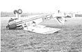 PZL-101 Gawron SP-CKO.jpg 1,230 × 774; 189 KB
-
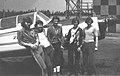 Rybnik-Gotartowice Airfield, 1978-1979 01.jpg 1,040 × 660; 214 KB

_An-2_Rybnik_Idaszak-1.jpg)
_An-2_Rybnik_Idaszak-2.jpg)


.gif)

