Category:SVG locator maps of former countries of Europe (gray and green globe scheme)
Jump to navigation
Jump to search
Media in category "SVG locator maps of former countries of Europe (gray and green globe scheme)"
The following 22 files are in this category, out of 22 total.
-
 AlmohadCaliphate (orthographic projection).svg 550 × 550; 540 KB
-
 Almoravid map.svg 537 × 536; 304 KB
-
 AlmoravidEmirate (orthographic projection).svg 550 × 550; 540 KB
-
 Austro-Hungary Empire (orthographic projection).svg 550 × 550; 878 KB
-
 Crimea 1502 Ortho.svg 8,054 × 6,897; 763 KB
-
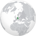
 Czechoslovakia (orthographic projection).svg 550 × 550; 195 KB
-
 Europe-GDR (orthographic projection).svg 2,048 × 2,048; 4.3 MB
-
 Europe-PRL (orthographic projection).svg 2,048 × 2,048; 4.3 MB
-
 Europe-West Germany (orthographic projection).svg 2,048 × 2,048; 4.3 MB
-
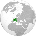 Frankish Empire (orthographic projection).svg 551 × 550; 735 KB
-
 German Reich 1942 (Orthographic Projection).svg 512 × 512; 5.81 MB
-
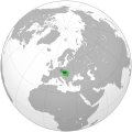 Great Moravia (orthographic projection).svg 512 × 512; 101 KB
-
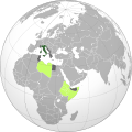 Italian Colonial Empire (orthographic projection).svg 551 × 550; 758 KB
-
 Ottoman Empire 1683 (orthographic projection).svg 553 × 553; 353 KB
-
 Roman Empire (orthographic projection).svg 550 × 550; 555 KB
-
 Russian Empire (1867).svg 550 × 550; 414 KB
-
 Russian Empire (orthographic projection).svg 541 × 541; 393 KB
-

-
 Third Reich (orthographic projection).svg 550 × 550; 661 KB
-
 Umayyad Caliphate 720 AD (orthographic projection).svg 550 × 550; 941 KB
-
 Union of Soviet Socialist Republics (1989).svg 550 × 550; 453 KB
-
 Union of Soviet Socialist Republics (orthographic projection).svg 541 × 541; 453 KB
.svg)

.svg)
.svg)

.svg)
.svg)
.svg)
.svg)
.svg)
.svg)
.svg)
.svg)
.svg)
.svg)
.svg)
.svg)

.svg)
.svg)
.svg)
.svg)
Categories:
- SVG locator maps of countries of Europe (gray and green globe scheme)
- SVG locator maps of former countries of Europe (gray and green scheme)
- Locator maps of former countries of Europe (gray and green globe scheme)
- SVG locator maps of former countries of Europe (gray globe scheme)
- SVG locator maps of former countries (gray and green globe scheme)