Category:SVG maps of Arkansas
Jump to navigation
Jump to search
States of the United States: Alabama · Alaska · Arizona · Arkansas · California · Colorado · Connecticut · Delaware · Florida · Georgia · Hawaii · Idaho · Illinois · Indiana · Iowa · Kansas · Kentucky · Louisiana · Maine · Maryland · Massachusetts · Michigan · Minnesota · Mississippi · Missouri · Montana · Nebraska · Nevada · New Hampshire · New Jersey · New Mexico · New York · North Carolina · North Dakota · Ohio · Oklahoma · Oregon · Pennsylvania · Rhode Island · South Carolina · South Dakota · Tennessee · Texas · Utah · Vermont · Virginia · Washington · West Virginia · Wisconsin · Wyoming – Washington, D.C.
American Samoa · Guam · Northern Mariana Islands · Puerto Rico – Navassa Island · Palmyra Atoll
American Samoa · Guam · Northern Mariana Islands · Puerto Rico – Navassa Island · Palmyra Atoll
Subcategories
This category has only the following subcategory.
Media in category "SVG maps of Arkansas"
The following 45 files are in this category, out of 45 total.
-
 1928 Arkansas gubernatorial election results map by county.svg 810 × 709; 46 KB
-
 1930 Arkansas gubernatorial election results map by county.svg 810 × 709; 46 KB
-
 1932 Arkansas gubernatorial election results map by county.svg 810 × 709; 46 KB
-
 1934 Arkansas gubernatorial election results map by county.svg 810 × 709; 46 KB
-
 1936 Arkansas gubernatorial election results map by county.svg 810 × 709; 46 KB
-
 1976 Arkansas gubernatorial election results map by county.svg 810 × 709; 46 KB
-
 1978 Arkansas gubernatorial election results map by county.svg 810 × 709; 46 KB
-
 1980 Arkansas gubernatorial election results map by county.svg 810 × 709; 46 KB
-
 2014 Arkansas gubernatorial election results map by county.svg 810 × 709; 46 KB
-
-
 AR2012Pres.svg 198 × 181; 44 KB
-
 Arkansas counties by race.svg 198 × 181; 27 KB
-
 Arkansas county map, cb 500k.svg 810 × 709; 39 KB
-
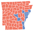
 Arkansas D Sweep.svg 198 × 181; 43 KB
-
 Arkansas election 2010.svg 500 × 457; 134 KB
-
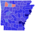
 Arkansas Governor Primary Results by County, 1928.svg 198 × 181; 44 KB
-
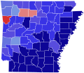
 Arkansas Governor Primary Results by County, 1930.svg 198 × 181; 44 KB
-
 Arkansas House 2012.svg 512 × 448; 6.05 MB
-
 Arkansas in United States (US48).svg 1,181 × 731; 2.35 MB
-
 Arkansas in United States.svg 1,181 × 731; 2.22 MB
-
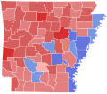
 Arkansas Presidential Election Results 2012.svg 810 × 709; 45 KB
-
 Arkansas racial and ethnic map.svg 198 × 181; 27 KB
-

-
 Arkansas Senate 2012.svg 512 × 448; 3.84 MB
-
 Arkansas Senate 2020.svg 512 × 448; 3.85 MB
-
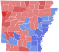
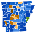
 Arkansas Senatorial Election Results by County, 2010.svg 198 × 181; 45 KB
-
 Arkansas WikiProject.svg 1,015 × 903; 28 KB
-
 COVID-19 cases in Arkansas by county.svg 4,474 × 3,895; 305 KB
-
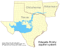 Edwards-Trinity aquifer system v1.svg 821 × 661; 636 KB
-
 Flag-map of Arkansas.svg 491 × 428; 41 KB
-
-
 LGBT flag map of Arkansas.svg 1,106 × 931; 14 KB
-
 Map of Arkansas highlighting Central Arkansas.svg 4,474 × 3,895; 105 KB
-
 Map of Arkansas highlighting Jonesboro MSA.svg 4,474 × 3,895; 104 KB
-
 Map of Arkansas highlighting NEA CSA 001.svg 4,474 × 3,895; 104 KB
-
 Map of Arkansas highlighting NEA CSA 002.svg 4,474 × 3,895; 104 KB
-
 Map of Arkansas highlighting Northwest Arkansas.svg 4,474 × 3,895; 105 KB
-
 Map of Arkansas highlighting Pine Bluff MSA.svg 4,474 × 3,895; 104 KB
-
 Map of the Arkansas Delta.svg 600 × 600; 105 KB
-
 Map of USA AR.svg 286 × 186; 167 KB
-
 Mississippi delta disambig.svg 489 × 655; 45 KB
-
 New Madrid Seismic Zone activity 1974-2011.svg 747 × 788; 1.73 MB
-
 NRHP Arkansas Map.svg 990 × 765; 15.56 MB
-
 Piney Woods Forests map.svg 1,712 × 1,992; 337 KB
-
 USA Arkansas relief location map.svg 1,201 × 1,040; 3.12 MB


.svg)


