Category:SVG maps of Cape Verde
Jump to navigation
Jump to search
Subcategories
This category has the following 5 subcategories, out of 5 total.
Media in category "SVG maps of Cape Verde"
The following 10 files are in this category, out of 10 total.
-
 Elecciones presidenciales de Cabo Verde, 1991.svg 875 × 725; 21 KB
-
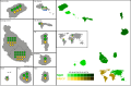
 Kapverdien 2017.svg 852 × 766; 1.77 MB
-
 Mapa de Cabo Verde (OCHA).svg 254 × 254; 400 KB
-
 Mapa de las elecciones parlamentarias de Cabo Verde de 1995.svg 1,181 × 772; 293 KB
-
 Mapa de las elecciones parlamentarias de Cabo Verde de 2006.svg 1,181 × 772; 284 KB
-
 Mapa de las elecciones parlamentarias de Cabo Verde de 2011.svg 1,181 × 772; 284 KB
-
 Mapa de las elecciones parlamentarias de Cabo Verde de 2016.svg 1,181 × 772; 284 KB
-
 Portugala kolonia milito.png 661 × 738; 107 KB
-
 Portuguese colonial war-eo.svg 635 × 709; 516 KB
-
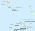
 SVG-Koort Kap Verde.svg 875 × 725; 22 KB


.svg)


