Category:SVG maps of Iran
Jump to navigation
Jump to search
Countries of Asia: Afghanistan · Armenia‡ · Azerbaijan‡ · Bahrain · Bangladesh · Bhutan · Brunei · Cambodia · People's Republic of China · Cyprus‡ · East Timor · Egypt‡ · Georgia‡ · India · Indonesia‡ · Iran · Iraq · Israel · Japan · Jordan · Kazakhstan‡ · Kuwait · Kyrgyzstan · Laos · Lebanon · Malaysia · Maldives · Mongolia · Myanmar · Nepal · North Korea · Oman · Pakistan · Philippines · Qatar · Russia‡ · Saudi Arabia · Singapore · South Korea · Sri Lanka · Syria · Tajikistan · Thailand · Turkey‡ · Turkmenistan · United Arab Emirates · Uzbekistan · Vietnam · Yemen
Limited recognition: Abkhazia‡ · Taiwan · State of Palestine · South Ossetia‡ – Other territories: Macau
‡: partly located in Asia
Limited recognition: Abkhazia‡ · Taiwan · State of Palestine · South Ossetia‡ – Other territories: Macau
‡: partly located in Asia
Subcategories
This category has the following 5 subcategories, out of 5 total.
B
- SVG Bilateral maps of Iran (3 F)
F
- SVG flag maps of Iran (11 F)
L
S
- SVG topographic maps of Iran (11 F)
Media in category "SVG maps of Iran"
The following 54 files are in this category, out of 54 total.
-
 2024 Iranian Assembly of Experts election seats per province.svg 512 × 457; 61 KB
-
 2024 Iranian legislative election seats per province.svg 512 × 457; 68 KB
-
 Adurbadagan as a Sasanian province-ar.svg 2,871 × 2,186; 1.65 MB
-
 Adurbadagan as a Sasanian province.svg 2,871 × 2,186; 1.7 MB
-
 Carte geologique elbourz-es.svg 1,041 × 509; 405 KB
-
 Caspian and Semnani languages.svg 485 × 300; 884 KB
-
 Caspian lang..svg 1,200 × 1,105; 686 KB
-
 Caspian languages (With Tati and Semnani).svg 485 × 300; 905 KB
-
 Caspian languages es.svg 485 × 300; 1.09 MB
-
 Gilan Map.svg 512 × 534; 63 KB
-
 Gorgan-e-Difar de.svg 1,025 × 652; 183 KB
-
 Gorgan-e-Difar-hu.svg 1,025 × 652; 186 KB
-
 Gorgan-e-Difar.svg 1,025 × 652; 227 KB
-
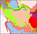 Iran biotopes.svg 1,371 × 1,250; 227 KB
-
 Iran Counties.svg 1,210 × 1,100; 2.51 MB
-
 Iran location map (counties).svg 1,200 × 1,071; 1.73 MB
-
 Iran location map.svg 1,200 × 1,071; 299 KB
-
 Iran map-es.svg 3,013 × 2,600; 4.53 MB
-
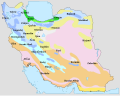
 Iran regions map Ar.svg 1,371 × 1,250; 831 KB
-
 Iran Yazd adm location map.svg 512 × 540; 38 KB
-
 Iran-climate-map-es.svg 3,220 × 2,560; 569 KB
-
 Iran-climate-map.svg 3,220 × 2,560; 193 KB
-
 Iran.svg 1,371 × 1,250; 235 KB
-
 Iranian provinces by HDI (2017).svg 512 × 490; 134 KB
-
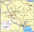 IranIraqWWII en.svg 567 × 523; 64 KB
-
 IranNumbered.svg 808 × 737; 276 KB
-
 Kurdistan Province Location Map.svg 718 × 601; 359 KB
-
 Location of abarkuh city.svg 383 × 377; 18 KB
-
 Location of ardakan city.svg 383 × 377; 18 KB
-
 Location of ashkezar city.svg 383 × 377; 18 KB
-
 Location of bafq city.svg 383 × 377; 18 KB
-
 Location of behabad city.svg 383 × 377; 18 KB
-
 Location of Iran.svg 940 × 415; 1.47 MB
-
 Location of khatam city.svg 383 × 377; 18 KB
-
 Location of mehriz city.svg 383 × 377; 18 KB
-
 Location of meybod city.svg 383 × 377; 18 KB
-
 Location of taft city.svg 383 × 377; 18 KB
-
 Location of yazd city.svg 383 × 377; 18 KB
-
 Location of Yazd province in Iran.svg 1,200 × 1,071; 470 KB
-
 LocationIran.svg 1,000 × 500; 2.76 MB
-
 Map of Iran.svg 1,001 × 500; 463 KB
-
 Map of Iranian Azerbaijan 1945-46 insurgency by Robert Rossow (corrected).svg 1,498 × 1,003; 878 KB
-
 Map of Iranian Azerbaijan 1945-46 insurgency by Robert Rossow.svg 1,498 × 1,003; 812 KB
-
 Map of the Sasanian province of Pars before Kavad I.svg 2,865 × 2,426; 4.99 MB
-
 Map of the Sasanian province of Pars.svg 2,865 × 2,496; 6.69 MB
-
 Map of the Sasanian province Spahan, also known as Parthau.svg 2,294 × 1,371; 2.22 MB
-
 Markazi province.svg 744 × 1,052; 27 KB
-
 Medieval Sistan.svg 1,483 × 1,333; 1.69 MB
-
 Sasanian Khuzestan.svg 450 × 450; 621 KB
-
 Sasanian Kirman.svg 4,254 × 3,513; 7.73 MB
-
 Talysh language dialects-ar.svg 696 × 325; 340 KB
-
 Talysh language dialects.svg 300 × 330; 634 KB
-
 United States of Iran ممالک متفقه ایران.svg 2,451 × 2,468; 59 KB
-
 Yazd-province-map-labeled-and-colorful.svg 383 × 377; 40 KB


.svg)


.svg)


.svg)


.svg)


