Category:SVG maps of South Sudan
Jump to navigation
Jump to search
Subcategories
This category has the following 6 subcategories, out of 6 total.
Media in category "SVG maps of South Sudan"
The following 26 files are in this category, out of 26 total.
-
 Blank Map of South Sudan.svg 1,500 × 1,100; 68 KB
-
 Koppen-Geiger Map SSD future.svg 1,479 × 850; 691 KB
-
 Koppen-Geiger Map SSD present.svg 1,479 × 850; 693 KB
-
 Luo Language.svg 365 × 480; 576 KB
-
 Sudan RC Church diocese district map 2007.svg 744 × 1,052; 159 KB
-
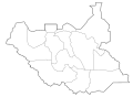
 South Sudan (2011–2015) adm location map.svg 1,561 × 1,133; 199 KB
-
 South Sudan (2015–2020) adm location map.svg 1,561 × 1,133; 213 KB
-
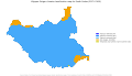
 South Sudan - Location Map (2012) - SSD - UNOCHA.svg 254 × 254; 456 KB
-
 South Sudan adm location map.svg 1,561 × 1,133; 201 KB
-
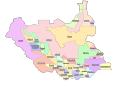 South Sudan ethnic map.svg 1,122 × 794; 872 KB
-
 South Sudan map of Köppen climate classification-es.svg 1,900 × 1,900; 74 KB
-
 South Sudan map of Köppen climate classification.svg 1,900 × 1,900; 84 KB
-
 South Sudan protected areas.svg 1,500 × 1,133; 484 KB
-
 Southern Sudan Geology Map-es.svg 1,500 × 1,133; 322 KB
-
 Southern Sudan Geology Map-it.svg 1,500 × 1,133; 313 KB
-
 Southern Sudan Hidrography Map-es.svg 1,500 × 1,133; 421 KB
-
 Southern Sudan Hidrography Map-sr.svg 1,500 × 1,133; 530 KB
-
 Southern Sudan Infrastructure Map-sr.svg 1,500 × 1,133; 400 KB
-
 Southern Sudan Map Blank.svg 422 × 315; 17 KB
-
 Southern Sudan Mineral Deposits Map-sr.svg 1,500 × 1,133; 359 KB
-
 Southern Sudan Nature Protection Map-sr.svg 1,500 × 1,133; 322 KB
-
 Sudan and South Sudan blank.svg 232 × 300; 7 KB
-
 Sudd location map.svg 1,561 × 1,133; 434 KB
-
 SudánDelSurFluvial.svg 808 × 599; 827 KB
-
 SudánDelSurGeneral.svg 2,504 × 1,847; 831 KB
-
 SudánDelSurGeneral2.svg 2,504 × 1,847; 854 KB


_adm_location_map.svg)
_adm_location_map.svg)
_-_SSD_-_UNOCHA.svg)


