Category:SVG maps of the world showing history
Jump to navigation
Jump to search
Subcategories
This category has only the following subcategory.
S
Media in category "SVG maps of the world showing history"
The following 136 files are in this category, out of 136 total.
-
 Amelia Earhart flight route.svg 2,326 × 1,420; 232 KB
-
 Anaximander world map as.svg 1,063 × 1,063; 21 KB
-
 Anaximander world map-bn.svg 1,063 × 1,063; 104 KB
-
 Anaximander world map-ca.svg 1,063 × 1,063; 14 KB
-
 Anaximander world map-da.svg 1,063 × 1,063; 14 KB
-
 Anaximander world map-de.svg 1,063 × 1,063; 14 KB
-
 Anaximander world map-dty.svg 1,063 × 1,063; 12 KB
-
 Anaximander world map-el.svg 1,063 × 1,063; 11 KB
-
 Anaximander world map-en.svg 1,063 × 1,063; 21 KB
-
 Anaximander world map-es.svg 1,063 × 1,063; 14 KB
-
 Anaximander world map-fr.svg 1,063 × 1,063; 14 KB
-
 Anaximander world map-gu.svg 1,063 × 1,063; 15 KB
-
 Anaximander world map-hi.svg 1,063 × 1,063; 19 KB
-
 Anaximander world map-hr.svg 1,063 × 1,063; 14 KB
-
 Anaximander world map-hu.svg 1,063 × 1,063; 14 KB
-
 Anaximander world map-it.svg 1,063 × 1,063; 14 KB
-
 Anaximander world map-ja.svg 1,063 × 1,063; 41 KB
-
 Anaximander world map-ka.svg 1,063 × 1,063; 14 KB
-
 Anaximander world map-kn.svg 1,063 × 1,063; 14 KB
-
 Anaximander world map-ko.svg 1,063 × 1,063; 14 KB
-
 Anaximander world map-lt.svg 1,063 × 1,063; 13 KB
-
 Anaximander world map-ml.svg 1,063 × 1,063; 14 KB
-
 Anaximander world map-mr.svg 1,063 × 1,063; 12 KB
-
 Anaximander world map-ne.svg 1,063 × 1,063; 12 KB
-
 Anaximander world map-nl.svg 1,063 × 1,063; 15 KB
-
 Anaximander world map-or.svg 1,063 × 1,063; 14 KB
-
 Anaximander world map-pa.svg 1,063 × 1,063; 12 KB
-
 Anaximander world map-pl.svg 1,063 × 1,063; 12 KB
-
 Anaximander world map-pt.svg 1,063 × 1,063; 14 KB
-
 Anaximander world map-ro.svg 1,063 × 1,063; 14 KB
-
 Anaximander world map-ru.svg 1,063 × 1,063; 17 KB
-
 Anaximander world map-sr.svg 1,063 × 1,063; 14 KB
-
 Anaximander world map-te.svg 1,063 × 1,063; 12 KB
-
 Anaximander world map-tr.svg 1,063 × 1,063; 11 KB
-
 Anaximander world map-ukr.svg 1,063 × 1,063; 13 KB
-
 Anaximander world map-zh.svg 1,063 × 1,063; 6 KB
-
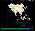 AncientCitiesTimelineAsiav3.svg 1,320 × 1,171; 1.02 MB
-
 Annibyniaeth gwledydd 4.svg 2,389 × 1,189; 222 KB
-
 Boeotia.svg 1,200 × 900; 487 KB
-
 British Empire in February 1952.svg 940 × 477; 833 KB
-
 British Empire Map (Chinese).svg 939 × 476; 1.7 MB
-
 British Empire Map (Indonesian).svg 939 × 476; 940 KB
-
 British Empire.svg 999 × 553; 617 KB
-
 Centres of origin and spread of agriculture labelled.svg 940 × 415; 1.49 MB
-
 Centres of origin and spread of agriculture.svg 940 × 415; 1.62 MB
-
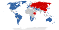 Cold War alliances mid-1975.svg 860 × 440; 1.36 MB
-
 Cold War Map 1980.svg 940 × 477; 2.29 MB
-
 Colonial empires in 1800.svg 1,425 × 625; 228 KB
-
 Colonisation 1800 EL.svg 1,425 × 625; 398 KB
-
 De-facto-territory-control-map-of-the-world-14-05-2019.svg 5,911 × 3,653; 1.89 MB
-
 Decolonization - World In 1945 en.svg 1,421 × 816; 802 KB
-
 Expansion d homo sapiens.svg 3,812 × 2,247; 758 KB
-
 First circumnavigation simplified.svg 2,246 × 1,139; 119 KB
-
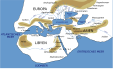
 First map of the world according to Anaximander (6th century BC).svg 512 × 431; 70 KB
-
 Hecataeus world map-az.svg 825 × 803; 65 KB
-
 Hecataeus world map-cy.svg 825 × 803; 67 KB
-
 Hecataeus world map-de.svg 825 × 803; 67 KB
-
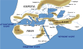
 Hecataeus world map-en.svg 825 × 803; 67 KB
-
 Hecataeus world map-eo.svg 825 × 803; 70 KB
-
 Hecataeus world map-es.svg 825 × 803; 66 KB
-
 Hecataeus world map-fa.svg 825 × 803; 67 KB
-
 Hecataeus world map-fr.svg 825 × 803; 67 KB
-
 Hecataeus world map-grc.svg 825 × 803; 65 KB
-
 Hecataeus world map-hu.svg 825 × 803; 67 KB
-
 Hecataeus world map-it.svg 825 × 803; 32 KB
-
 Hecataeus world map-ru.svg 825 × 803; 67 KB
-
 Hecataeus world map-sq.svg 825 × 803; 67 KB
-
 Hecataeus world map-tr.svg 825 × 803; 67 KB
-
 Hecataeus world map-ukr.svg 825 × 803; 67 KB
-
 Hecataeus world map-zh.svg 825 × 803; 71 KB
-
 Herodotus world map-be-x-old.svg 788 × 476; 277 KB
-
 Herodotus world map-be.svg 788 × 476; 275 KB
-
 Herodotus world map-de.svg 788 × 476; 277 KB
-
 Herodotus world map-el.svg 788 × 476; 272 KB
-
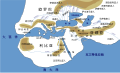
 Herodotus world map-en.svg 788 × 476; 319 KB
-
 Herodotus world map-es.svg 788 × 476; 309 KB
-
 Herodotus world map-eu.svg 788 × 476; 274 KB
-
 Herodotus world map-fr.svg 788 × 476; 276 KB
-
 Herodotus world map-grc.svg 788 × 476; 242 KB
-
 Herodotus world map-hu.svg 788 × 476; 272 KB
-
 Herodotus world map-ka.svg 788 × 476; 280 KB
-
 Herodotus world map-ru.svg 788 × 476; 276 KB
-
 Herodotus world map-ukr.svg 788 × 476; 277 KB
-
 Herodotus world map-zh.svg 985 × 597; 98 KB
-
 LaGuerraFria 1980.svg 1,458 × 710; 403 KB
-
 List of countries gained independance from the UK 2.svg 2,389 × 1,189; 222 KB
-
 List of countries gained independence from the UK Flag version 3.svg 2,400 × 1,189; 364 KB
-
 List of Countries that have gained independece from Spain (Catalan version).svg 1,070 × 535; 164 KB
-
 List of Countries that have gained independece from Spain Euskara.svg 1,070 × 535; 165 KB
-
 Magalhães Elcano Circum-navegação-pt.svg 749 × 380; 112 KB
-
 Magellan Elcano Circumnavigation-ar.svg 2,246 × 1,139; 222 KB
-
 Magellan Elcano Circumnavigation-de.svg 2,246 × 1,139; 219 KB
-
 Magellan Elcano Circumnavigation-en.svg 2,246 × 1,139; 219 KB
-
 Magellan Elcano Circumnavigation-es.svg 2,246 × 1,139; 1.02 MB
-
 Magellan Elcano Circumnavigation-fr.svg 2,246 × 1,139; 258 KB
-
 Magellan Elcano Circumnavigation-hu.svg 2,246 × 1,139; 365 KB
-
 Magellan Elcano Circumnavigation-ru.svg 2,249 × 1,181; 224 KB
-
 Magellan Elcano Circumnavigation-zhs.svg 2,246 × 1,139; 211 KB
-
 Magellan's voyage EN.svg 2,488 × 1,378; 4.13 MB
-
 Magellan's voyage ET.svg 2,488 × 1,378; 4.11 MB
-
 Magellan's voyage HU.svg 2,488 × 1,378; 4.15 MB
-
 Magellan's voyage HY.svg 2,488 × 1,378; 4.11 MB
-
 Magellan's voyage IT.svg 2,488 × 1,378; 4.13 MB
-
 Magellan's voyage MK.svg 2,488 × 1,378; 4.11 MB
-
 Magellan's voyage PL.svg 2,488 × 1,378; 4.11 MB
-
 Magellan's voyage PT.svg 2,488 × 1,378; 4.11 MB
-
 Magellan's voyage SR.svg 2,488 × 1,378; 4.11 MB
-
 Magellan's voyage zh-classical.svg 2,488 × 1,378; 4.33 MB
-
 Magellan's voyage-fr.svg 2,998 × 1,900; 4.29 MB
-
 Map of countries that gained independence from the UK Catalan version.svg 2,389 × 1,189; 222 KB
-
 Map of Countries that have gained independence from Spain Part 2.svg 600 × 535; 351 KB
-
 Map of Countries that have gained independence from Spain Whole.svg 1,070 × 535; 350 KB
-
 Map of SEATO member countries - de.svg 940 × 477; 639 KB
-
 Map of SEATO member countries - en.svg 940 × 477; 639 KB
-
 Map of SEATO member countries - fr.svg 940 × 477; 734 KB
-
 Map of SEATO member countries - id.svg 940 × 477; 639 KB
-
 Map of the MENA region in 1798.svg 1,543 × 1,006; 528 KB
-
 Mediterranea world200bc-es.svg 1,428 × 313; 76 KB
-
 Mediterranea world200bc-pt.svg 1,428 × 313; 76 KB
-
 Ortogonalis polikonikus kepzetes kupvetulet.svg 1,381 × 927; 2.91 MB
-
 Parthia and Rome century2bc-es.svg 1,428 × 313; 46 KB
-
 Parthia and Rome century2bc-pt.svg 512 × 121; 26 KB
-
 Political map world 1986-1989 Dutch.svg 2,692 × 1,473; 1.82 MB
-
 Political map world 1990-1991 Dutch.svg 2,692 × 1,473; 1.81 MB
-
 Political map world 1992 Dutch.svg 2,692 × 1,473; 1.85 MB
-
 Political map world 1993-1994 Dutch.svg 2,692 × 1,473; 1.85 MB
-
 Political map world 1994-1997 Dutch.svg 2,692 × 1,473; 1.84 MB
-
 Political map world 1997-1999 Dutch.svg 2,692 × 1,473; 1.84 MB
-
 Political map world 1999-2002 Dutch.svg 2,692 × 1,473; 1.84 MB
-
 Political map world 2003-2006 Dutch.svg 2,692 × 1,473; 1.85 MB
-
 Political map world 2007-2008 Dutch.svg 2,692 × 1,473; 1.85 MB
-
 Political map world 2009-2010 Dutch.svg 2,692 × 1,473; 1.85 MB
-
 Political map world 2011-2014 Dutch.svg 2,692 × 1,473; 1.87 MB
-
 Political map world since 2014 Dutch.svg 2,692 × 1,473; 1.87 MB
-
 Political World (1938).svg 5,911 × 3,653; 1.16 MB
-
 Route-Marco-Polo-fr-old.svg 541 × 541; 257 KB


.svg)
.svg)


.svg)


.svg)


.svg)
