Category:SVG political maps of Africa
Jump to navigation
Jump to search
Temperate regions: North America · South America · Africa · Europe · Asia · – Polar regions: – Other regions: Afro-Eurasia ·
| NO WIKIDATA ID FOUND! Search for SVG political maps of Africa on Wikidata | |
| Upload media |

Countries of Africa: Algeria · Angola · Benin · Botswana · Burkina Faso · Burundi · Cameroon · Cape Verde · the Central African Republic ≈ Central African Republic · Chad · the Comoros ≈ Comoros · the Democratic Republic of the Congo ≈ Democratic Republic of the Congo · the Republic of the Congo ≈ Republic of the Congo · Djibouti · Egypt‡ · Equatorial Guinea · Eritrea · Eswatini · Ethiopia · Gabon · the Gambia ≈ Gambia · Ghana · Guinea · Guinea-Bissau · Ivory Coast · Kenya · Lesotho · Liberia · Libya · Madagascar · Malawi · Mali · Mauritania · Mauritius · Morocco · Mozambique · Namibia · Niger · Nigeria · Rwanda · São Tomé and Príncipe · Senegal · the Seychelles ≈ Seychelles · Sierra Leone · Somalia · South Africa · South Sudan · Sudan · Tanzania · Togo · Tunisia · Uganda · Zambia · Zimbabwe
Limited recognition: Ambazonia · Azawad · Puntland · the Sahrawi Arab Democratic Republic ≈ Sahrawi Arab Democratic Republic · Somaliland – Other areas: Bir Tawil · the Canary Islands ≈ Canary Islands · Ceuta · Madeira · Mayotte · Melilla · Réunion · Saint Helena, Ascension and Tristan da Cunha · the Scattered Islands in the Indian Ocean ≈ Scattered Islands in the Indian Ocean · Western Sahara
‡: partly located in Africa
Subcategories
This category has the following 2 subcategories, out of 2 total.
A
Media in category "SVG political maps of Africa"
The following 29 files are in this category, out of 29 total.
-
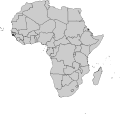
 Africa countries white.svg 800 × 520; 192 KB
-
 Africa detailed borders blank.svg 749 × 713; 7.95 MB
-
 Africa just countries grayish.svg 1,200 × 1,230; 57 KB
-
 Africa location map without rivers.svg 1,525 × 1,440; 529 KB
-
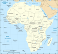
 Africa location map.svg 1,525 × 1,440; 774 KB
-
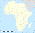
 Africa map blank.svg 1,525 × 1,440; 682 KB
-
 Africa map political-fr.svg 1,525 × 1,440; 754 KB
-
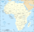
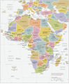
 Africa map political.svg 1,525 × 1,440; 700 KB
-
 Africa map with inset.svg 1,430 × 1,350; 1.22 MB
-
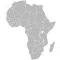
 Africa map.svg 1,200 × 1,230; 37 KB
-
 Africa mapa politico pt.png 5,291 × 5,291; 4.05 MB
-
 African continent-fr.svg 1,525 × 1,440; 741 KB
-
 African continent-nb en.svg 1,390 × 1,295; 617 KB
-
 African continent.png 1,084 × 1,024; 377 KB
-
 Blank Map Africa 1932.svg 300 × 355; 85 KB
-
 Blank Map Africa surroundings equirect.svg 380 × 380; 175 KB
-
 Blank Map-Africa.svg 1,200 × 1,230; 54 KB
-
 BlankMap-Africa.svg 1,000 × 1,000; 184 KB
-
 BlankMap-Africa2.svg 1,158 × 1,032; 263 KB
-
 BlankMap-Africa3.svg 1,000 × 1,000; 181 KB
-
 Map of the Maghreb extended.svg 1,000 × 1,000; 184 KB
-
 Map of the Maghreb.svg 1,000 × 1,000; 184 KB
-
 Organization of African Unity Map.svg 997 × 927; 266 KB
-
 P-Africa.svg 1,123 × 1,105; 336 KB
-
 Physical Map of Africa (2021).svg 637 × 772; 3.17 MB
-
 Political Map of Africa (2021).svg 676 × 820; 3.15 MB
-
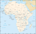
 Political Map of Africa.svg 676 × 820; 3.66 MB
-
 SubSaharanAfrica-OHADA.svg 1,000 × 1,000; 229 KB
-
 SubSaharanAfrica.svg 1,000 × 1,000; 188 KB


.svg)
.svg)


