Category:SVG topographic maps of Indonesia
Jump to navigation
Jump to search
Media in category "SVG topographic maps of Indonesia"
The following 23 files are in this category, out of 23 total.
-
 Bali topographic map-id.svg 2,432 × 1,336; 11.95 MB
-
 Indonesia - Sumatra rotated - id.svg 445 × 326; 1.32 MB
-
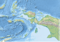 Indonesia Maluku-Western New Guinea rel location map.svg 1,472 × 1,033; 1.03 MB
-
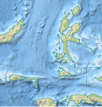 Indonesia North Maluku rel location map.svg 523 × 543; 1.32 MB
-
 Indonezija.svg 831 × 362; 1.99 MB
-
 Madura Island topographic map - ru.svg 2,401 × 806; 1.09 MB
-
 Minahassa Peninsula topographic map - id.svg 2,731 × 1,440; 3.97 MB
-
 Minahassa Peninsula topographic map - ru.svg 2,731 × 1,440; 4.51 MB
-
 Mursala dan Tapanuli Teluk peta topografi id.svg 1,720 × 1,191; 620 KB
-
 Nias peta topografi-id.svg 1,336 × 1,326; 2.04 MB
-
 North Kalimantan (Indonesia) topographic map - id.svg 1,557 × 1,473; 2.27 MB
-
 North Kalimantan (Indonesia) topographic map - ru.svg 1,557 × 1,473; 2.28 MB
-
 Peta Topografi Kabupaten Tanah Laut-Text.svg 1,054 × 745; 3.62 MB
-
 Peta Topografi Kabupaten Tanah Laut.svg 1,054 × 745; 3.54 MB
-
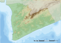
 Puncak Jaya topographic map-fr.svg 1,280 × 915; 1.22 MB
-
 Puncak Jaya topographic map-hu.svg 1,280 × 915; 868 KB
-
 Puncak Jaya topographic map-id.svg 1,280 × 915; 1.17 MB
-
 Puncak Jaya topographic map-mk.svg 1,280 × 915; 1.49 MB
-
 Sapudi Island topographic map - ru.svg 1,500 × 1,400; 473 KB
-
 Sumatra.svg 164 × 120; 1.31 MB
-
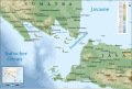 Sunda Strait map-de.svg 3,579 × 2,395; 2.05 MB
-
 Sunda Strait map-fr.svg 3,579 × 2,395; 2.08 MB
-
 Topographic map of Buru-en.svg 1,972 × 1,475; 1.14 MB


_topographic_map_-_id.svg)
_topographic_map_-_ru.svg)


