Category:Salzstock Lesum
Jump to navigation
Jump to search
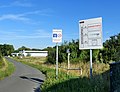
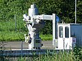
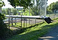
Deutsch: Der Salzstock Lesum ist eine unterirdische Salzstruktur in Bremen-Burglesum. Fotos zeigen oberirdische Auswirkungen und Nutzungen des Salzstocks.
Subcategories
This category has only the following subcategory.
N
- Naturschutzgebiet Ruschdahlmoor (21 F)
Media in category "Salzstock Lesum"
The following 14 files are in this category, out of 14 total.
-
 KavLesum Brokkampweg (1).jpg 3,536 × 2,596; 3.2 MB
-
 KavLesum Brokkampweg (2).jpg 3,344 × 2,556; 3.23 MB
-
 KavLesum Entnahme(1).jpg 2,936 × 2,030; 2.04 MB
-
 KavLesum Entnahme(2).jpg 3,324 × 2,544; 3.06 MB
-
 KavLesum L203.jpg 4,000 × 3,000; 3.96 MB
-
 KavLesum L301 302.jpg 3,333 × 2,315; 2.46 MB
-
 KavLesum Sole (1).jpg 2,926 × 2,112; 1.96 MB
-
 KavLesum Sole (2).jpg 3,392 × 2,324; 2.79 MB
-
 KavLesum Sole (3).jpg 3,736 × 2,572; 3.09 MB
-
 KavLesum Sole (4).jpg 3,516 × 2,424; 3.14 MB
-
 KavLesum Sole (5).jpg 3,604 × 2,792; 3.1 MB
-
 KavLesum Wiese (1).jpg 4,000 × 3,000; 4.29 MB
-
 KavLesum Wiese (2).jpg 4,000 × 3,000; 3.91 MB
-
 KavLesum Wiese (3).jpg 4,000 × 3,000; 4.07 MB
.jpg)
.jpg)
.jpg)
.jpg)


.jpg)
.jpg)
.jpg)
.jpg)
.jpg)
.jpg)
.jpg)
.jpg)