Category:Sanborn Fire Insurance Map from Stuart, Gutbrie and Adair Counties, Iowa
Jump to navigation
Jump to search
Media in category "Sanborn Fire Insurance Map from Stuart, Gutbrie and Adair Counties, Iowa"
The following 27 files are in this category, out of 27 total.
-

-

-
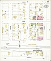
 Sanborn Fire Insurance Map from Stuart, Gutbrie and Adair Counties, Iowa. LOC sanborn02841 002-1.tif 6,450 × 7,650; 141.17 MB
-

-
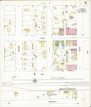
 Sanborn Fire Insurance Map from Stuart, Gutbrie and Adair Counties, Iowa. LOC sanborn02841 002-2.tif 6,450 × 7,650; 141.17 MB
-

-
 Sanborn Fire Insurance Map from Stuart, Gutbrie and Adair Counties, Iowa. LOC sanborn02841 003-1.tif 6,450 × 7,650; 141.17 MB
-

-
 Sanborn Fire Insurance Map from Stuart, Gutbrie and Adair Counties, Iowa. LOC sanborn02841 003-2.tif 6,450 × 7,650; 141.17 MB
-

-
 Sanborn Fire Insurance Map from Stuart, Gutbrie and Adair Counties, Iowa. LOC sanborn02841 003-3.tif 6,450 × 7,650; 141.17 MB
-

-
 Sanborn Fire Insurance Map from Stuart, Gutbrie and Adair Counties, Iowa. LOC sanborn02841 004-1.tif 6,450 × 7,650; 141.17 MB
-
-
 Sanborn Fire Insurance Map from Stuart, Gutbrie and Adair Counties, Iowa. LOC sanborn02841 004-2.tif 6,450 × 7,650; 141.17 MB
-

-
 Sanborn Fire Insurance Map from Stuart, Gutbrie and Adair Counties, Iowa. LOC sanborn02841 004-3.tif 6,450 × 7,650; 141.17 MB
-

-
 Sanborn Fire Insurance Map from Stuart, Gutbrie and Adair Counties, Iowa. LOC sanborn02841 004-4.tif 6,450 × 7,650; 141.17 MB
-

-
 Sanborn Fire Insurance Map from Stuart, Gutbrie and Adair Counties, Iowa. LOC sanborn02841 005-1.tif 6,450 × 7,650; 141.17 MB
-

-
 Sanborn Fire Insurance Map from Stuart, Gutbrie and Adair Counties, Iowa. LOC sanborn02841 005-2.tif 6,450 × 7,650; 141.17 MB
-

-
 Sanborn Fire Insurance Map from Stuart, Gutbrie and Adair Counties, Iowa. LOC sanborn02841 005-3.tif 6,450 × 7,650; 141.17 MB
-

-
 Sanborn Fire Insurance Map from Stuart, Gutbrie and Adair Counties, Iowa. LOC sanborn02841 005-4.tif 6,450 × 7,650; 141.17 MB


