Category:Sandymoor
Jump to navigation
Jump to search
suburb and civil parish in Runcorn, Cheshire, England, UK  | |||||
| Upload media | |||||
| Instance of | |||||
|---|---|---|---|---|---|
| Location | Halton, Cheshire, North West England, England | ||||
| Population |
| ||||
 | |||||
Subcategories
This category has the following 3 subcategories, out of 3 total.
Media in category "Sandymoor"
The following 66 files are in this category, out of 66 total.
-
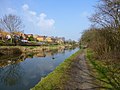
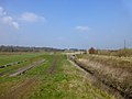
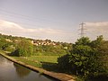 Bridgewater canal from the railway - geograph.org.uk - 3971581.jpg 640 × 480; 54 KB
-
 Chancellor Road and stored tankers - geograph.org.uk - 3207845.jpg 640 × 480; 83 KB
-
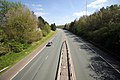
 Daresbury Expressway - geograph.org.uk - 2749899.jpg 640 × 454; 32 KB
-
 Daresbury Expressway roundabout - geograph.org.uk - 2749904.jpg 640 × 480; 38 KB
-
 European Eagle Owl, Norton Priory, Cheshire - geograph.org.uk - 5073814.jpg 1,869 × 1,869; 680 KB
-
 Field path crossing valley of Keckwick Brook E of Norton - geograph.org.uk - 5626439.jpg 5,184 × 2,920; 5.62 MB
-
 Footbridge on the Mersey Valley Trail - geograph.org.uk - 4391582.jpg 1,024 × 768; 313 KB
-
 Four stone coffins at Norton Priory - geograph.org.uk - 5148215.jpg 4,184 × 2,789; 4.96 MB
-
 Keckwick Brook - geograph.org.uk - 2933050.jpg 800 × 600; 97 KB
-
 Malmesbury Park - geograph.org.uk - 4811170.jpg 640 × 480; 75 KB
-
 Manchester ship canal - geograph.org.uk - 2653803.jpg 640 × 480; 33 KB
-
 Manchester Ship Canal - geograph.org.uk - 4073696.jpg 640 × 427; 54 KB
-
 Manchester Ship Canal - geograph.org.uk - 4073722.jpg 640 × 427; 83 KB
-

-
 Manchester Ship Canal near Halton - geograph.org.uk - 3672432.jpg 640 × 480; 305 KB
-
 Manchester Ship Canal near Manor Park - geograph.org.uk - 4953383.jpg 640 × 480; 441 KB
-
 Manchester Ship Canal near Norton - geograph.org.uk - 4786166.jpg 1,600 × 1,064; 236 KB
-
 Medieval embroiderer, Norton Priory, Cheshire - geograph.org.uk - 5073789.jpg 3,062 × 4,593; 1.21 MB
-
 Mersey Valley Trail near Norton Town Bridge - geograph.org.uk - 4391488.jpg 1,024 × 768; 390 KB
-
 Mersey Valley Trail railway bridge near Norton - geograph.org.uk - 4391499.jpg 1,024 × 768; 324 KB
-
 New Norton Bridge - geograph.org.uk - 2429498.jpg 640 × 480; 108 KB
-
 New Norton Townfield Bridge 73 - geograph.org.uk - 2429504.jpg 640 × 415; 103 KB
-
 Norton Priory - geograph.org.uk - 5147905.jpg 4,184 × 2,789; 4.35 MB
-
 Norton Priory - geograph.org.uk - 5147915.jpg 4,184 × 2,789; 4.16 MB
-
 Norton Town Bridge 71 - geograph.org.uk - 2429497.jpg 640 × 382; 95 KB
-
 Norton Water Tower, Runcorn, from the air - geograph.org.uk - 5025913.jpg 1,024 × 681; 232 KB
-
 Norton, Manchester Ship Canal - geograph.org.uk - 2614923.jpg 1,024 × 768; 90 KB
-

-
 Pembroke Court, Runcorn - geograph.org.uk - 2653786.jpg 640 × 480; 51 KB
-
 Power lines at Round Chevaral - geograph.org.uk - 3426435.jpg 1,024 × 768; 104 KB
-
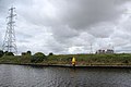
 Power lines over the canal - geograph.org.uk - 4786183.jpg 1,600 × 1,064; 209 KB
-
 Preston Brook Marina, Runcorn from the air - geograph.org.uk - 5025791.jpg 1,024 × 681; 205 KB
-
 Public art at Keckwick - geograph.org.uk - 4881252.jpg 1,000 × 752; 565 KB
-
 Public art at Keckwick - geograph.org.uk - 4881256.jpg 1,000 × 840; 571 KB
-
 Pylon Next to the Manchester Ship Canal - geograph.org.uk - 4953243.jpg 480 × 640; 340 KB
-
 Railway Bridge 70 - geograph.org.uk - 2429496.jpg 640 × 387; 75 KB
-

-
 Road works at Sandymoor - geograph.org.uk - 3408539.jpg 4,592 × 3,056; 7.45 MB
-
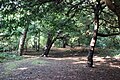
 Sandymoor Wood - geograph.org.uk - 3408552.jpg 3,668 × 2,703; 7.88 MB
-
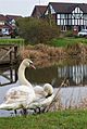 SandymoorSwans1.JPG 1,679 × 2,507; 1.01 MB
-
 Sculpture at Keckwick - geograph.org.uk - 4881262.jpg 1,000 × 1,333; 846 KB
-
 Stuart Road, Manor Park - geograph.org.uk - 3016838.jpg 4,492 × 2,988; 5.7 MB
-
 The 12th Century Vaulted Undercroft at Norton Priory - geograph.org.uk - 5148405.jpg 4,184 × 2,789; 3.5 MB
-
 The A558 (Daresbury Expressway) - geograph.org.uk - 4438661.jpg 3,184 × 2,123; 1.38 MB
-
 The A558 (Daresbury Expressway) - geograph.org.uk - 4438670.jpg 3,184 × 2,123; 1.47 MB
-
 The Bridgewater Canal at Norton Priory - geograph.org.uk - 5151966.jpg 4,184 × 2,789; 4.5 MB
-
 The Bridgewater Canal near Norton - geograph.org.uk - 4391478.jpg 1,024 × 768; 221 KB
-
-
 The Manchester Ship Canal near Stonedelph Dock - geograph.org.uk - 3760312.jpg 1,024 × 768; 168 KB
-
 The Mersey Valley Trail crosses Keckwick Brook - geograph.org.uk - 4391508.jpg 1,024 × 768; 156 KB
-
 The Museum and Visitor Centre at Norton Priory - geograph.org.uk - 5146467.jpg 5,184 × 3,456; 5.55 MB
-
 The north bank of the Manchester Ship Canal - geograph.org.uk - 3426431.jpg 1,024 × 768; 133 KB
-
 The remains of Norton Priory - geograph.org.uk - 5144684.jpg 4,184 × 2,789; 4.12 MB
-
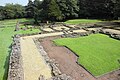 The remains of Norton Priory - geograph.org.uk - 5144697.jpg 4,184 × 2,789; 4.15 MB
-
 The remains of Norton Priory - geograph.org.uk - 5144699.jpg 4,184 × 2,789; 3.99 MB
-
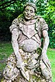
 The remains of William Dutton (possibly) at Norton Priory - geograph.org.uk - 5147961.jpg 2,789 × 4,184; 3.78 MB
-
 The Scribe and Limner ^2, Norton Priory, Cheshire - geograph.org.uk - 5073794.jpg 1,865 × 1,895; 382 KB
-
 The Scribe and Limner, Norton Priory, Cheshire - geograph.org.uk - 5073784.jpg 1,517 × 1,961; 474 KB
-
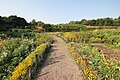 The Walled Garden at Norton Priory - geograph.org.uk - 5149502.jpg 3,184 × 2,123; 3.84 MB
-
 The Walled Garden at Norton Priory - geograph.org.uk - 5149506.jpg 4,184 × 2,789; 4.92 MB
-
 The Walled Garden at Norton Priory - geograph.org.uk - 5149520.jpg 4,184 × 2,789; 4.77 MB
-
 The Walled Garden at Norton Priory - geograph.org.uk - 5149525.jpg 4,184 × 2,789; 3.51 MB
-
 The Woodland at Norton Priory - geograph.org.uk - 5151954.jpg 4,184 × 2,789; 4.92 MB
-
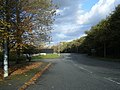 Warrington Road - geograph.org.uk - 3207777.jpg 640 × 481; 97 KB
-
 Warrington Road near Stonedelph Dock - geograph.org.uk - 3207795.jpg 640 × 480; 83 KB
-
 Windmill Hill Avenue looking north - geograph.org.uk - 4811169.jpg 640 × 480; 74 KB


_-_geograph.org.uk_-_4438661.jpg)
_-_geograph.org.uk_-_4438670.jpg)


_at_Norton_Priory_-_geograph.org.uk_-_5147961.jpg)


