Category:Santa Rita-San Antonio, Concepcion, Tarlac Bridge and Parua River
Jump to navigation
Jump to search
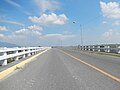
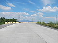
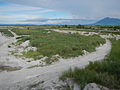
Barangay Santa Rita, Concepcion, Tarlac along the Santa Rita-San Antonio Concepcion, Tarlac Bridge and Parua River, (Lat Long 15.2701,120.7702 which originates from Sacobia-Bamban river that comes from Mount Pinatubo is heavily silted with 7 meters of sand at the foot of Mount Arayat, Pampanga, gateway to the Welcome Arch of Barangay San Antonio, Concepcion, Tarlac - Santa Rita-San Antonio, Concepcion, Tarlac Bridge over the Parua River estimate terrain elevation above seal level is 31 metres Latitude: 15°18'10.08" Longitude: 120°40'53.82" December 31, 2005, in Barangays San Martin, Santa Rita and San Antonio, Concepcion, Tarlac).
Media in category "Santa Rita-San Antonio, Concepcion, Tarlac Bridge and Parua River"
The following 84 files are in this category, out of 84 total.
-
 08934jfSanta Rita River Concepcion Tarlacfvf 01.JPG 4,608 × 3,456; 6.15 MB
-
 08934jfSanta Rita River Concepcion Tarlacfvf 02.JPG 4,608 × 3,456; 6.25 MB
-
 08934jfSanta Rita River Concepcion Tarlacfvf 03.JPG 4,608 × 3,456; 6.09 MB
-
 08934jfSanta Rita River Concepcion Tarlacfvf 04.JPG 4,608 × 3,456; 6.01 MB
-
 08934jfSanta Rita River Concepcion Tarlacfvf 05.JPG 4,608 × 3,456; 6.28 MB
-
 08934jfSanta Rita River Concepcion Tarlacfvf 06.JPG 4,608 × 3,456; 6.46 MB
-
 08934jfSanta Rita River Concepcion Tarlacfvf 07.JPG 4,608 × 3,456; 6.45 MB
-
 08934jfSanta Rita River Concepcion Tarlacfvf 08.JPG 4,608 × 3,456; 6.68 MB
-
 08934jfSanta Rita River Concepcion Tarlacfvf 09.JPG 4,608 × 3,456; 6.6 MB
-
 08934jfSanta Rita River Concepcion Tarlacfvf 10.JPG 4,608 × 3,456; 6.69 MB
-
 08934jfSanta Rita River Concepcion Tarlacfvf 11.JPG 4,608 × 3,456; 6.7 MB
-
 08934jfSanta Rita River Concepcion Tarlacfvf 12.JPG 4,608 × 3,456; 6.67 MB
-
 08934jfSanta Rita River Concepcion Tarlacfvf 13.JPG 4,608 × 3,456; 6.78 MB
-
 08934jfSanta Rita River Concepcion Tarlacfvf 14.JPG 4,608 × 3,456; 6.8 MB
-
 08934jfSanta Rita River Concepcion Tarlacfvf 15.JPG 4,608 × 3,456; 5.86 MB
-
 08934jfSanta Rita River Concepcion Tarlacfvf 16.JPG 4,608 × 3,456; 6.12 MB
-
 08934jfSanta Rita River Concepcion Tarlacfvf 17.JPG 4,608 × 3,456; 5.95 MB
-
 08934jfSanta Rita River Concepcion Tarlacfvf 18.JPG 4,608 × 3,456; 5.99 MB
-
 08934jfSanta Rita River Concepcion Tarlacfvf 19.JPG 4,608 × 3,456; 6.33 MB
-
 08934jfSanta Rita River Concepcion Tarlacfvf 20.JPG 4,608 × 3,456; 6.21 MB
-
 08934jfSanta Rita River Concepcion Tarlacfvf 21.JPG 4,608 × 3,456; 6.13 MB
-
 08934jfSanta Rita River Concepcion Tarlacfvf 22.JPG 4,608 × 3,456; 6.12 MB
-
 08934jfSanta Rita River Concepcion Tarlacfvf 23.JPG 4,608 × 3,456; 6.36 MB
-
 08934jfSanta Rita River Concepcion Tarlacfvf 24.JPG 4,608 × 3,456; 6.21 MB
-
 08934jfSanta Rita River Concepcion Tarlacfvf 25.JPG 4,608 × 3,456; 6.22 MB
-
 08934jfSanta Rita River Concepcion Tarlacfvf 26.JPG 4,608 × 3,456; 6.48 MB
-
 08934jfSanta Rita River Concepcion Tarlacfvf 27.JPG 4,608 × 3,456; 6.51 MB
-
 08934jfSanta Rita River Concepcion Tarlacfvf 28.JPG 4,608 × 3,456; 6.42 MB
-
 08934jfSanta Rita River Concepcion Tarlacfvf 29.JPG 4,608 × 3,456; 7.03 MB
-
 08934jfSanta Rita River Concepcion Tarlacfvf 30.JPG 4,608 × 3,456; 7.03 MB
-
 5850ajfSanta Rita Bridge River Concepcion Tarlacfvf 01.jpg 1,024 × 768; 371 KB
-
 5850ajfSanta Rita Bridge River Concepcion Tarlacfvf 02.jpg 1,024 × 768; 393 KB
-
 5850ajfSanta Rita Bridge River Concepcion Tarlacfvf 03.jpg 1,024 × 768; 366 KB
-
 5850ajfSanta Rita Bridge River Concepcion Tarlacfvf 04.jpg 1,024 × 768; 437 KB
-
 5850ajfSanta Rita Bridge River Concepcion Tarlacfvf 05.jpg 1,024 × 768; 426 KB
-
 5850ajfSanta Rita Bridge River Concepcion Tarlacfvf 06.jpg 1,024 × 768; 454 KB
-
 5850ajfSanta Rita Bridge River Concepcion Tarlacfvf 07.jpg 1,024 × 768; 463 KB
-
 5850ajfSanta Rita Bridge River Concepcion Tarlacfvf 08.jpg 1,024 × 768; 466 KB
-
 5850ajfSanta Rita Bridge River Concepcion Tarlacfvf 09.jpg 1,024 × 768; 456 KB
-
 5850ajfSanta Rita Bridge River Concepcion Tarlacfvf 10.jpg 1,024 × 768; 404 KB
-
 5850ajfSanta Rita Bridge River Concepcion Tarlacfvf 11.jpg 1,024 × 768; 406 KB
-
 5850ajfSanta Rita Bridge River Concepcion Tarlacfvf 12.jpg 1,024 × 768; 365 KB
-
 5850ajfSanta Rita Bridge River Concepcion Tarlacfvf 13.jpg 1,024 × 768; 481 KB
-
 5850ajfSanta Rita Bridge River Concepcion Tarlacfvf 14.jpg 977 × 768; 400 KB
-
 5850ajfSanta Rita Bridge River Concepcion Tarlacfvf 15.jpg 1,024 × 768; 425 KB
-
 5850ajfSanta Rita Bridge River Concepcion Tarlacfvf 16.jpg 1,024 × 768; 341 KB
-
 5850ajfSanta Rita Bridge River Concepcion Tarlacfvf 17.jpg 1,024 × 768; 380 KB
-
 5850ajfSanta Rita Bridge River Concepcion Tarlacfvf 18.jpg 4,608 × 3,456; 6.11 MB
-
 5850ajfSanta Rita Bridge River Concepcion Tarlacfvf 19.jpg 1,024 × 768; 462 KB
-
 5850ajfSanta Rita Bridge River Concepcion Tarlacfvf 20.jpg 1,024 × 768; 387 KB
-
 5850ajfSanta Rita Bridge River Concepcion Tarlacfvf 21.jpg 1,024 × 768; 383 KB
-
 5850ajfSanta Rita Bridge River Concepcion Tarlacfvf 22.jpg 1,024 × 768; 362 KB
-
 5850ajfSanta Rita Bridge River Concepcion Tarlacfvf 23.jpg 4,608 × 3,456; 6.39 MB
-
 5850ajfSanta Rita Bridge River Concepcion Tarlacfvf 24.jpg 1,024 × 768; 438 KB
-
 5850ajfSanta Rita Bridge River Concepcion Tarlacfvf 25.jpg 1,024 × 768; 464 KB
-
 5850ajfSanta Rita Bridge River Concepcion Tarlacfvf 26.jpg 768 × 1,024; 383 KB
-
 5850ajfSanta Rita Bridge River Concepcion Tarlacfvf 27.jpg 1,024 × 768; 435 KB
-
 5850ajfSanta Rita Bridge River Concepcion Tarlacfvf 28.jpg 1,024 × 768; 454 KB
-
 5881jfSan Antonio Santa Rita Bridge River Concepcion Tarlacfvf 02.JPG 4,608 × 3,456; 6.01 MB
-
 5881jfSan Antonio Santa Rita Bridge River Concepcion Tarlacfvf 03.JPG 4,608 × 3,456; 6.2 MB
-
 5881jfSan Antonio Santa Rita Bridge River Concepcion Tarlacfvf 04.JPG 4,608 × 3,456; 6 MB
-
 5881jfSan Antonio Santa Rita Bridge River Concepcion Tarlacfvf 05.JPG 3,456 × 4,608; 6.09 MB
-
 5881jfSan Antonio Santa Rita Bridge River Concepcion Tarlacfvf 06.JPG 4,608 × 3,456; 6.28 MB
-
 5881jfSan Antonio Santa Rita Bridge River Concepcion Tarlacfvf 07.JPG 4,608 × 3,456; 5.99 MB
-
 5881jfSan Antonio Santa Rita Bridge River Concepcion Tarlacfvf 08.JPG 4,608 × 3,456; 5.88 MB
-
 5881jfSan Antonio Santa Rita Bridge River Concepcion Tarlacfvf 09.JPG 4,608 × 3,456; 6.14 MB
-
 5881jfSan Antonio Santa Rita Bridge River Concepcion Tarlacfvf 10.JPG 3,456 × 4,608; 6.17 MB
-
 5881jfSan Antonio Santa Rita Bridge River Concepcion Tarlacfvf 11.JPG 4,608 × 3,456; 5.98 MB
-
 5881jfSan Antonio Santa Rita Bridge River Concepcion Tarlacfvf 12.JPG 4,608 × 3,456; 6.46 MB
-
 5881jfSan Antonio Santa Rita Bridge River Concepcion Tarlacfvf 13.JPG 4,608 × 3,456; 6.24 MB
-
 5881jfSan Antonio Santa Rita Bridge River Concepcion Tarlacfvf 14.JPG 4,608 × 3,456; 6.73 MB
-
 5881jfSan Antonio Santa Rita Bridge River Concepcion Tarlacfvf 15.JPG 4,608 × 3,456; 6.36 MB
-
 5881jfSan Antonio Santa Rita Bridge River Concepcion Tarlacfvf 16.JPG 4,608 × 3,456; 6.59 MB
-
 5881jfSan Antonio Santa Rita Bridge River Concepcion Tarlacfvf 17.JPG 4,608 × 3,456; 6.39 MB
-
 5881jfSan Antonio Santa Rita Bridge River Concepcion Tarlacfvf 18.JPG 4,608 × 3,456; 6.87 MB
-
 5881jfSan Antonio Santa Rita Bridge River Concepcion Tarlacfvf 19.JPG 4,608 × 3,456; 6.58 MB
-
 5881jfSan Antonio Santa Rita Bridge River Concepcion Tarlacfvf 20.JPG 4,608 × 3,456; 7.16 MB
-
 5881jfSan Antonio Santa Rita Bridge River Concepcion Tarlacfvf 21.jpg 1,024 × 768; 475 KB
-
 5881jfSan Antonio Santa Rita Bridge River Concepcion Tarlacfvf 22.jpg 1,024 × 768; 450 KB
-
 5881jfSan Antonio Santa Rita Bridge River Concepcion Tarlacfvf 23.jpg 1,024 × 768; 417 KB
-
 5881jfSan Antonio Santa Rita Bridge River Concepcion Tarlacfvf 24.jpg 1,024 × 768; 412 KB
-
 5881jfSan Antonio Santa Rita Bridge River Concepcion Tarlacfvf 25.jpg 1,024 × 768; 452 KB
-
 5881jfSan Antonio Santa Rita Bridge River Concepcion Tarlacfvf 26.jpg 1,024 × 768; 414 KB
-
 5881jfSan Antonio Santa Rita Bridge River Concepcion Tarlacfvf 27.jpg 1,024 × 768; 427 KB


