Category:Sarsen stones
Jump to navigation
Jump to search
type of sandstone block found in the United Kingdom  | |||||
| Upload media | |||||
| Subclass of | |||||
|---|---|---|---|---|---|
| Location |
| ||||
| |||||
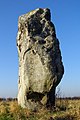
English: Sarsen stones are sandstone blocks found in quantity in the United Kingdom on Salisbury Plain, the Marlborough Downs, in Kent, and in smaller quantities in Berkshire, Essex, Oxfordshire, Dorset and Hampshire. They are the post-glacial remains of a cap of tertiary silcrete which once covered much of southern England.
Subcategories
This category has the following 5 subcategories, out of 5 total.
Media in category "Sarsen stones"
The following 55 files are in this category, out of 55 total.
-
 A Grey Wether, near Manton, Marlborough - geograph.org.uk - 969406.jpg 640 × 480; 138 KB
-
 Arran Bank Farm, Dunn Street - geograph.org.uk - 100410.jpg 640 × 480; 132 KB
-
 Cherhill bus shelter sundial, Cherhill - geograph.org.uk - 811093.jpg 640 × 480; 185 KB
-
 ChristChurch, Cadley - geograph.org.uk - 123149.jpg 640 × 481; 77 KB
-

-
 Coffinstone1.jpg 2,048 × 1,536; 163 KB
-

-
 Cow Down - geograph.org.uk - 419373.jpg 640 × 480; 120 KB
-

-
 Downland near Rockley - geograph.org.uk - 408862.jpg 640 × 480; 132 KB
-
 Downland, Stanton St Bernard - geograph.org.uk - 844974.jpg 640 × 480; 123 KB
-
 Ethandunmem.jpg 535 × 640; 114 KB
-

-
 Fyfield Down NNR sarsen stones.jpg 3,456 × 1,944; 2.8 MB
-

-
 Grey Wethers, west of Manton - geograph.org.uk - 969420.jpg 640 × 480; 110 KB
-
 Ingatestone Sarson Stone High Street.jpg 2,338 × 3,186; 1.68 MB
-
 Ingatestone Sarson Stone.jpg 2,444 × 3,607; 3.26 MB
-
 Ingatestone Sarson Stones.jpg 2,788 × 3,895; 2.74 MB
-
 Lone sarsen near Little Kit's Coty House.jpg 1,552 × 2,592; 1.16 MB
-
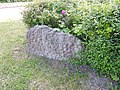
 Memorial Sarsen - geograph.org.uk - 818050.jpg 480 × 640; 88 KB
-
 Memorial Sarsen - geograph.org.uk - 818059.jpg 480 × 640; 100 KB
-

-
 Patcham, Tegdown Hill - geograph.org.uk - 729099.jpg 640 × 480; 90 KB
-
 Princes Risborough, The Pudding Stone - geograph.org.uk - 747364.jpg 640 × 480; 121 KB
-
 Rest and Be Thankful - geograph.org.uk - 27444.jpg 640 × 480; 151 KB
-
 Rochester Eastgate House 6287.jpg 4,608 × 3,456; 3.51 MB
-
 Sarsen in Wiltshire.jpg 2,560 × 1,920; 1.87 MB
-
 Sarsen Stone 1 at Max Gate, Dorchester.jpg 2,560 × 1,920; 1.21 MB
-
 Sarsen Stone 2 at Max Gate, Dorchester.jpg 2,560 × 1,920; 1.32 MB
-
 Sarsen stone near Fiddler's Hill, Hackpen - geograph.org.uk - 553409.jpg 640 × 480; 293 KB
-
 Sarsen stone on Wayland's Smithy - geograph.org.uk - 1371763.jpg 426 × 640; 98 KB
-
 Sarsen Stones - approaching from the west - geograph.org.uk - 6951.jpg 640 × 480; 108 KB
-
 Sarsen stones - geograph.org.uk - 365928.jpg 640 × 479; 95 KB
-

-
 Sarsen stones, beside Delling Copse - geograph.org.uk - 408882.jpg 640 × 480; 147 KB
-
 Sarsen stones, Fyfield Down - geograph.org.uk - 412186.jpg 640 × 480; 148 KB
-

-
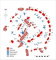 Stone Plan Coloured.jpg 4,016 × 4,252; 3.78 MB
-
 Stone Plan.jpg 4,016 × 4,252; 1.91 MB
-
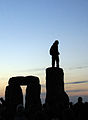 Stonehenge Summer Solstice man on stones.jpg 587 × 800; 52 KB
-
 The Tarry Stone in Cookham - geograph.org.uk - 958662.jpg 640 × 480; 96 KB
-

-
 Three crutches sarsen stones , Strood 4911.jpg 4,608 × 3,456; 3.47 MB
-
 Three crutches sarsen stones , Strood 4912.jpg 4,608 × 3,456; 3.42 MB
-
 Three crutches sarsen stones , Strood 4913.jpg 4,608 × 3,456; 3.38 MB
-
 Three crutches sarsen stones description board, Strood 4910.jpg 4,608 × 3,456; 3.58 MB
-
 Track on Weathercock Hill - geograph.org.uk - 918555.jpg 640 × 480; 108 KB
-
 Valley of Stones, sarsons - geograph.org.uk - 1529567.jpg 640 × 480; 100 KB
-
-

-
 Dry Valley on Fyfield Down - geograph.org.uk - 422893.jpg 640 × 480; 79 KB
-

-
 Sarsen stones on Pratling Street - geograph.org.uk - 108398.jpg 640 × 480; 107 KB
-
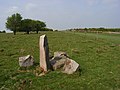 Standing stone and gallop, Overton Down - geograph.org.uk - 412185.jpg 640 × 480; 140 KB


